- Home
- :
- All Communities
- :
- Products
- :
- ArcGIS Enterprise
- :
- ArcGIS Enterprise Questions
- :
- Arcgis 10.8.1 Image Server ECW appear in black and...
- Subscribe to RSS Feed
- Mark Topic as New
- Mark Topic as Read
- Float this Topic for Current User
- Bookmark
- Subscribe
- Mute
- Printer Friendly Page
Arcgis 10.8.1 Image Server ECW appear in black and white checkers
- Mark as New
- Bookmark
- Subscribe
- Mute
- Subscribe to RSS Feed
- Permalink
Hi,
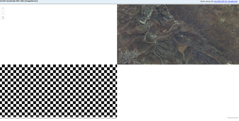
Attached screenshot is ImageServer service with MosaicSet with 2 rasters in same folder!
the top one is SID
and Bottom is ECW.
As you can see it's displays as checkers (black and white)
Any suggestion?
- Mark as New
- Bookmark
- Subscribe
- Mute
- Subscribe to RSS Feed
- Permalink
@Dvirus wrote:Hi,
Attached screenshot is ImageServer service with MosaicSet with 2 rasters in same folder!
the top one is SID
and Bottom is ECW.
As you can see it's displays as checkers (black and white)
Any suggestion?
https://community.esri.com/t5/arcgis-enterprise-questions/mosaic-dataset-as-map-service-black-and-wh...
As for the black/white checkerboard, this indicates the imagery could not be found by the server. Since it happens when you zoom in, it sounds like the server has access to only the overviews, but not the source imagery. Do you have the source directory registered with the server's data store and did it validate? While we're at it, since you do have the extension, what happens if you publish the mosaic dataset as an image service rather than a map service? Do you still see the issue with image service?
Alternatively, there could be a difference in pixel depth among your various input source rasters. Check the pixel depth (e.g., 1-bit, 8-bit, 16-bit, etc.) to see if you have a mixture. I found this to be the case at one point in the past; I ended up forgoing the entire mosaic dataset approach and instead going with an unmanaged raster catalog stored in a file geodatabase. You may need a mosaic dataset for your specific workflows, so this may be irrelevant to you. If you don't, consider using an unmanaged raster catalog published as a map service (from an MXD not an MSD if using 10.0) as a workaround rather than a mosaic dataset as part of a map or image service.
- Mark as New
- Bookmark
- Subscribe
- Mute
- Subscribe to RSS Feed
- Permalink
Thanks for reply,
I think that overviews are generated as Tiff (I checked the folder content) and that why in some of scale (the very first ones) are showing.
Any suggestion why it's happen?
- Mark as New
- Bookmark
- Subscribe
- Mute
- Subscribe to RSS Feed
- Permalink
As per ESRI Tech Article https://support.esri.com/en/technical-article/000010516, A ECW plugin and "To use ECW in server-based products requires additional licensing permissions from Hexagon AB, who acquired ERDAS, Inc., the inventors of the ECW format.".
Search for the plugin download - https://download.hexagongeospatial.com/search?keyword=ecw&lang=en
