- Home
- :
- All Communities
- :
- Products
- :
- ArcGIS Enterprise
- :
- ArcGIS Enterprise Portal Questions
- :
- Re: What format is returned from "ArcGIS for Porta...
- Subscribe to RSS Feed
- Mark Topic as New
- Mark Topic as Read
- Float this Topic for Current User
- Bookmark
- Subscribe
- Mute
- Printer Friendly Page
What format is returned from "ArcGIS for Portal" Feature Service
- Mark as New
- Bookmark
- Subscribe
- Mute
- Subscribe to RSS Feed
- Permalink
- Report Inappropriate Content
I'm looking for documentation of the complete format that is sent back, mostly on the transform component
- Mark as New
- Bookmark
- Subscribe
- Mute
- Subscribe to RSS Feed
- Permalink
- Report Inappropriate Content
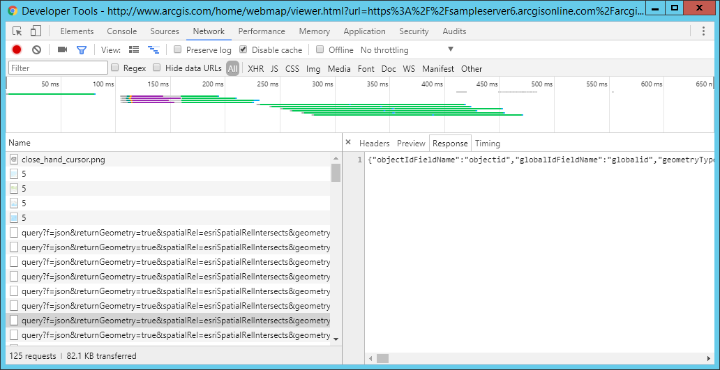
Can you elaborate on what you mean? Any any client is using a feature service will make query requests to return JSON, which is parsed by the client for geometry and attributes:
Ex.
- Mark as New
- Bookmark
- Subscribe
- Mute
- Subscribe to RSS Feed
- Permalink
- Report Inappropriate Content
I would like to understand the following, there appears to be two different way to describe a polygon; either by
geographic coordinates
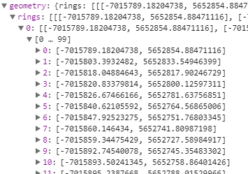
or relevant positions.
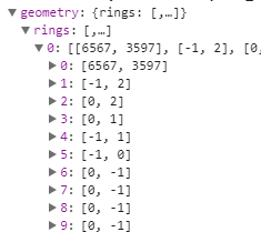
In the case os the relevant postion, the following is added to the end of the JSON return.
I would like to get documentation on the complete format of the return.
Thanks for your help
- Mark as New
- Bookmark
- Subscribe
- Mute
- Subscribe to RSS Feed
- Permalink
- Report Inappropriate Content
I've never seen the relevant positions format... I assumed geometry should have defined coordinates. Anyway, here's the docs on geometry objects:
ArcGIS Server REST API - Geometry objects
I don't see anything on relevant positions. In what context is that information returned? Are you using a hosted feature service or a traditional ArcGIS Server map service with feature access? What application is that format returned in, one of the built-in templates or a custom app?
- Mark as New
- Bookmark
- Subscribe
- Mute
- Subscribe to RSS Feed
- Permalink
- Report Inappropriate Content
I am using AGOL, below are links to the two different returns:
Relevant
Geometry
- Mark as New
- Bookmark
- Subscribe
- Mute
- Subscribe to RSS Feed
- Permalink
- Report Inappropriate Content
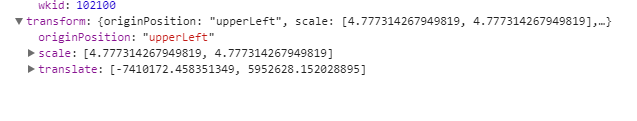
If you look at the HTML view, you can inspect the parameters sent with the request. The one that's different is the Quantization Parameters parameter sent with the relevant response.
Ex:
Quantization Parameters = {"mode":"view","originPosition":"upperLeft","tolerance":2.388657133974319,"extent":{"type":"extent","xmin":-7241915.960087257,"ymin":5658078.265584529,"xmax":-7038189.895516766,"ymax":5782130.8860775875,"spatialReference":{"wkid":102100,"latestWkid":3857}}}
From an unrelated API doc, it looks like it creates a virtual grid from the geometry, explaining why you see relevant positions for features: