- Home
- :
- All Communities
- :
- Products
- :
- ArcGIS Enterprise
- :
- ArcGIS Enterprise Portal Questions
- :
- web map layer symbol
- Subscribe to RSS Feed
- Mark Topic as New
- Mark Topic as Read
- Float this Topic for Current User
- Bookmark
- Subscribe
- Mute
- Printer Friendly Page
- Mark as New
- Bookmark
- Subscribe
- Mute
- Subscribe to RSS Feed
- Permalink
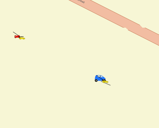
Hello, I created a map on the portal of our organization.
When I add a layer to the map image layer, the symbols are displayed without problem.
However, when I add the same data to the feature layer, I notice a discrepancy of the symbols that I can not explain.
If someone has a solution to this problem, I am a taker.
- Mark as New
- Bookmark
- Subscribe
- Mute
- Subscribe to RSS Feed
- Permalink
Feature layers in a web map do not have access to all the same symbology options that a map image layer or desktop GIS does, and are somewhat limited.
Can you give some more details about how the symbology is being defined? Are there feature attributes being used to set things like the angles and distances?
Kendall County GIS
- Mark as New
- Bookmark
- Subscribe
- Mute
- Subscribe to RSS Feed
- Permalink
Yes, there are definite feature attributes likes as angles and distances in desktop GIS.
SIG LM
- Mark as New
- Bookmark
- Subscribe
- Mute
- Subscribe to RSS Feed
- Permalink
another details, whe have many type of symbols: points symbols, images symbols and shape symbols.
Do you know a way to solve this problem?
- Mark as New
- Bookmark
- Subscribe
- Mute
- Subscribe to RSS Feed
- Permalink
Yes, there are definite feature attributes likes as angles and distances in desktop GIS.
SIG LM