- Home
- :
- All Communities
- :
- Products
- :
- ArcGIS Earth
- :
- ArcGIS Earth Questions
- :
- Re: ArcGIS Earth basemap image issues
- Subscribe to RSS Feed
- Mark Topic as New
- Mark Topic as Read
- Float this Topic for Current User
- Bookmark
- Subscribe
- Mute
- Printer Friendly Page
ArcGIS Earth basemap image issues
- Mark as New
- Bookmark
- Subscribe
- Mute
- Subscribe to RSS Feed
- Permalink
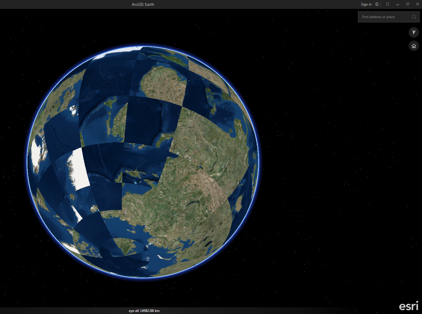
Has anyone had issues with ArcGIS Earth 1.1 displaying images?
I get the following;
- Mark as New
- Bookmark
- Subscribe
- Mute
- Subscribe to RSS Feed
- Permalink
I am having the same issue. Our office is thinking it is the firewall. Have you figured out anything?
- Mark as New
- Bookmark
- Subscribe
- Mute
- Subscribe to RSS Feed
- Permalink
No luck yet. Only option is not to use it - back to Google Earth...
Was hoping someone at ESRI had an answer?
- Mark as New
- Bookmark
- Subscribe
- Mute
- Subscribe to RSS Feed
- Permalink
I've got this same problem as well, started in 1.0 and still present in version 1.2
ArcGIS Earth seems like it could be a great addition to our workflow, especially when all our Desktop licenses are in use and staff just need to reference a shapefile or add annotation. But it's a pretty hard sell to colleagues when the startup image depicts some sort of global catastrophe...

- Mark as New
- Bookmark
- Subscribe
- Mute
- Subscribe to RSS Feed
- Permalink
That's great to hear Katie! Can you elaborate further on what you mean when you say you "added it as acceptable" to the firewall? Is that an ESRI server that's being whitelisted, or a port that's being opened... or some other firewall thing that I'm not familiar with (which is most of them)?
Thanks,
Ben
- Mark as New
- Bookmark
- Subscribe
- Mute
- Subscribe to RSS Feed
- Permalink
The issue has been fixed by our IT - I am told that a port needs to be enabled on the firewall.
- Mark as New
- Bookmark
- Subscribe
- Mute
- Subscribe to RSS Feed
- Permalink
It appears that several ports need to be enabled.
Our IT used some snooping technique to discover which ports, but that will only detect the ports that Earth is using at the time - there may be several more!
Best if ESRI could provide the necessary info...
- Mark as New
- Bookmark
- Subscribe
- Mute
- Subscribe to RSS Feed
- Permalink
I also have the same problem with Drone2Map. Can someone please be more specific on what to do to fix this very annoying issue? Some of the IT guys want a URL to allow through the firewall. I agree with some of the other posts about ESRI should have a solution. I'm sure were not the only ones with this problem. Step it up ESRI! Thanks
- Mark as New
- Bookmark
- Subscribe
- Mute
- Subscribe to RSS Feed
- Permalink
Hi folks,
This is interesting as to our knowledge, Earth is not using any dedicated ports. We have heard of one case where packet transfer optimization software was passing requests from Earth through a specific port and it was causing this issue, but this wasn't an Esri technology.
Earth does make several simultaneous requests to ArcGIS Online (if you're connected to the internet) and it's possible that some networks are redirecting/mixing up these requests somehow. We have definitely seen this behavior when proxy settings are wrong and would be happy for more information about other cases.
Chris