- Home
- :
- All Communities
- :
- Products
- :
- ArcGIS Earth
- :
- ArcGIS Earth Blog
- :
- Accessing content with ArcGIS Earth 1.6.1
Accessing content with ArcGIS Earth 1.6.1
- Subscribe to RSS Feed
- Mark as New
- Mark as Read
- Bookmark
- Subscribe
- Printer Friendly Page
- Report Inappropriate Content
ArcGIS Earth can aggregate both 2D and 3D spatial information. As a result, ArcGIS Earth was designed for organizations to have the flexibility to add content in a variety of ways. ArcGIS Earth is built on top of the ArcGIS Platform and gives users direct access to Esri’s collaborative web GIS infrastructure. ArcGIS Earth further extends access, via URL to the open source community. In addition, ArcGIS Earth users in the field who are disconnected from a network, can load and work with data (including basemaps and elevation) locally onto the globe.
Accessing content from ArcGIS Online
ArcGIS Online is a collaborative web GIS where ArcGIS Earth users gain access to publicly available content shared by Esri and GIS users from around the world in the Living Atlas. ArcGIS Earth users can further enhance this experience by subscribing to ArcGIS Online, opening access to premium content and much more.
Accessible data types –
- Map service
- Image service
- Feature service
- Scene service
- KML service
Publicly accessing content from ArcGIS Online
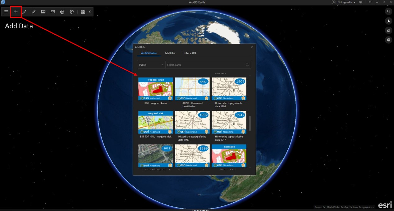
Accessing data with an ArcGIS Online Account
ArcGIS Enterprise
Along with ArcGIS Online, ArcGIS Enterprise is a key component of the ArcGIS platform. If you run your GIS from behind a firewall, in your infrastructure on-premises, ArcGIS Earth can access your organization portal(s) content directly and load this data on the ArcGIS Earth globe.
Accessible data types –
- Map service
- Image service
- Feature service
- Scene service
- KML service
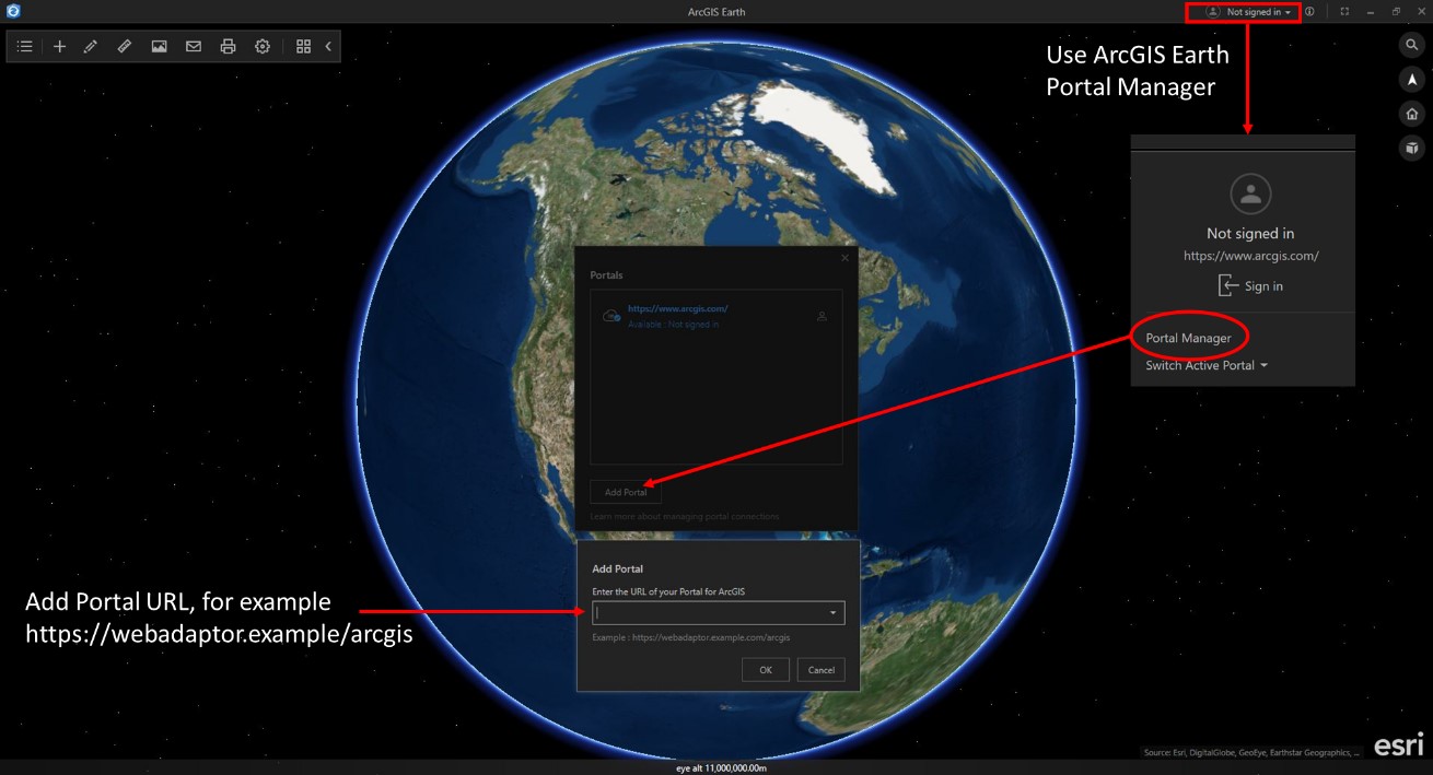
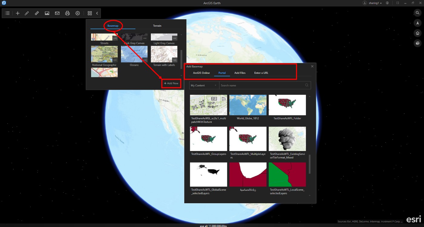
Adding your ArcGIS Enterprise Portal to ArcGIS Earth
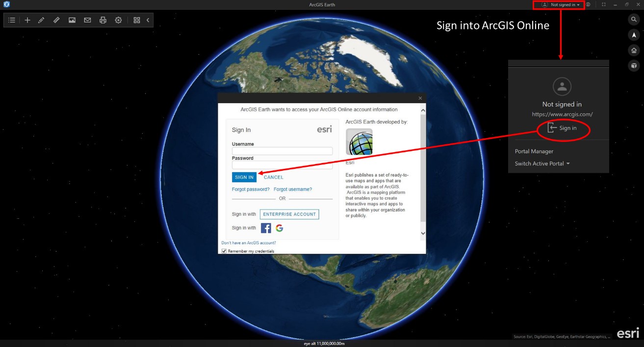
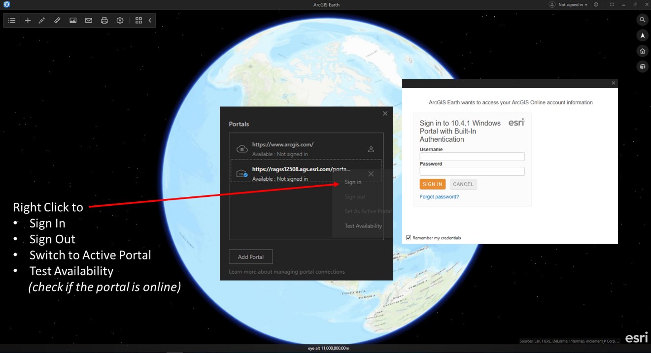
Signing into a portal
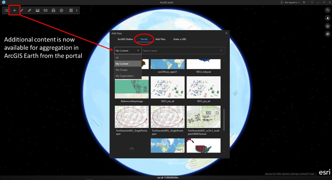
Adding data from a portal
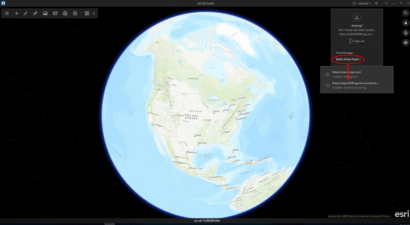
Add multiple portals and switch between them
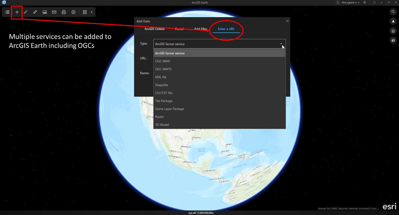
URL
Another way to access your data on the web, is by providing ArcGIS Earth with the URL of a service or a file. Simply select the type of service from the list below, add the URL. Earth provides a default name, but you can add your own.
Accessible data types –
- ArcGIS Server Web Service
- OGC Web Map Service (WMS)
- OGC Web Map Tile Service (WMTS)
- URL to a KML or KMZ service or file
- URL to a shapefile
- URL to a TXT or CSV file
- URL to a tile package
- URL to a scene layer package
- URL to a raster file
Adding content via a URL in ArcGIS Earth
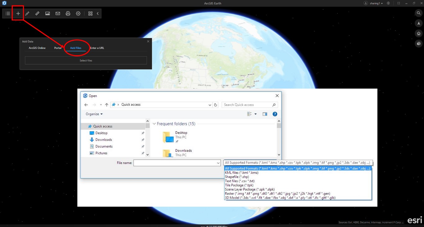
Local Files – Using ArcGIS Earth in the field, in a disconnected network environment
The lightweight ArcGIS Earth client also functions in a disconnected environment. Data can be loaded onto a folder on a laptop, taken into the field and side-loaded into ArcGIS Earth. To view local file data from your computer or shared drive in ArcGIS Earth, choose the Add Files option on the Add Data dialog box.
Accessible data types –
- Shapefiles
- KML and KMZ
- TXT and CSV containing location coordinates or addresses (geocode in ArcGIS Online and Enterprise)
- Tile package
- Scene layer package with file extension in. spk and. slpk
- Raster file - Control opacity, brightness contrast and gamma on local imagery
- ASRP/USRP
- DTED0,1, 2
- GeoTIFF
- IMG
- JPEG
- JPEG2000
- NTIF
- PNG
- SRTM1, 2
- 3D Model – Geolocate, edit view and properties of models in 3D
- 3ds Max 3DS ( .3ds )
- Collada ( .dae )
- Autodesk ( .fbx )
- AutoCAD DXF ( .dxf )
- Wavefront Object ( .obj )
- DirectX X ( .x )
- Stanford Polygon Library ( .ply )
- Stereolithography ( .stl )
- Industry Foundation Classes (IFC/Step) ( .ifc ) – beta
- glTF ( .gltf, .glb )
Adding local data into ArcGIS Earth
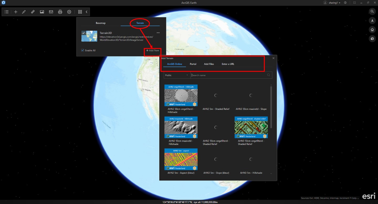
Basemaps and Terrain
ArcGIS Earth users also have the power to set the background geographic context and elevation reference by the same methods as adding data onto the globe. You can add all supported data types as a basemap, except shapefiles and CSV and TXT formats. Additionally, local raster data and elevation image services with LERC tile format can be added as terrain.
Adding Basemaps
Adding Elevation
Look out for additional data types including access to Vector Tiles, Point Clouds, 3D Points GeoJSON and in the future Mobile Scene Packages for single file offline usage.
ArcGIS Earth is free for download and use. Download directly from http://j.mp/ArcGISEarthDownload
More information and support:
Help documentation and system requirements – http://j.mp/Earth1_0Doc
GeoNet forum - http://j.mp/Earth1_0Forum
Twitter - @ArcGISEarth
You Tube Videos – ArcGIS Earth playlist on the ArcGIS Channel
You must be a registered user to add a comment. If you've already registered, sign in. Otherwise, register and sign in.