Hi,
I've created a Drone2Map project in order to generate orthomosiac from images captured by thermal camera. I have used 1 frame every second, my geolocation.csv contains lon,lat and alt. Image are in fairly low resolution (640x480),
.png)
Import images and geolocation.csv file results in a trail visible above. Unfortunately processing ends with error.
Processing report.
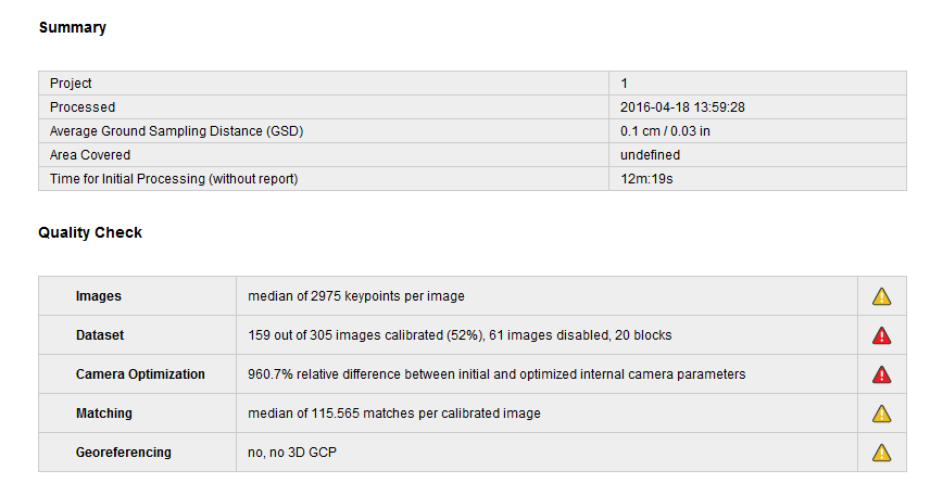
What could be a problem for Drone2Map to finish the processing ? Low quality of the images ? What is the guideline for image quality ?