Many organizations publish OGC WFS services as one option for data supply, either to the general public or to a restricted audience. Often however these services are intended for large scale mapping, such as within a single municipality, and bulk download at national scale is not supported - either a maximum feature collection size per request is set on the server, or response paging is not supported, so an out-of-the-box client is not going to deliver an entire dataset. Sometimes, although these restrictions are not present, assembling and delivering a request for a large feature collection is beyond the capability of the server or network settings (by design), or the client app doesn't support paging (full disclosure, WFS 2.0.0 response paging is coming to core ArcGIS Pro in a future release; Data Interoperability extension already supports WFS 2.0.0 paging if the server provides next/previous URLs).
This blog is about using ArcGIS Data Interoperability to work around these limitations to achieve repeatable bulk download of WFS data at any scale. You will need solid Data Interoperability (or FME) skills to implement this workflow, or be willing to learn from the content of the blog download.
At this point I need to show you a map or you'll go do something else, so I bring you today's subject matter - Norway!
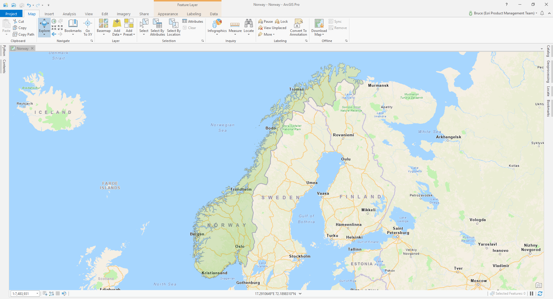
It's necessary to use a real world example, and the people at GeoNorge have excellent public WFS services that let me show the issues, so Norway is it. Browsing their site I settled on a road network service. Here is how to get there yourself, while optionally learning a little Norwegian. Here is GeoNorge, (don't use '/en' if your Norwegian is up to it) click on Go to the map catalogue, then in the selector pane on the left choose Type = Service, Topic = Transportation, Distribution form = WFS Service, then of the available services click on ELF Road Transport Network. Scroll down and you'll see: Get Capabilites Url: https://wfs.geonorge.no/skwms1/wfs.inspire-tn-ro?request=GetCapabilities&service=WFS.
If you don't know OGC standards, be thankful, that's our job! The URL above is a typical pattern, the XML document returned advertises what the WFS service can do. You know I'm going to make you click on the above URL don't you and inspect the response, but before the excitement of XML we'll go off road here and begin to understand the problem a little better.
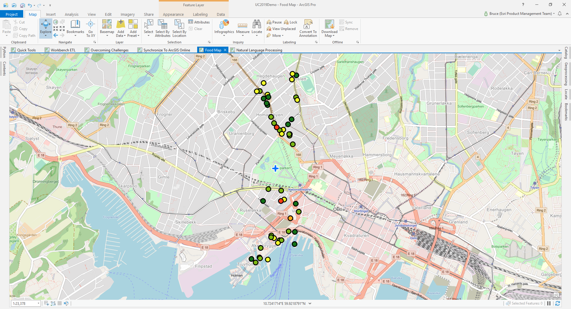
Here is a map of 50 food businesses within 500m walking distance of the Royal Palace in Oslo. I detect a pattern of having to walk north or south of the palace for lunch, which is interesting, maybe its a function of having to cross a major road bisecting the area, but my main point is downtown Oslo has a lot of roads you can walk alongside, whereas up in the arctic circle - not so many (no map, but trust me). We're going to need a way to read the WFS road transport service in chunks such that we don't request more than the service response limit in cities and don't make unnecessary requests in areas with few roads. We're going to design a tiled WFS reading strategy.
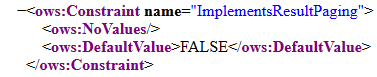
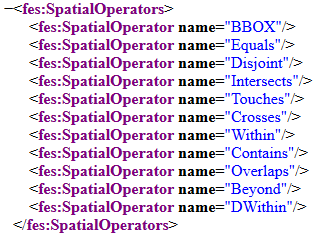
We cannot request pages:
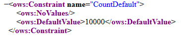
We can only get 10000 features at a time:
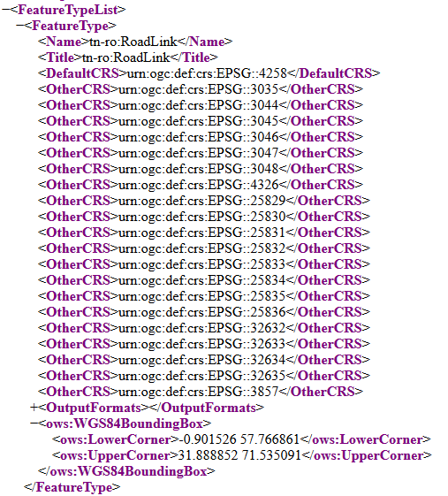
We can retrieve tn-ro:RoadLink feature types in a wide variety of coordinate systems over a huge area:
We can request features within a Bounding Box (BBOX):
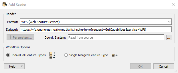
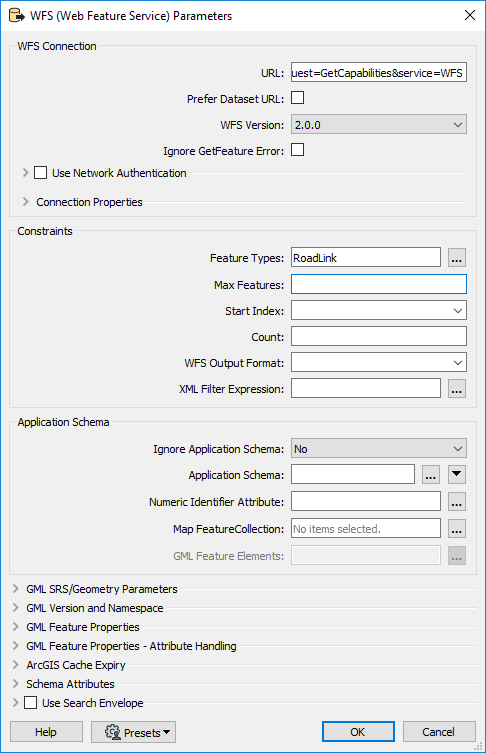
Now for an exercise. Open the Workbench app from the Analysis ribbon (Data Interoperability will need to be installed and licensed) and add a WFS Reader using these parameters (GetCapabilities URL, WFS Version 2.0.0, RoadLink feature type, no MaxFeatures). Connect a logger to the reader, there is no need to write anything.
Run the workspace, you will see
this URL is generated and you'll get a download containing 10000 features.
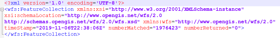
Now add the URL to your browser then edit the URL to add a parameter '
resultType=hits'. This is a special request to count the number of features available in the service, run the
edited URL in your browser. You'll get a response like this:
See the numberMatched property - 1,976,423 Road Link features are available.
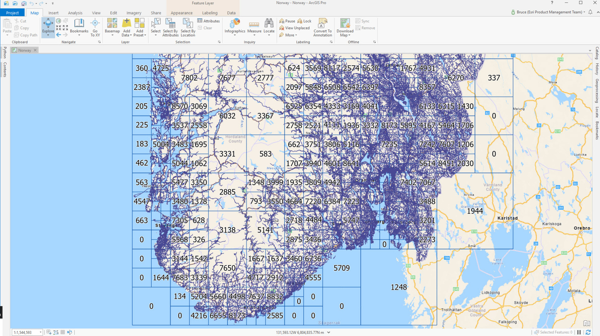
Norway has a land area of ~385,000 square kilometers, so on average ~5 road link features per square kilometer, and on average ~2,000 square kilometers will have ~10,000 road links, the WFS service limit, roughly a 45km square. It is going to be a much larger area in the country's north to contain 10,000 features. Using the scientific method of picking a convenient number out of thin air that is the right order of magnitude, my starting point for a WFS-reading tiling scheme was a 100km square fishnet, made with the Create Fishnet geoprocessing tool (cells that do not intersect land are deleted, and I went with ETRS 1989 UTM Zone 33N projection, which is EPSG:25833 in the service properties):
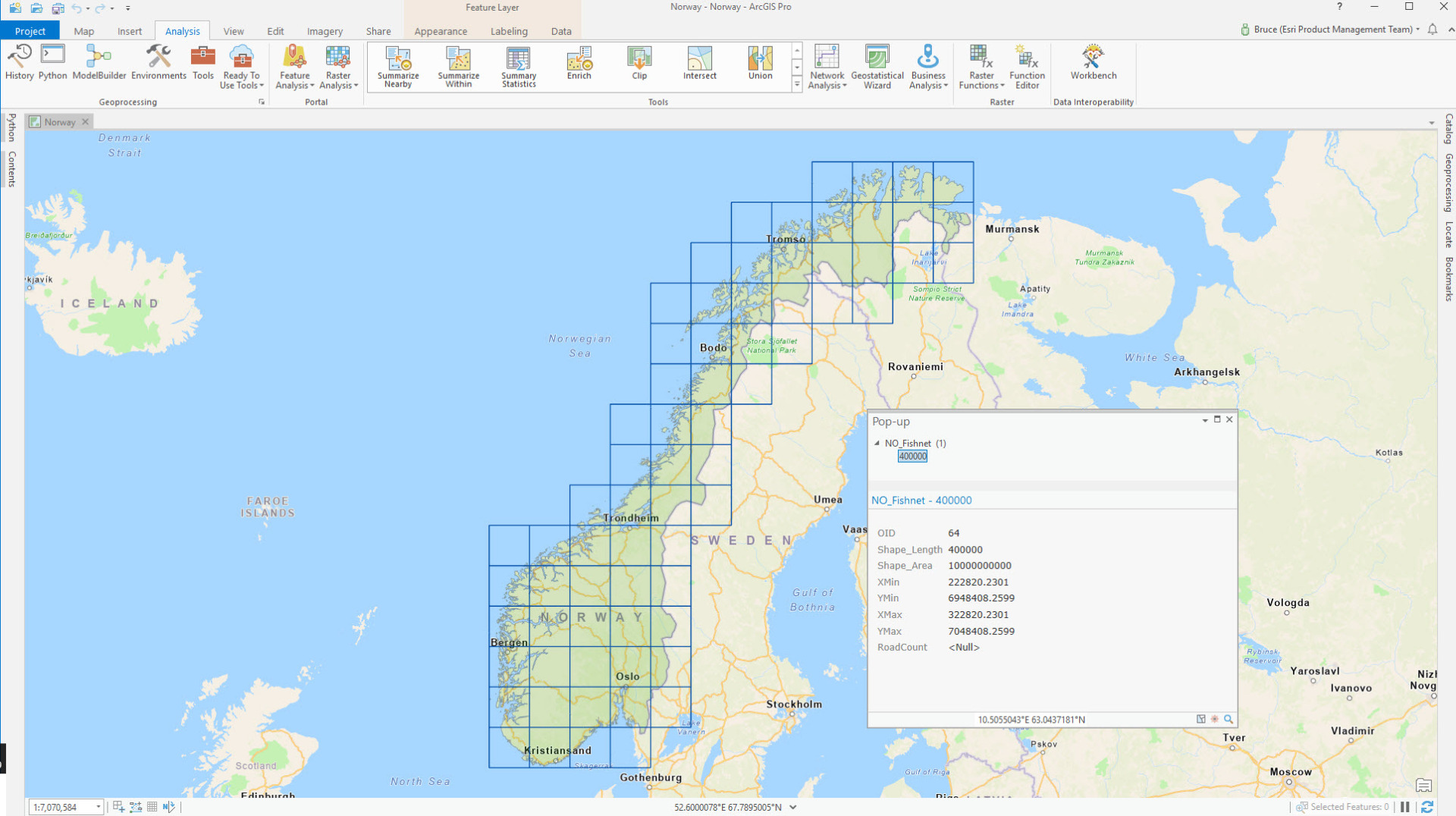
Notice I added some fields (XMin,YMin,XMax,YMax,RoadCount) to the fishnet and set the initial values for the coordinate bounds fields (using Python snippets - these are in the blog download). These bounds are going to be used as Bounding Box parameter inputs in WFS requests. Now I need a workflow to refine the fishnet so cells are subdivided progressively so less than 10,000 road link features will be in each. First I need to figure out the methodology of reading the WFS service in an extent....
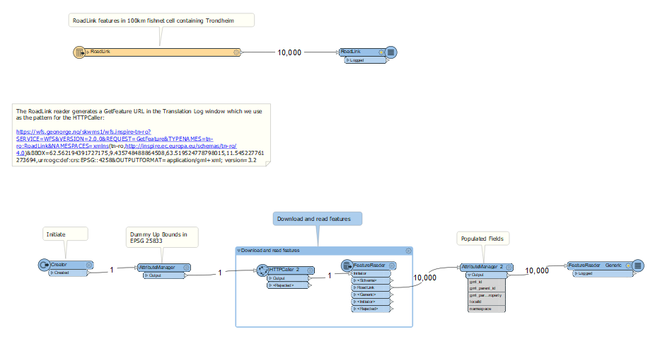
If you open Workbench and drag in BasicGetFeatureWithBBOX.fmw from the blog download you'll see a WFS reader with the properties I needed to inspect a GetFeature URL. The workspace looks like this:
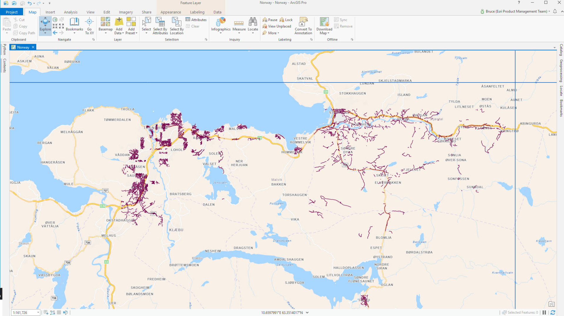
Under the reader you can see how I replicated the GetFeature URL in an HTTPCaller but parameterized the BBOX values. I used a fishnet cell extent containing the city of Trondheim. The download format is GML I used the Quick Import geoprocessing tool (available with Data Interoperability) to translate the GML into a file geodatabase. Here are 10,000 road links around Trondheim:
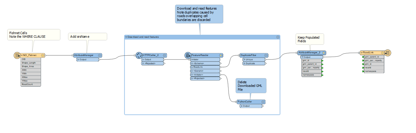
Now I have the building blocks of a tiled WFS reader. And here it is! ReadWFSFeatures.fmw:
The Spatial ETL tool reads RoadLink features in fishnet cells selected by a WHERE clause, here is the first pass reading features in all cells:
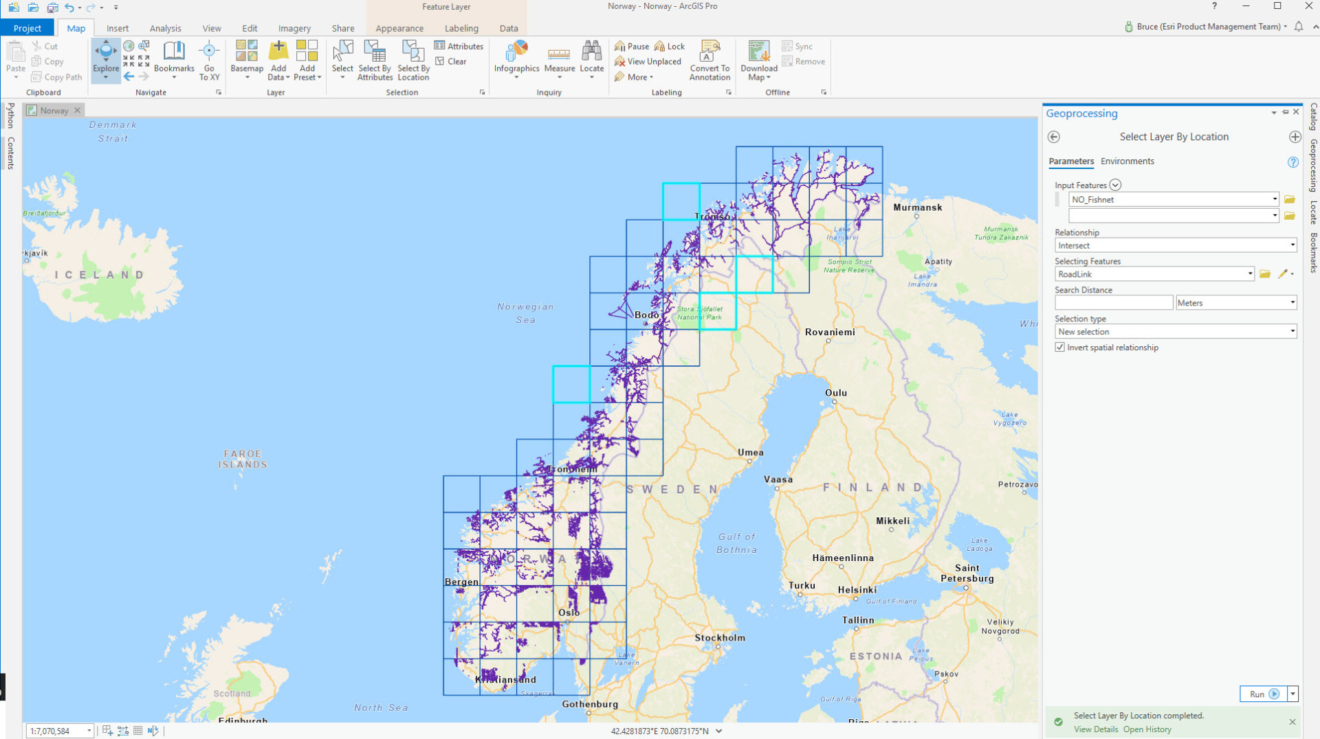
I can see not all 100km cells intersect roads - the ones you can see selected in the fishnet layer - so they can be deleted. Now the work of refining the fishnet begins.
The iterative workflow is this (be very careful!):
- Run ReadWFSFeatures.fmw with a WHERE clause selecting the smallest cell size (initially Shape_Length = 400000, then 200000 when those cells are made, then 100000 when those are made in a subsequent step below...)
- Add the output RoadLink feature class to your map
- Run RoadCount.py in the Python window to populate RoadCount in NO_Fishnet
- Select NO_Fishnet features with RoadCount >= 9000 (undershooting 10,000 to allow for road construction)
- If there are no NO_Fishnet features selected then BREAK - you are finished making the fishnet
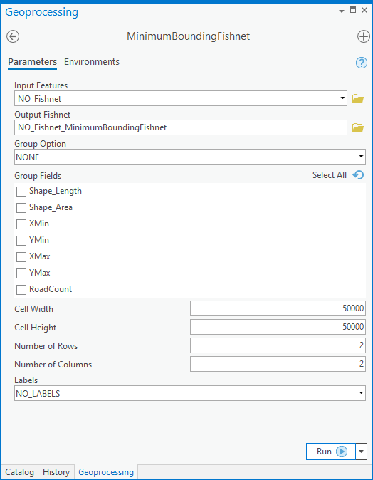
- Run MinimumBoundingFishnet to create a separate fishnet with cells half the width/height of the previous minimum; it is important the selection on NO_Fishnet is still active
- Run Delete Features on the selected NO_Fishnet cells
- Run Append to add the generated smaller fishnet cells to NO_Fishnet, using the field map option.
- Run SetExtentAttributes.py in the Python window to recalculate the boundary coordinates
- Delete the RoadLink feature class
- Go back to the first step
The first subdivision of fishnet cells into 50km square features with MinimumBoundingFishnet looks like this:
After looping through the fishnet refinement process until no cells contain more than 9,000 roads, you can run ReadWFSFeatures.fmw with a WHERE clause that selects all fishnet cells and create the complete RoadLink feature class. Finally run RoadCount.py to populate NO_Fishnet with how many road segments intersect each cell. See if there are any cells with RoadCount = 0 and if you think roads will never be built there then delete the cells, but you'll have to be Norwegian to make that judgement.
Downloading all features took exactly 1hr 0s and exactly 1,976,423 arrived, just as advertised by the WFS service. Here is how the data looks, with the labels being the final road count:
The fishnet can be repurposed to access other WFS features from the GeoNorge agency, and the methodology applied to any WFS service that cannot supply a complete dataset with core approaches.
This post was created using
ArcGIS Pro 2.5 beta 2 software, but the .fmw files should work in Pro 2.4. If the
MinimumBoundingFishnet tool doesn't work for you, download a fresh copy from
here.