- Home
- :
- All Communities
- :
- Products
- :
- ArcGIS Collector
- :
- ArcGIS Collector Questions
- :
- map tile packages
- Subscribe to RSS Feed
- Mark Topic as New
- Mark Topic as Read
- Float this Topic for Current User
- Bookmark
- Printer Friendly Page

- Mark as New
- Bookmark
- Subscribe to RSS Feed
- Permalink
Hello, I would like to create a basemap as a tpkx file for mobile data collection via Fieldmaps. Since the data collection takes place in areas without internet ans using orthophotos. Are there tips and tricks to keep the storage volume as low as possible? The basis is the OSM basemap (visible on a scale when enlarged by more than 1:5000) and individual rasters (orthophotos, visible on a scale when reduced by more than 1:5000). Unfortunately, non reproducible errors also occur. Sometimes completely empty map tile packages are created (i.e. without visible content) and other times map tile packages are created, but the file size varies with differences of up to 10 GB despite the same settings.
Solved! Go to Solution.
Accepted Solutions


- Mark as New
- Bookmark
- Subscribe to RSS Feed
- Permalink
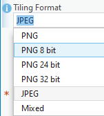
Its a question of the needed quality or resolution of imagery. Using Create Map Tile Package geoprocessing tool to create the TPKX the the Tiling Format
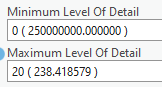
Level of Detail
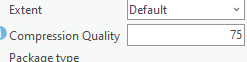
and compression quality
will determine the resulting file size.
As an example I started with a TIFF image it has a source resolution of 1:288
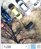
The Tiff image is roughly 300x300 meters
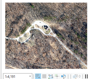
The file size with pyramids is 60 mb
If I create a TPKX using JPEG Tiling scheme Level of Detail 1-20 and Compression 75 the resulting TPKX is 11.3 megabytes
If I create the same setting compression to 20 the resulting file size is 6.2 megabytes. At scale of 1:288 hardly noticeable difference.
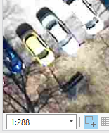
going further I can reduce level of detail to 19, this results in file size of 3.8 megabytes, we can see a difference in quality of display at the source scale.
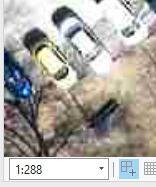
At this point its a matter of how good the data needs to appear to get the desired work done. For example Level of detail 18 compression 20 the file size is 2.8 mb at source scale appears like this.
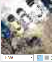
at 1:1099 it looks like this.
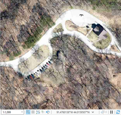
Use the JPEG tiling format and experiment with the level of detail and compression to get the needed quality.
- Mark as New
- Bookmark
- Subscribe to RSS Feed
- Permalink
Its a question of the needed quality or resolution of imagery. Using Create Map Tile Package geoprocessing tool to create the TPKX the the Tiling Format
Level of Detail
and compression quality
will determine the resulting file size.
As an example I started with a TIFF image it has a source resolution of 1:288
The Tiff image is roughly 300x300 meters
The file size with pyramids is 60 mb
If I create a TPKX using JPEG Tiling scheme Level of Detail 1-20 and Compression 75 the resulting TPKX is 11.3 megabytes
If I create the same setting compression to 20 the resulting file size is 6.2 megabytes. At scale of 1:288 hardly noticeable difference.
going further I can reduce level of detail to 19, this results in file size of 3.8 megabytes, we can see a difference in quality of display at the source scale.
At this point its a matter of how good the data needs to appear to get the desired work done. For example Level of detail 18 compression 20 the file size is 2.8 mb at source scale appears like this.
at 1:1099 it looks like this.
Use the JPEG tiling format and experiment with the level of detail and compression to get the needed quality.
