Turn on suggestions
Auto-suggest helps you quickly narrow down your search results by suggesting possible matches as you type.
Cancel
- Home
- :
- All Communities
- :
- Products
- :
- ArcGIS Collector
- :
- ArcGIS Collector Questions
- :
- Field Data Collecting
Options
- Subscribe to RSS Feed
- Mark Topic as New
- Mark Topic as Read
- Float this Topic for Current User
- Bookmark
- Subscribe
- Mute
- Printer Friendly Page
Field Data Collecting
Subscribe
959
0
04-12-2021 02:37 AM
04-12-2021
02:37 AM
- Mark as New
- Bookmark
- Subscribe
- Mute
- Subscribe to RSS Feed
- Permalink
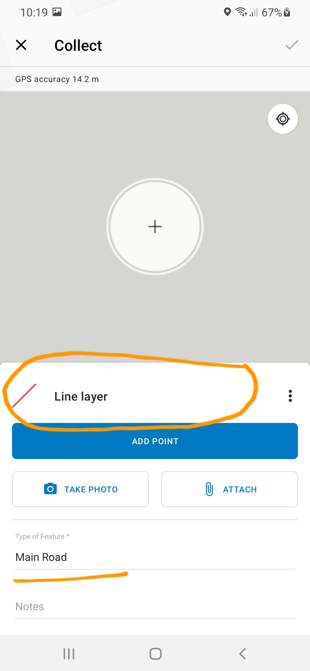
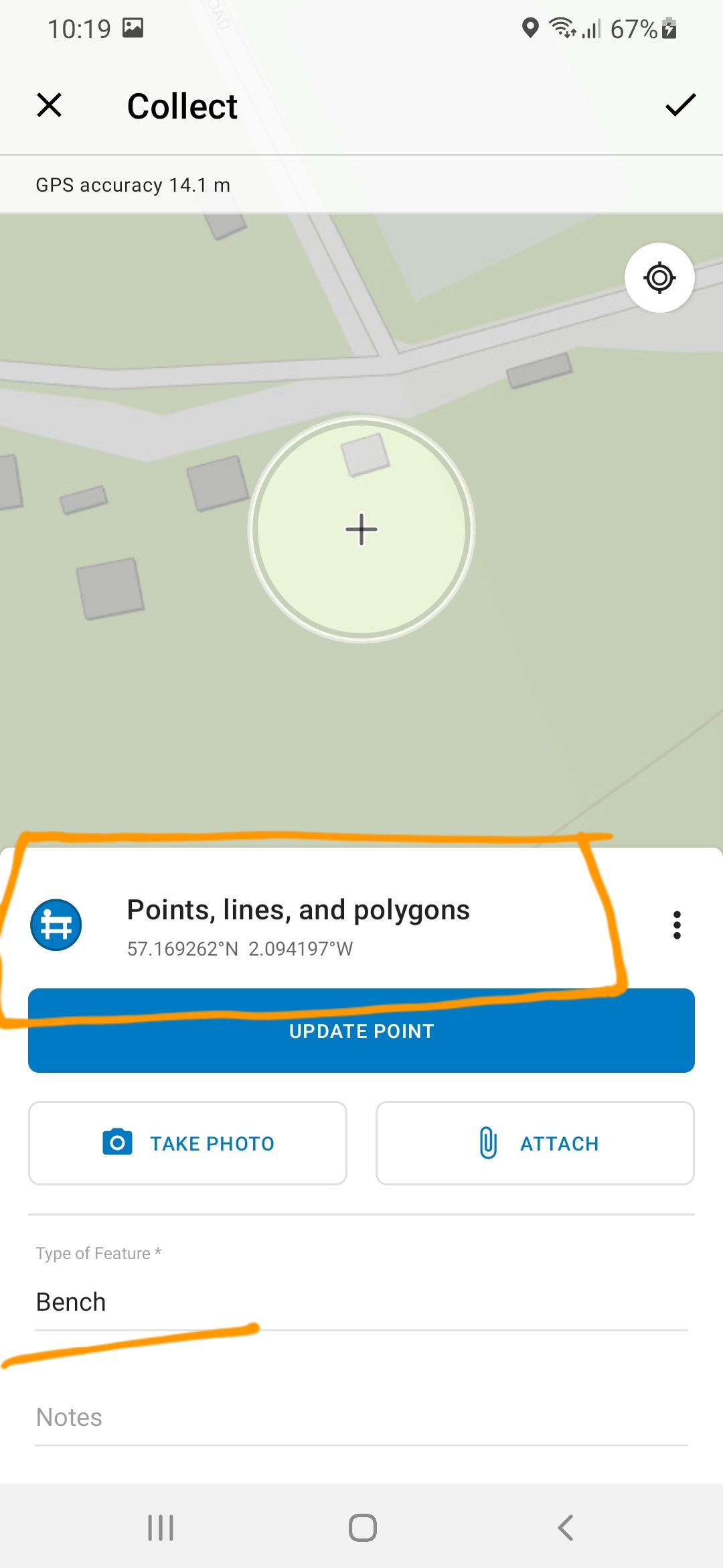
I am going to collect data by using ArcGIS Collector app using a Map Template created by me. But when I am going to add a Bench (point feature) it indicates as "Points,lines, and polygons" but with the correct symbol I used. In line features also it appears as "Line Layer" instead of "Main Road" but with the correct symbol I applied. Same thing occurs with polygons. Please see attached screenshots.
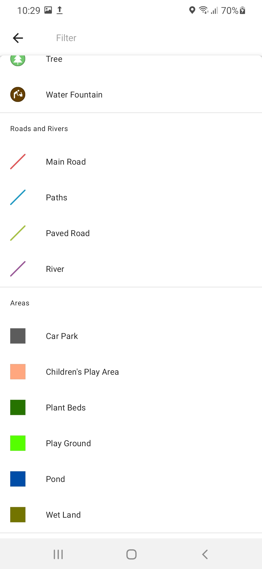
In the given Map Templates it shows as Bench when we are going to add a Bench and Picnic table when we are going to add a Picnic table.Please help me to find out the error.
Thank You!
0 Replies