- Home
- :
- All Communities
- :
- Products
- :
- ArcGIS CityEngine
- :
- ArcGIS CityEngine Questions
- :
- Terrain Not Aligning
- Subscribe to RSS Feed
- Mark Topic as New
- Mark Topic as Read
- Float this Topic for Current User
- Bookmark
- Subscribe
- Mute
- Printer Friendly Page
Terrain Not Aligning
- Mark as New
- Bookmark
- Subscribe
- Mute
- Subscribe to RSS Feed
- Permalink
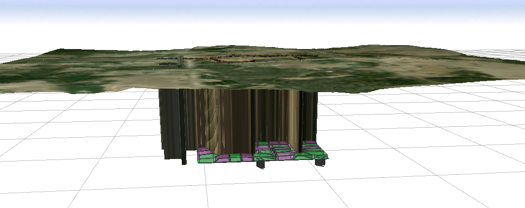
I imported terrain using the Get Map Data, but the terrain appears way above the rest of the data. I've tried and tried, and just can't figure out how to fix it.
So, I moved on and added streets to my subdivision. Now there are "holes" in the terrain where the streets were digitized.
So, I moved on and tried to create some buildings on my lots. The buildings all generated upside down.
Is there any help to this? Or am I going to have to start over?
- Mark as New
- Bookmark
- Subscribe
- Mute
- Subscribe to RSS Feed
- Permalink
The elevation is at the real-world level. Your models are at y = 0. You usually do it the other way around, align shapes to geometry (usually translate to minimum). You align geometry to shapes to flatten out the ground where it goes into your models. As for the streets, they muck up the terrain as you draw them. I usually set the aerial to y = 0 and draw them, then align, then fix up. Not ideal either, but afaik street creation involving any kind of realistic terrain (i.e. not completely flat) is a huge pain no matter what.