- Home
- :
- All Communities
- :
- Products
- :
- ArcGIS CityEngine
- :
- ArcGIS CityEngine Questions
- :
- Re: Selected Extent Too Small for Get Map Data- Ci...
- Subscribe to RSS Feed
- Mark Topic as New
- Mark Topic as Read
- Float this Topic for Current User
- Bookmark
- Subscribe
- Mute
- Printer Friendly Page
Selected Extent Too Small for Get Map Data- CityEngine
- Mark as New
- Bookmark
- Subscribe
- Mute
- Subscribe to RSS Feed
- Permalink
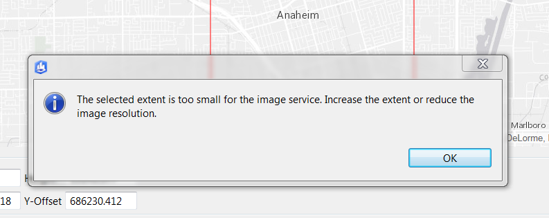
I keep getting this error while trying to get map data. I am not sure what I am doing incorrectly. I do this because there is a known bug in 2016.1 where you can't map to layer attributes without a raster image of some type in the scene or a layer that has an attribute whose named is shared with the rule*(See Cheryl's comment below).
I can get it to work at a very low resolution when zoomed out, but the same is not possible when zoomed in. Is there any guidance between the relationship between the resolution or extent for this feature?
Any ideas?
Relevant documentation page: Get map data from ArcGIS Online / Portal
Solved! Go to Solution.
Accepted Solutions
- Mark as New
- Bookmark
- Subscribe
- Mute
- Subscribe to RSS Feed
- Permalink
The tile server needs to re-project the base map data of the requested region into the scene coordinate system.
By the time the request is sent to the server the highest available resolution in this region is unknown.
If the source resolution is significantly lower than the target one, a lower resolution or larger area must be selected.
Esri is constantly striving to improve the resolution ad currency of its base map services (e.g. the World Imagery Service)
- Mark as New
- Bookmark
- Subscribe
- Mute
- Subscribe to RSS Feed
- Permalink
Did you try unchecking the elevation raster option? Maybe it's causing problems due to its low resolution (if the service is using SRTM data, 90m would equal 1 pixel).
- Mark as New
- Bookmark
- Subscribe
- Mute
- Subscribe to RSS Feed
- Permalink
Yes I did. I actually was not interested in elevation data in this particular case.
I ultimately got it work by dropping resolution to 1 K I think. It could be a limitation of the zoom level I was at? Have you ever had issues with really zoomed in extractions before?
- Mark as New
- Bookmark
- Subscribe
- Mute
- Subscribe to RSS Feed
- Permalink
I haven't used the get map feature beyond a few tests but as far as I can tell it downloads WMS tiles or at least tries. Results vary as not every location has hi res imagery available, e. g. you can get 1x1 km 4k imagery around the white house, but can't in rural areas. By decreasing the image resolution (e. g. 500x500 px) but keeping the bounding area the same you're basically requesting a chunk of a low resolution tile that may be available.
- Mark as New
- Bookmark
- Subscribe
- Mute
- Subscribe to RSS Feed
- Permalink
That makes a lot of sense. It would also explain why it occurs in some areas and not others. What I found strange was that usually the base maps (not imagery) have coverage regardless of resolution level typically, but in this case it did not seem to.
- Mark as New
- Bookmark
- Subscribe
- Mute
- Subscribe to RSS Feed
- Permalink
With regards to linking layer attributes, you should be able to link to layer attributes without having to import an image. There is a bug here which disables this ability, but if you create an attribute with the same name, then layer linking should be enabled again. You don't have to use the attribute with the same name, and you can even delete it once the layer linking is enabled. https://community.esri.com/message/660438-re-connecting-attributes?commentID=660438&et=notification....
- Mark as New
- Bookmark
- Subscribe
- Mute
- Subscribe to RSS Feed
- Permalink
I have updated the post. However, do you know why the tile has to be a minimum size and why certain base maps are hard to get at a high resolution?
- Mark as New
- Bookmark
- Subscribe
- Mute
- Subscribe to RSS Feed
- Permalink
The tile server needs to re-project the base map data of the requested region into the scene coordinate system.
By the time the request is sent to the server the highest available resolution in this region is unknown.
If the source resolution is significantly lower than the target one, a lower resolution or larger area must be selected.
Esri is constantly striving to improve the resolution ad currency of its base map services (e.g. the World Imagery Service)
- Mark as New
- Bookmark
- Subscribe
- Mute
- Subscribe to RSS Feed
- Permalink
Hi Thomas,
Thanks for the reply. Does the scene coordinate system have some impact on the tiles that can be retrieved then? Or is it just that you need to select a larger or lower res tile in some cases depending on what is available?
David