- Home
- :
- All Communities
- :
- Products
- :
- ArcGIS CityEngine
- :
- ArcGIS CityEngine Questions
- :
- How to add a street shape file to cityengine?
- Subscribe to RSS Feed
- Mark Topic as New
- Mark Topic as Read
- Float this Topic for Current User
- Bookmark
- Subscribe
- Mute
- Printer Friendly Page
How to add a street shape file to cityengine?
- Mark as New
- Bookmark
- Subscribe
- Mute
- Subscribe to RSS Feed
- Permalink
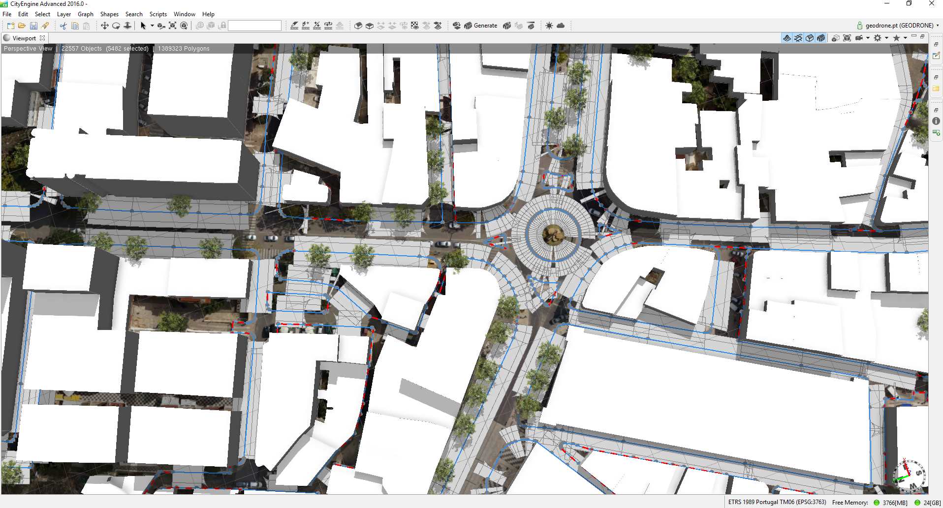
Hi again guys.
So i'm been buying working in my 3d city but now i'm stuck again.
Buildings shapes and height, tree and vegetation shapes already working and ortophotomap everything ok.
So the problema is when i try do add the street shape (see the attach n1 - blue lines) the CE thinks that i'm adding multiple roads (see the attach n2) since i dont have a center line but only the road perimeter.
So what can i do to tell CE that the road is inside the lines not on the top of the lines?
Already tried to found any info regarding this in the FAQ's and in the Help file and didnt found anything. 
Attach n3 is the street shape file info in arcgis.
Thanks once again
Best regards
JM
- Mark as New
- Bookmark
- Subscribe
- Mute
- Subscribe to RSS Feed
- Permalink
This might be very difficult because City Engine uses a single line to create street segment and uses single nodes to create intersections and crossing types. I think it would be worth your time to re-create your street data with single lines. However, a great resource for street data (if it is available for your area) is Open Street Maps.
https://www.openstreetmap.org/#map=16/18.4621/-66.1154
I have gotten plenty of data from them before and used it in CityEngine street network generation.
A third option (And not very trustworthy) would be to erase the sidewalk (width = 0) from street segment sides that are in the median of the road. Use the other street segment sidewalk that is in the median as an actual median. However, this may be more trouble than its worth.
Good luck.
- Mark as New
- Bookmark
- Subscribe
- Mute
- Subscribe to RSS Feed
- Permalink
So maybe i can use this street shape to create the sidewalk shape, no?
Is it possible to create the sidewalk and automatically stop in the building shape? Or do i have to resized it all by hand?
Regarding the street shape itself i gonna create a single street segment then.
Thank you, Micah
- Mark as New
- Bookmark
- Subscribe
- Mute
- Subscribe to RSS Feed
- Permalink
Your welcome.
Yes, if you want to use a single segment as a sidewalk....you could make one sidewalk width = 0, the street width = 0, and the other sidewalk = *however wide*...But again, I think your best option is to clean up the data before importing to CityEngine.
The streets only 'perfectly' match the buildings if the buildings were created from the blocks in the street network, but it is pretty easy to line the street shapes up along the buildings once you have them generated. Just play with SidewalkWidthLeft, SidewalkWidthRight, and StreetWidth in the inspector window.
Good luck. 
- Mark as New
- Bookmark
- Subscribe
- Mute
- Subscribe to RSS Feed
- Permalink
If you have ArcMap ArcGIS for Desktop  , you could try this*, however I only had decent success with very simple stuff, and even that required manual cleanup. You could also buffer the lines by 0.5*street width, then convert the buffers to lines, then cut the lines.. or get the streets elsewhere like Micah Taylor suggested..
* Collapse Dual Lines To Centerline—Help | ArcGIS for Desktop
- Mark as New
- Bookmark
- Subscribe
- Mute
- Subscribe to RSS Feed
- Permalink
LR thanks for that ''little'' tip maybe be useful later for another shape for now i downloaded the shape from OSM and already readjusted to my ortophotomap. Its perfect!
Gonna try to reuse the old shape file (streets) for the sidewalk at least.
Thank you guys for the tips and the quick replies.
JM