Turn on suggestions
Auto-suggest helps you quickly narrow down your search results by suggesting possible matches as you type.
Cancel
- Home
- :
- All Communities
- :
- Products
- :
- ArcGIS CityEngine
- :
- ArcGIS CityEngine Questions
- :
- Re: heightmap issues
Options
- Subscribe to RSS Feed
- Mark Topic as New
- Mark Topic as Read
- Float this Topic for Current User
- Bookmark
- Subscribe
- Mute
- Printer Friendly Page
heightmap issues
Subscribe
5338
9
04-11-2013 07:08 AM
04-11-2013
07:08 AM
- Mark as New
- Bookmark
- Subscribe
- Mute
- Subscribe to RSS Feed
- Permalink
I have been away from this tool for a couple of months but for some reason seem to have forgotten a workaround I had for importing a heightmap. I tried Brady's example in an earlier thread but an odd thing almost always happens. I tried creating the image in various tools and various formats. I've gone back to trying to use a geotiff. I've tried 8 bit, 16 bit and 32 bit. When the file is imported, it seems to put it in the correct place but the odd thing I encounter is that I never see the terrain. When I "fit" it in the scene, it goes to where I expect but there is no geometry. The grid position looks right but the perspective view contains 1 object, 0 polygons.
There was something I'd forgotten to do in my importing process but I can't for the life of me remember what it was that made all the difference.
There was something I'd forgotten to do in my importing process but I can't for the life of me remember what it was that made all the difference.
9 Replies
04-12-2013
05:01 AM
- Mark as New
- Bookmark
- Subscribe
- Mute
- Subscribe to RSS Feed
- Permalink
Hi !
Can it be that your GeoTif is more than 4000 px wide/long ?
32 bit GeoTif is correct for the heightmap.
Let me know .. 😮 [[ I love this smiley !! ]]
Matt
ps. maybe you find an other answer here :
http://forums.arcgis.com/threads/54072-textures-raster-files-concepts-in-CityEngine-ArcGIS
Can it be that your GeoTif is more than 4000 px wide/long ?
32 bit GeoTif is correct for the heightmap.
Let me know .. 😮 [[ I love this smiley !! ]]
Matt
ps. maybe you find an other answer here :
http://forums.arcgis.com/threads/54072-textures-raster-files-concepts-in-CityEngine-ArcGIS
04-12-2013
05:24 AM
- Mark as New
- Bookmark
- Subscribe
- Mute
- Subscribe to RSS Feed
- Permalink
Actually the elevation map is pretty small. When I was working on an earlier project, I became acquainted with the small memory space.
04-12-2013
06:22 AM
- Mark as New
- Bookmark
- Subscribe
- Mute
- Subscribe to RSS Feed
- Permalink
Hmm.
Do you get any errors in the Log Window ?
Can you post a screenshot of what you see ?
Did you maybe forget to set map layers to visible ( Toggle with F9 )
Let me know ..
M.
Do you get any errors in the Log Window ?
Can you post a screenshot of what you see ?
Did you maybe forget to set map layers to visible ( Toggle with F9 )
Let me know ..
M.
04-12-2013
10:18 AM
- Mark as New
- Bookmark
- Subscribe
- Mute
- Subscribe to RSS Feed
- Permalink
I think F9 was the problem I had earlier, but this one has become more crafty. I seem to be having a hard time attaching an image from our network. Could you PM me your email address? The log file was surprisingly quiet.
04-15-2013
04:35 AM
- Mark as New
- Bookmark
- Subscribe
- Mute
- Subscribe to RSS Feed
- Permalink
Hi !
1]
Note that you don't have a .prj file. So set the SCS first to the target projection. Or create the .prj file if you import your terrain into a new scene.
After importing ( and not seeing the terrain ), can you activate the viewport by clicking it, then press 'f'.
The camera should then fly to the object. It may still now be visible. Can you then rotate the camera so you see it from below ? Is then something visible ?
Can you package the file up and post it as a zip ?
I'll PM mail mail address.
Matt
04-18-2013
02:22 PM
- Mark as New
- Bookmark
- Subscribe
- Mute
- Subscribe to RSS Feed
- Permalink
hi there
i am new to city engine 😮
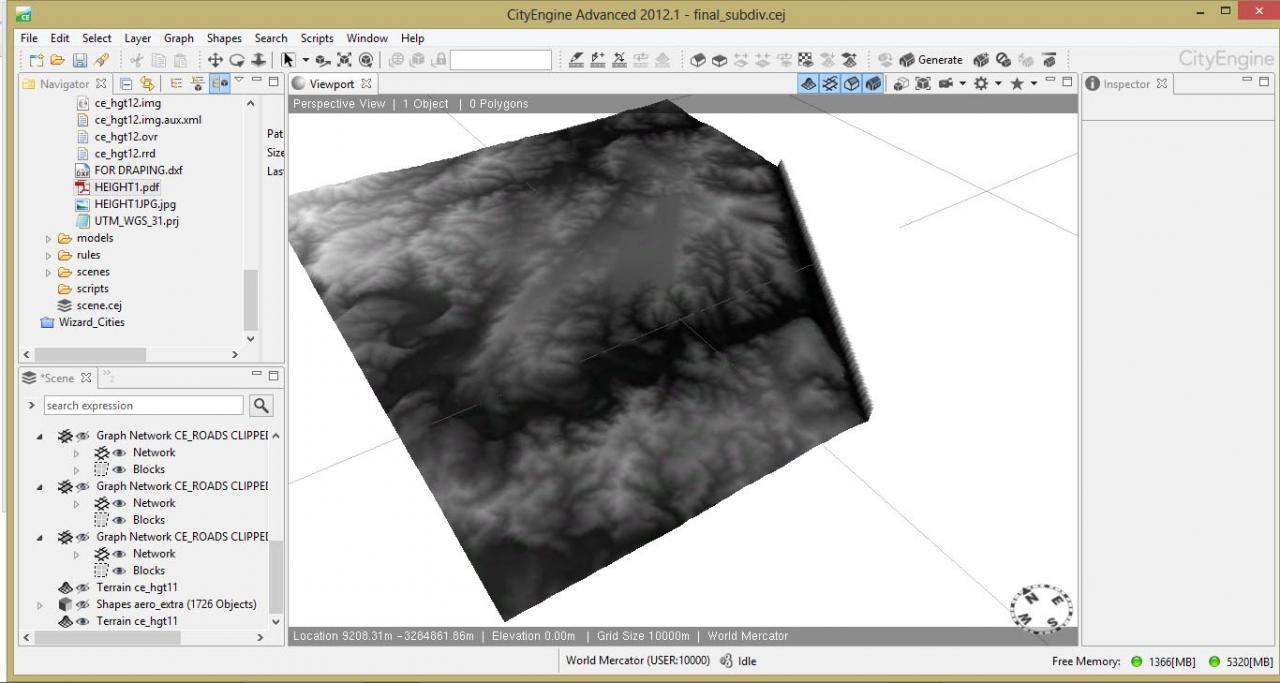
i created a heightmap from arcmap (see attached files) - it's of an area close to the ocean. the ocean appears as a wall rather than on 'zero ground'. When i went back to the tif file created in arcmap it has a the ocean area in black rather than white. i am struggling to get rid of this.
can you help me please?
is there an easy way to get rid of this without having to recreate the heightmap / contour lines in arcmap?
thanks.
[ATTACH=CONFIG]23626[/ATTACH][ATTACH=CONFIG]23627[/ATTACH]
i am new to city engine 😮
i created a heightmap from arcmap (see attached files) - it's of an area close to the ocean. the ocean appears as a wall rather than on 'zero ground'. When i went back to the tif file created in arcmap it has a the ocean area in black rather than white. i am struggling to get rid of this.
can you help me please?
is there an easy way to get rid of this without having to recreate the heightmap / contour lines in arcmap?
thanks.
[ATTACH=CONFIG]23626[/ATTACH][ATTACH=CONFIG]23627[/ATTACH]
04-19-2013
03:46 AM
- Mark as New
- Bookmark
- Subscribe
- Mute
- Subscribe to RSS Feed
- Permalink
Hi !
If the pixel values of the terrain are exactly '0' or 'noData', they are sadly translated to the terrain's max.
Use con() of the Raster Calculator GP tool to replace these values first. That's a bug in CE currently.
http://resources.arcgis.com/en/help/main/10.1/index.html#//009z000000z7000000
Ok ?
m.
04-29-2013
09:40 AM
- Mark as New
- Bookmark
- Subscribe
- Mute
- Subscribe to RSS Feed
- Permalink
I knew it was something simple and silly. After viewing a screencast from tech support and repeating the same process with the SAME files I realized that my render mode was wireframe untextured and I don't have the skydome loaded in so I was looking at a white wireframe on a white background.
I apologize for wasting everyone's time.
I apologize for wasting everyone's time.