- Home
- :
- All Communities
- :
- Products
- :
- ArcGIS Business Analyst
- :
- ArcGIS Business Analyst Ideas
- :
- "Find Existing Locations" results to include SITE ...
- Subscribe to RSS Feed
- Mark as New
- Mark as Read
- Bookmark
- Follow this Idea
- Printer Friendly Page
"Find Existing Locations" results to include SITE & DISTANCE to site
- Mark as New
- Bookmark
- Subscribe
- Mute
- Subscribe to RSS Feed
- Permalink
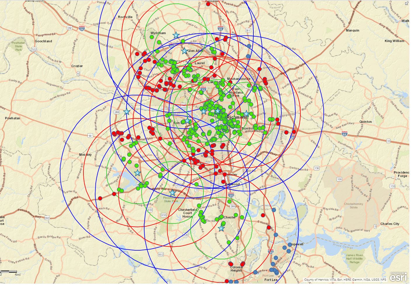
Scenario: 10 sites with a buffer of 3 rings each = 30 sets of data.
100's of uploaded addresses.
The exported results to Excel should identify the "site" and the "distance" from each address. The site is necessary since there will be overlap.
Currently, I have to perform 30 processes using the "Find Existing Locations" to identify the proximity to the site.
Is there currently a better way to perform this task? If not, please consider automating.
The attached map shows total data points in each radius pulled as a group with "Find Existing Locations", but the data exported does not clarify the site or the distance to the site.
Have you tried using the Near (Analysis Tool)?
It will give you In FID, Out FID, Distance, XY and even angle to the near item.
Robert, I played around with this and it is fabulous. Exactly what I need. Except it is not connecting to all of my data points. I have deselected all of the limitations. Do you know why this is happening? I tried it twice and got the same thing.
Thanks so much!
Jo
<http://www.hhhunt.com/>
C. Jo LoCicero
Market Analyst . Properties Division
1401 Sunday Drive, Suite 109
Raleigh, NC 27606
Office – 919.461.0587 Ext. 119
HHHunt.com<http://www.hhhunt.com/>
<http://www.facebook.com/> <http://www.twitter.com/> <http://www.linkedin.com/>
This is what I am talking about.
Robert, I played around with this and it is fabulous. Exactly what I need. Except it is not connecting to all of my data points. I have deselected all of the limitations. Do you know why this is happening? I tried it twice and got the same thing.
Thanks so much!
Jo
<http://www.hhhunt.com/>
C. Jo LoCicero
Market Analyst . Properties Division
1401 Sunday Drive, Suite 109
Raleigh, NC 27606
Office – 919.461.0587 Ext. 119
HHHunt.com<http://www.hhhunt.com/>
<http://www.facebook.com/> <http://www.twitter.com/> <http://www.linkedin.com/>
Hi Jo,
Are you using the Nearby summaries in BA Web App? If so, here are some resources on this topic.
- http://doc.arcgis.com/en/business-analyst/web/building-infographic-reports.htm#ESRI_SECTION1_6F191F7... (scroll down to the nearby section)
Thanks,
Praveen
Good morning, Praveen.
I ultimately got this worked out. Thanks for taking the time to check with me.
Have a great day!
Jo
<http://www.hhhunt.com/>
C. Jo LoCicero
Market Analyst . Properties Division
1401 Sunday Drive, Suite 109
Raleigh, NC 27606
Office – 919.461.0587 Ext. 119
HHHunt.com<http://www.hhhunt.com/>
<http://www.facebook.com/> <http://www.twitter.com/> <http://www.linkedin.com/>
You must be a registered user to add a comment. If you've already registered, sign in. Otherwise, register and sign in.