Turn on suggestions
Auto-suggest helps you quickly narrow down your search results by suggesting possible matches as you type.
Cancel
- Home
- :
- All Communities
- :
- Developers
- :
- ArcGIS API Silverlight (Retired)
- :
- ArcGIS API Silverlight Questions
- :
- I need help to make an scaleZoom based application
Options
- Subscribe to RSS Feed
- Mark Topic as New
- Mark Topic as Read
- Float this Topic for Current User
- Bookmark
- Subscribe
- Mute
- Printer Friendly Page
I need help to make an scaleZoom based application
Subscribe
832
1
08-18-2010 04:18 AM
08-18-2010
04:18 AM
- Mark as New
- Bookmark
- Subscribe
- Mute
- Subscribe to RSS Feed
- Permalink
Hi, where i work we have this application (on the screenshot):
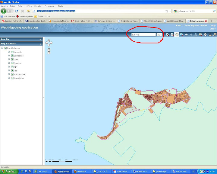
The marked area is a zoom by scale function, where you type the scale and it zooms in till the map reaches the desired scale.
this application(.NET 4.0) doesn't use Silverlight, and what I need is to make an scale based zoom to our new applications, silverlight based.
does anyone have any idea of how to make it??
1 Reply
08-19-2010
08:27 AM
- Mark as New
- Bookmark
- Subscribe
- Mute
- Subscribe to RSS Feed
- Permalink
The Silverlight map uses resolution in stead of scale, since scale is a very misleading value on a computer screen (because you basically don't know the dimension of your screen).
So to zoom to a scale this use the Map.ZoomToResolution(mapUnitsPerPixel) method instead.
where mapUnitsPerPixels is how many meters/feets/degrees (based on what projection you use) one pixel covers.
To convert this value from a scale, you will need to know how big a pixel is on your screen. As mentioned above this is where it gets misleading, because most screens are different (when you connect a projector you even have two scales, one on your laptop and another one on your projector). An often used assumption is 96dpi (pixels per inch), so with a little math, you can calculate the resolution based on a specific scale (ie. 1:25000 means 1inch on screen = 25000 inches on the map, so at 96 dpi, 1 pixel is 25000/96, and lastly you should convert the inches to whatever unit your map projection is using) .
Also see the scale discussion here:
http://help.arcgis.com/en/webapi/silverlight/apiref/ESRI.ArcGIS.Client~ESRI.ArcGIS.Client.Map.html