- Home
- :
- All Communities
- :
- Developers
- :
- ArcGIS API for Python
- :
- ArcGIS API for Python Questions
- :
- Why curves get converted to line segments in API?
- Subscribe to RSS Feed
- Mark Topic as New
- Mark Topic as Read
- Float this Topic for Current User
- Bookmark
- Subscribe
- Mute
- Printer Friendly Page
Why curves get converted to line segments in API?
- Mark as New
- Bookmark
- Subscribe
- Mute
- Subscribe to RSS Feed
- Permalink
Hi,
I'm working with the Python API wherein I update a polygon hosted feature layer. I get the data from a local file geodatabase and iterate the featureclass inside that geodatabase. I'm using the SpatialDataframe module and use from_featureclass() method to do this.
![]()
However, when I try to edit the features (I truncates first the hosted layer) by passing the array of features, all curves get converted to line segments? Is there a way on how I can preserve the curves of my features? Upon checking the coordinates, both were projected in web mercator. Thanks.
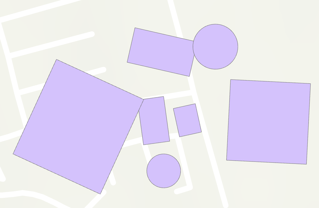
This is my features as seen on my desktop.
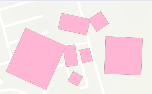
This is the result when I'm done with editing.
Thank you!
- Mark as New
- Bookmark
- Subscribe
- Mute
- Subscribe to RSS Feed
- Permalink
https://community.esri.com/message/935520-true-arcs-geocoding-and-other-musings
Good chance that the SDF or the SEDF doesn't support them. Densification seems to be the default outside of the file geodatabase
... sort of retired...