- Home
- :
- All Communities
- :
- Developers
- :
- ArcGIS API for Python
- :
- ArcGIS API for Python Questions
- :
- How to display a polygon instead of a point
- Subscribe to RSS Feed
- Mark Topic as New
- Mark Topic as Read
- Float this Topic for Current User
- Bookmark
- Subscribe
- Mute
- Printer Friendly Page
How to display a polygon instead of a point
- Mark as New
- Bookmark
- Subscribe
- Mute
- Subscribe to RSS Feed
- Permalink
Hi,
Using PostGIS I have created a geometry column which contains a 100 FT buffer around each point. I'm trying to take this from PostGIS and create/update a feature layer in ArcGIS Online. This will be part of an automated pipeline and I'm using the arcgis python api. How I normally update datasets is I first upload a csv file and then overwrite that csv using the api whenever new data is received.
I've tried exporting this data in a CSV and a shapefile and then uploading that to ArcGIS Online but there is no option that I could see to choose to display the buffer polygon. It only will show the points.
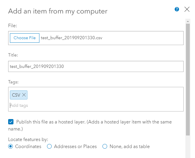
Uploading CSV:
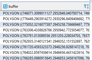
Buffer column in PostGIS:
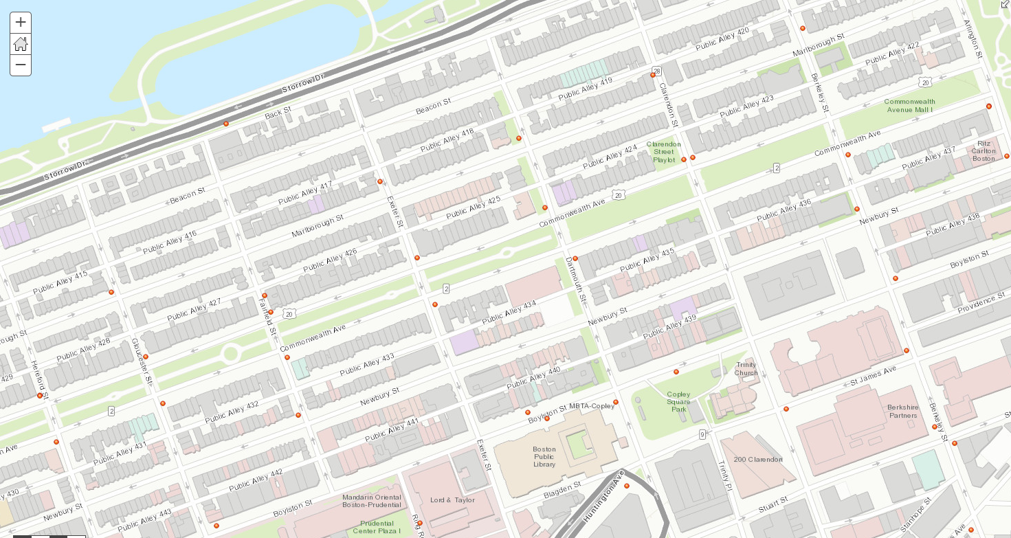
What happens when I upload the data:
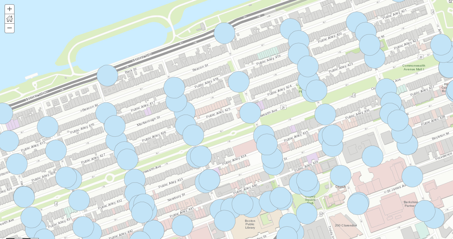
What I'm trying to achieve:
- Mark as New
- Bookmark
- Subscribe
- Mute
- Subscribe to RSS Feed
- Permalink
The screenshot you are showing is a WKT representation of a polygon, albeit truncated to the first vertex since the column is only so wide.
It would help to explain your situation a bit more. It seems like you have a table in PostGIS that you want to either upload or update into ArcGIS Online or ArcGIS Enterprise. Am I on the right path?
- Mark as New
- Bookmark
- Subscribe
- Mute
- Subscribe to RSS Feed
- Permalink
Hi Joshua,
Yes you are correct - I updated my question with more details and screenshots. I'm still pretty new to ArcGIS Online so forgive me if this is a silly question. I appreciate any help or direction you can point me in!