- Home
- :
- All Communities
- :
- Developers
- :
- ArcGIS API for Python
- :
- ArcGIS API for Python Questions
- :
- Add a feature class to a map in Jupyter Notebook
- Subscribe to RSS Feed
- Mark Topic as New
- Mark Topic as Read
- Float this Topic for Current User
- Bookmark
- Subscribe
- Mute
- Printer Friendly Page
Add a feature class to a map in Jupyter Notebook
- Mark as New
- Bookmark
- Subscribe
- Mute
- Subscribe to RSS Feed
- Permalink
Can I add a field of a feature class to a map using something like map1.add_layer(FeatureClassName, FieldName, SymbologyType, ColorMap)?
- Mark as New
- Bookmark
- Subscribe
- Mute
- Subscribe to RSS Feed
- Permalink
Notebooks from inside or outside of ArcGIS Pro?
you can use the arcgis and the arcpy modules.
It would be kind of useless to make a map inside a notebook inside of Pro, since you can just look at the map there.
There is webmap stuff and other things in
API Reference for the ArcGIS API for Python — arcgis 1.8.0 documentation
and the arcpy mapping module
Introduction to arcpy.mp—ArcPy | Documentation
... sort of retired...
- Mark as New
- Bookmark
- Subscribe
- Mute
- Subscribe to RSS Feed
- Permalink
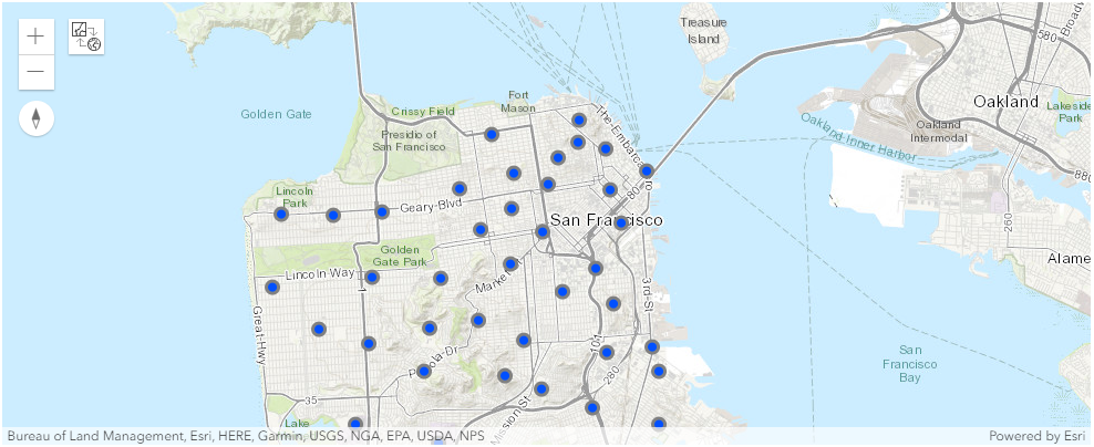
Yes you can, sort of. You can't directly view the Feature Class (FC), but if you want to see what the data looks like in a map, you can convert it to a Spatially Enabled DataFrame (SeDF), and then plot that on a map in Jupyter Notebooks. Just keep in mind that your FC and the SeDF are disconnected. If you make changes to your FC then you will need to update the SeDF.
This is one way to do it that I use:
# import modules
import pandas as pd
from arcgis.features import GeoAccessor, GeoSeriesAccessor
from arcgis.gis import GIS
# create map
gis = GIS()
my_map = gis.map(location = 'San Francisco, CA', zoomlevel = 12)
# load your feature class into a spatially enabled dataframe (sedf)
fc = r'c:\gis\my_geodatabase.gdb\firestations'
my_sedf = pd.DataFrame.spatial.from_featureclass(fc)
# plot the sedf on your map
my_sedf.spatial.plot(map_widget = my_map)
# show the map
my_map
- Mark as New
- Bookmark
- Subscribe
- Mute
- Subscribe to RSS Feed
- Permalink
Hi Alex,
How would one go about adding labels to these points so they display in the map widget?
Thanks!
Brian