Turn on suggestions
Auto-suggest helps you quickly narrow down your search results by suggesting possible matches as you type.
Cancel
- Home
- :
- All Communities
- :
- Developers
- :
- JavaScript Maps SDK
- :
- JavaScript Maps SDK Questions
- :
- Re: How can I get the map to repeat to fill the sc...
Options
- Subscribe to RSS Feed
- Mark Topic as New
- Mark Topic as Read
- Float this Topic for Current User
- Bookmark
- Subscribe
- Mute
- Printer Friendly Page
How can I get the map to repeat to fill the screen?
Subscribe
03-13-2013
07:54 AM
- Mark as New
- Bookmark
- Subscribe
- Mute
- Subscribe to RSS Feed
- Permalink
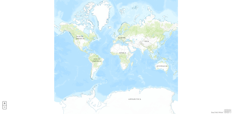
I'm programming my first ArcGIS application. I've created a simple map. When I zoom out to a world view, the map doesn't fill the width of the screen. Ideally I'd like it to repeat until the available space is filled. How can I do this?
Here's the code I have so far:
var map = new esri.Map("map", {
basemap: "topo",
center: [0, 0],
zoom: 2
});
And here's the result:
[ATTACH=CONFIG]22575[/ATTACH]
How can I get the map to repeat to fill the white space on either side?
Many thanks in advance,
JcFx
Here's the code I have so far:
var map = new esri.Map("map", {
basemap: "topo",
center: [0, 0],
zoom: 2
});
And here's the result:
[ATTACH=CONFIG]22575[/ATTACH]
How can I get the map to repeat to fill the white space on either side?
Many thanks in advance,
JcFx
Solved! Go to Solution.
1 Solution
Accepted Solutions
03-13-2013
08:58 PM
- Mark as New
- Bookmark
- Subscribe
- Mute
- Subscribe to RSS Feed
- Permalink
When I zoom out to a world view, the map doesn't fill the width of the screen. Ideally I'd like it to repeat until the available space is filled. How can I do this?
To my knowledge, this isn't possible in the Esri JS API. At the developer summit 2 years ago, Jeremy mentioned that they didn't like the way Google Maps shows "multiple worlds" and that Esri approached it differently. (As an aside, I just noticed that Google Maps is no longer showing "multiple worlds" either.)
wraparound180 will mean that you can pan continuously east or west, but if you zoom out too far you'll see white space. A workaround is to prevent zooming out too far by specifying the Level of Details (LODs).
5 Replies
03-13-2013
08:38 AM
- Mark as New
- Bookmark
- Subscribe
- Mute
- Subscribe to RSS Feed
- Permalink
Use wrapAround180 in the constructor. Note that
var map = new esri.Map("map", {
basemap: "topo",
center: [0, 0],
zoom: 2
wrapAround180: true
});
When true, supports continuous pan across the dateline. Wraparound is supported in the following cases:At version 3.1 the default value is true. For versions earlier than 3.1 the default value is false.
- Map spatial reference is WGS84 or Web Mercator
- The tiling scheme is either the pre-9.3 ArcGIS Online (4326) tiling scheme or ArcGIS/Google Maps/ Bing tiling scheme.
- Dynamic services must be version 10 or greater.
var map = new esri.Map("map", {
basemap: "topo",
center: [0, 0],
zoom: 2
wrapAround180: true
});
03-13-2013
08:45 AM
- Mark as New
- Bookmark
- Subscribe
- Mute
- Subscribe to RSS Feed
- Permalink
Ken,
Thanks for the speedy reply. I tried that, but it didn't work. How can I check if those criteria (spatial reference, tiling scheme, dynamic services version) are met? Is there a sample that shows how to set them for minimal horizontal wraparound? I'm working with v3.3 of the API, in case that is relevant.
My constructor now looks like this:
var map = new esri.Map("map", {
basemap: "topo",
center: [0, 0],
zoom: 2,
sliderPosition: "bottom-left",
spatialRefence: new esri.SpatialReference({ "wkid": 3857 }),
wrapAround180: true
});
JcFx
03-13-2013
08:58 PM
- Mark as New
- Bookmark
- Subscribe
- Mute
- Subscribe to RSS Feed
- Permalink
When I zoom out to a world view, the map doesn't fill the width of the screen. Ideally I'd like it to repeat until the available space is filled. How can I do this?
To my knowledge, this isn't possible in the Esri JS API. At the developer summit 2 years ago, Jeremy mentioned that they didn't like the way Google Maps shows "multiple worlds" and that Esri approached it differently. (As an aside, I just noticed that Google Maps is no longer showing "multiple worlds" either.)
wraparound180 will mean that you can pan continuously east or west, but if you zoom out too far you'll see white space. A workaround is to prevent zooming out too far by specifying the Level of Details (LODs).
03-14-2013
02:40 AM
- Mark as New
- Bookmark
- Subscribe
- Mute
- Subscribe to RSS Feed
- Permalink
To my knowledge, this isn't possible in the Esri JS API. At the developer summit 2 years ago, Jeremy mentioned that they didn't like the way Google Maps shows "multiple worlds" and that Esri approached it differently. (As an aside, I just noticed that Google Maps is no longer showing "multiple worlds" either.)
wraparound180 will mean that you can pan continuously east or west, but if you zoom out too far you'll see white space. A workaround is to prevent zooming out too far by specifying the Level of Details (LODs).
Actually Google Maps does still repeat (at least in Chrome, as of today), if you drag it into a wide enough, narrow enough configuration - they just manipulate the minimum zoom value so that it's rarely necessary. Thanks for the answer though, which is useful.