- Home
- :
- All Communities
- :
- Developers
- :
- JavaScript Maps SDK
- :
- JavaScript Maps SDK Questions
- :
- Visualize a FeatureLayer in 3D with attribute's va...
- Subscribe to RSS Feed
- Mark Topic as New
- Mark Topic as Read
- Float this Topic for Current User
- Bookmark
- Subscribe
- Mute
- Printer Friendly Page
Visualize a FeatureLayer in 3D with attribute's values as absolute height
- Mark as New
- Bookmark
- Subscribe
- Mute
- Subscribe to RSS Feed
- Permalink
Hello
Is JS 4.3 ready for visualizing a FeatureLayer (FeatureService) in 3D with attribute's values as absolute height?
Thank you
Chris
- Mark as New
- Bookmark
- Subscribe
- Mute
- Subscribe to RSS Feed
- Permalink
This option still isn't supported. You could write a function that uses the FeatureLayer.applyEdits() method to add Z values to the geometry object based on the attribute field value.
- Mark as New
- Bookmark
- Subscribe
- Mute
- Subscribe to RSS Feed
- Permalink
This response is also assuming that you're working with point geometries. If you're referring to extruding polygons based on real world height, this is doable. See this sample: Extrude building footprints based on real world heights | ArcGIS API for JavaScript 4.3
- Mark as New
- Bookmark
- Subscribe
- Mute
- Subscribe to RSS Feed
- Permalink
Thank you for the quick reaction.
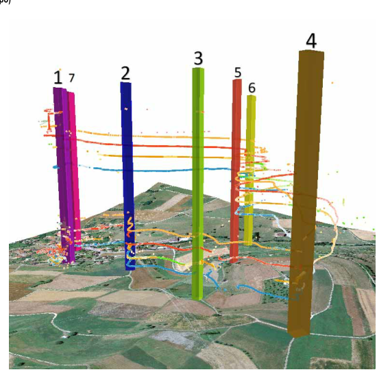
Yes indeed, I use point geometries (trajectories) and like to visualize them as space-time cubes in the web (https://omleth.ch) to evaluate the results. Below an ArcScene VIZ.
Do you know the road map of this very important 3D feature, Height based on feature attribute?
- Mark as New
- Bookmark
- Subscribe
- Mute
- Subscribe to RSS Feed
- Permalink
The roadmap is never set in stone as requirements or any number of issues can arise, postponing the planned release of a feature. But the plan is to have this in by the end of the year. Again, it's not set in stone, just a projection. It's an issue that's definitely been on our radar for a while and we've finally made plans to include it.
- Mark as New
- Bookmark
- Subscribe
- Mute
- Subscribe to RSS Feed
- Permalink
I'm not entirely sure of your requirements, but my guess is that there's no reason you can't do this currently if you're willing to dig into the API a little.
If you have a list of graphics/features (with point geometries) and want to use an attribute on each feature as its z value, you could simply write a function to edit the geometries on each feature based on some attribute. Ideally you would set this up in your feature service beforehand (that is, make your feature service serve up features with z values set beforehand), but there's no reason you can't do it in the browser.
Here's an example: JS Bin - Collaborative JavaScript Debugging
In that example I used the index of each feature in the array as its z value, but you could access some attribute on the graphic for that purpose instead. This is also using a 2D symbol, but you could use a 3D symbol.
- Mark as New
- Bookmark
- Subscribe
- Mute
- Subscribe to RSS Feed
- Permalink
That example is exactly what I need, thank you!
You can replace the attribute idx with Crown_Height to make the sample reasonable... 😉
Great thank you!
- Mark as New
- Bookmark
- Subscribe
- Mute
- Subscribe to RSS Feed
- Permalink
Hi Thomas
Still me sorry. You have several Integer attributes in used fs https://services.arcgis.com/V6ZHFr6zdgNZuVG0/arcgis/rest/services/Landscape_Trees/FeatureServer/0 of the above sample. When I replace the idx attribute with p.e. "Crown_Base", the features are still visualized by the OBJECTID.
What are the changes to vis. the 3d map by Crown_Base ?
Thank you!
- Mark as New
- Bookmark
- Subscribe
- Mute
- Subscribe to RSS Feed
- Permalink
The issue here is that, by default, the query won't return all attributes on each feature. To force it to return all attributes, you need to set outFields on the query: JS Bin - Collaborative JavaScript Debugging
- Mark as New
- Bookmark
- Subscribe
- Mute
- Subscribe to RSS Feed
- Permalink
Can you use also the system-Attribute "Created_Date" in decimal numbers?
And what about polygon features?