- Home
- :
- All Communities
- :
- Developers
- :
- JavaScript Maps SDK
- :
- JavaScript Maps SDK Questions
- :
- Re: JavaScript 3.27 API - Buffer tool isn't buffer...
- Subscribe to RSS Feed
- Mark Topic as New
- Mark Topic as Read
- Float this Topic for Current User
- Bookmark
- Subscribe
- Mute
- Printer Friendly Page
JavaScript 3.27 API - Buffer tool isn't buffering to the correct distances
- Mark as New
- Bookmark
- Subscribe
- Mute
- Subscribe to RSS Feed
- Permalink
I've been using the JS 3.27 api buffer tool:
https://developers.arcgis.com/javascript/3/jssamples/util_buffergraphic.html
I've got it working in my custom map, but the buffer sizes are wrong. For example, I've done a buffer of 1600 metres, but when I measure it, it is about 1900 metres. It's not the measure tool, because I've buffered some grid roads, the distances of which are 1600 metres apart, so when I buffer a line in the middle, it goes over by about 150m on each side
I've measured other buffers and they are wrong too, by about 20%.
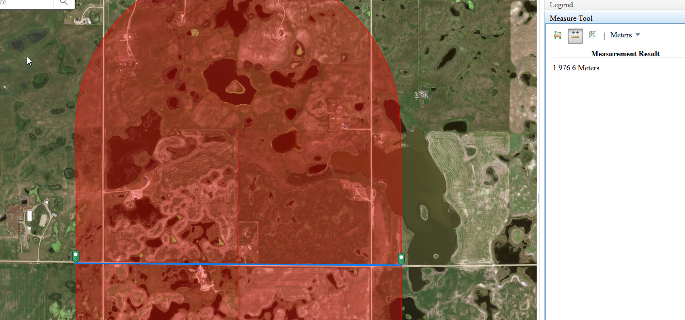
Have a look at my attachment, it shows two grid roads (north-south), 1,600 metres apart. The buffer was supposed to be 1,600 metres wide, but when measured it is around ,1900 metres.
Solved! Go to Solution.
Accepted Solutions
- Mark as New
- Bookmark
- Subscribe
- Mute
- Subscribe to RSS Feed
- Permalink
Carl,
If your map is Geographic or WebMercator then you need to use
params.geodesic = true;
- Mark as New
- Bookmark
- Subscribe
- Mute
- Subscribe to RSS Feed
- Permalink
Carl,
If your map is Geographic or WebMercator then you need to use
params.geodesic = true;
- Mark as New
- Bookmark
- Subscribe
- Mute
- Subscribe to RSS Feed
- Permalink
Thanks so much! That has fixed the problem! I sort of suspected something like that, but that parameter wasn't in the code to begin with.