- Home
- :
- All Communities
- :
- Developers
- :
- JavaScript Maps SDK
- :
- JavaScript Maps SDK Questions
- :
- Identify/hover over functionality with .mvt vector...
- Subscribe to RSS Feed
- Mark Topic as New
- Mark Topic as Read
- Float this Topic for Current User
- Bookmark
- Subscribe
- Mute
- Printer Friendly Page
Identify/hover over functionality with .mvt vector tiles
- Mark as New
- Bookmark
- Subscribe
- Mute
- Subscribe to RSS Feed
- Permalink
- Report Inappropriate Content
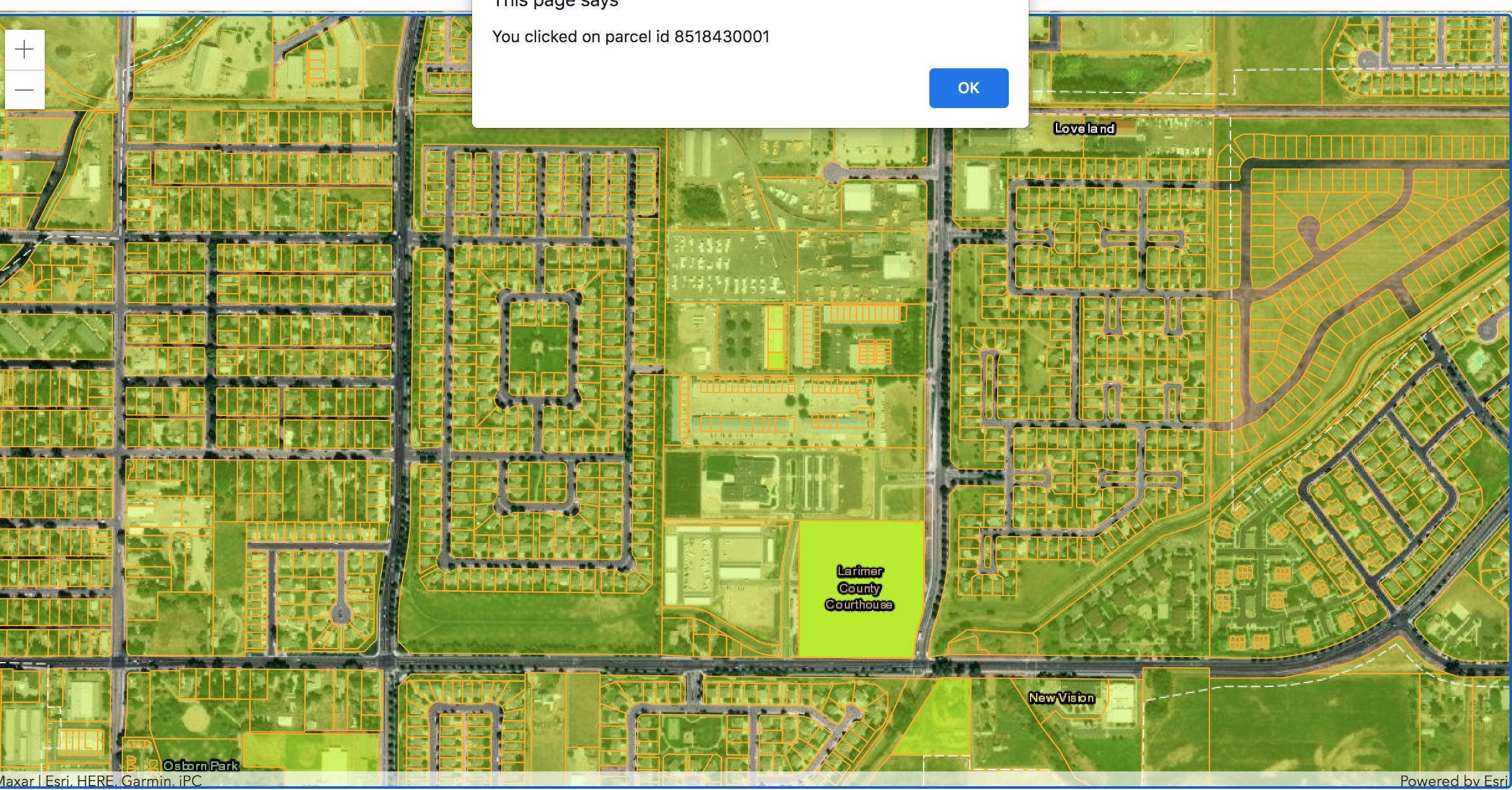
I've been having issues with mapbox vector tile identify functionality for an app i'm developing with the ESRI JS API. Specifically, I can't get the identify interactivity/click over behavior to function as it should for a vector map tile. When I load my VectorTileLayer, they function as if they were raster tiles, with limited mouse-over behavior. Attached is a screenshot of the extent of the identify behavior i've been able to configure.
Also i'm having trouble with the tilejson metadata, is there a way to visualize this on a web map built with the Esri JS API?
Going back a few years on several threads, it looks like many other people have the same issue and i'm wondering if there's been any updates, or if this is on the future roadmap for ESRI.
- Mark as New
- Bookmark
- Subscribe
- Mute
- Subscribe to RSS Feed
- Permalink
- Report Inappropriate Content
The JSAPI doesn't support cooked attributes in vector tiles. Only layer ids to update styles.
- Mark as New
- Bookmark
- Subscribe
- Mute
- Subscribe to RSS Feed
- Permalink
- Report Inappropriate Content
I'd love to have this feature as well. Any news on when this functionality will be added to ArcGIS Javascript API? I've been able to do this in Mapbox GL JS for years.