- Home
- :
- All Communities
- :
- Developers
- :
- JavaScript Maps SDK
- :
- JavaScript Maps SDK Questions
- :
- Re: How to use CEH Digital River Network of Great ...
- Subscribe to RSS Feed
- Mark Topic as New
- Mark Topic as Read
- Float this Topic for Current User
- Bookmark
- Subscribe
- Mute
- Printer Friendly Page
How to use CEH Digital River Network of Great Britain URL in my application using feature service
- Mark as New
- Bookmark
- Subscribe
- Mute
- Subscribe to RSS Feed
- Permalink
How to use CEH Digital River Network of Great Britain URL in my application as I am using feature service to display data from URL. https://arcg.is/1ebGvC0 this particular is providing external URL in WMS source. My question is how can I display this data in feature service and how can I generate that URL to display data in my application.
Solved! Go to Solution.
Accepted Solutions
- Mark as New
- Bookmark
- Subscribe
- Mute
- Subscribe to RSS Feed
- Permalink
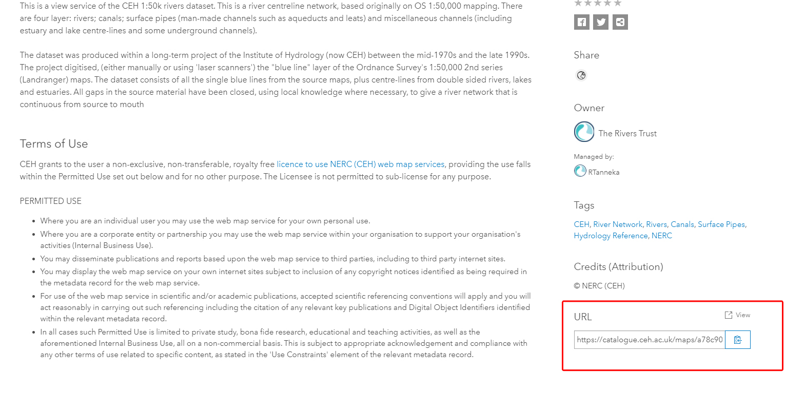
The url can be retrieved from the portion of the page that is indicated in the attached image. To add it to the application then just use a WMSLayer in the JS API.
- Mark as New
- Bookmark
- Subscribe
- Mute
- Subscribe to RSS Feed
- Permalink
The url can be retrieved from the portion of the page that is indicated in the attached image. To add it to the application then just use a WMSLayer in the JS API.
- Mark as New
- Bookmark
- Subscribe
- Mute
- Subscribe to RSS Feed
- Permalink
Thanks for reply, but after applying WMSLayer class in JS API. Still I am not able to display data in application. I think this might be the version problem because I'm using 4.14 version and WMSLayer is compatible with 4.4 version.
- Mark as New
- Bookmark
- Subscribe
- Mute
- Subscribe to RSS Feed
- Permalink
When I tested that service using 4.16 it worked but it took about a minute to finally draw on the map because of the rivers. If specify only the Canals sublayer it is much quicker.
var layer = new WMSLayer({
url: "https://catalogue.ceh.ac.uk/maps/a78c90a2-8da4-4f0a-9c6a-c1d1a4a3c2b0",
sublayers: [
{
name: "HY.PhysicalWaters.WaterBodies.Canals"
}
]
});