- Home
- :
- All Communities
- :
- Developers
- :
- JavaScript Maps SDK
- :
- JavaScript Maps SDK Questions
- :
- Re: Edit Existing Graphics with Sketch/SketchViewM...
- Subscribe to RSS Feed
- Mark Topic as New
- Mark Topic as Read
- Float this Topic for Current User
- Bookmark
- Subscribe
- Mute
- Printer Friendly Page
Edit Existing Graphics with Sketch/SketchViewModel
- Mark as New
- Bookmark
- Subscribe
- Mute
- Subscribe to RSS Feed
- Permalink
I am trying to get the sketch widget (or sketchviewmodel) to work with graphics that were added to the map using the graphicsLayer.add(graphic) method in the esri js api 4.x.
Currently a user can create a new graphic using the sketch widget and all the necessary info (geometry, color, label text, size, etc.) is stored inside a database so it can save and reload the graphics they made. However, the graphics created using add method do not interact with the sketch widget at all, and cannot be edited after they are saved. Both graphics (one created from sketch and the ones created with add) are on the same graphicslayer.
Is there a way to allow the sketch to edit the added graphics or a workaround to use?
Solved! Go to Solution.
Accepted Solutions
- Mark as New
- Bookmark
- Subscribe
- Mute
- Subscribe to RSS Feed
- Permalink
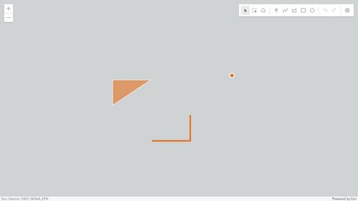
It is possible to edit existing graphics on a GraphicsLayer using the Sketch widget, if the widget is using the same GraphicsLayer. The graphics must be using the same spatial reference as the view, otherwise you will experience the issue you are seeing where you are not able to edit the existing graphics. To demonstrate this is possible, here is a test app:
https://codepen.io/banuelosj/pen/GRvjjow
Notice the graphics in the app added with GraphicsLayer.add(graphic) are using the same spatial reference as the MapView, which is Web Mercator (102100).
Thanks,
Jose
- Mark as New
- Bookmark
- Subscribe
- Mute
- Subscribe to RSS Feed
- Permalink
Thanks for the answer, made me realize I was getting the spatial reference from the wrong place, and its now working properly.
Thank You.
