- Home
- :
- All Communities
- :
- Developers
- :
- JavaScript Maps SDK
- :
- JavaScript Maps SDK Blog
- :
- ArcGIS API for JavaScript 4.17 and 3.34
ArcGIS API for JavaScript 4.17 and 3.34
- Subscribe to RSS Feed
- Mark as New
- Mark as Read
- Bookmark
- Subscribe
- Printer Friendly Page
Today, we are pleased to release versions 4.17 and 3.34 of the ArcGIS API for JavaScript. Here are some of the 4.17 highlights (please refer to the 3.34 link at the end for 3.x updates).
Introduction
We fixed 31 bugs, added 5 new samples, boosted performance (more on that later), and announced that version 4.17 will be the last release to support IE 11 (and Edge Legacy).
Methods
Every release, we look for ways that we can further optimize performance, modernize the development process, and add sweet new features and functionality. The performance is for the end-user, the modernization is for the developer (and for us, I suppose), and the sweet new stuff is for everyone.
Results
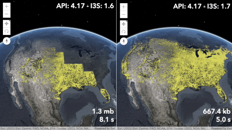
Faster loading and preprocessing for large FeatureLayers with many features. The StreamLayer can now handle much faster websocket streams. CSVLayer, GeoJSONLayer, and FeatureLayer created from client-side graphics are now taking advantage of a worker to store the data. Point 3D SceneLayers now load and display up to twice as fast by supporting the latest I3S specification version 1.7. The new 3D BuildingComponentSublayerView class allows you to query features of a BuildingSceneLayer directly in the client.
https://developers.arcgis.com/javascript/latest/guide/release-notes/#performance-enhancements
Discussion
After closely looking over the results from this release, you’re probably asking yourself about those sweet new features that did not necessarily significantly boost performance. Let’s discuss.
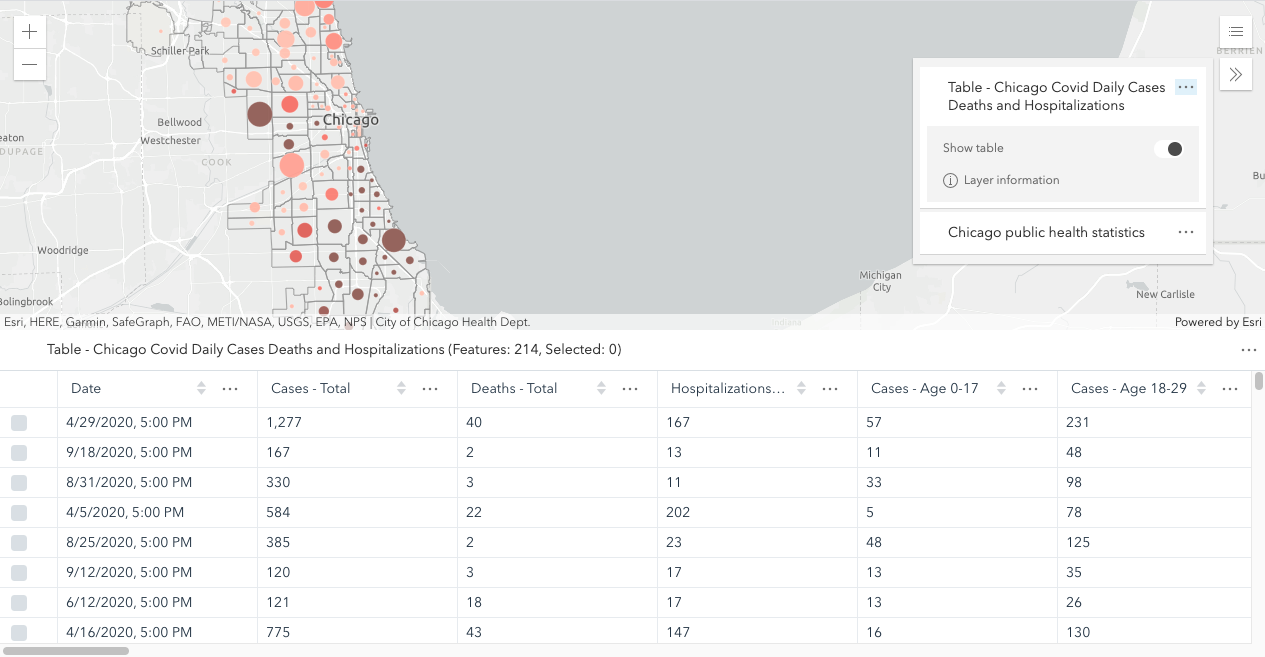
It is now possible to create and load non-spatial feature layers stored as tables in a Map, WebMap, or WebScene. The FeatureTable now supports editing date fields. A UI was added to make this workflow easier to manage. The new TableList widget provides a way to display a list of tables within a Map and/or WebMap.
The Print widget got a new exportedLinks property that allows you to access the collection of links exported from a print request, and two events, `complete` and `submit`, to give developers a much easier way to manage printing results and behavior.
The new StylePattern3D class provides different styles that are compatible with existing capabilities across the ArcGIS platform. Use the new polygon fill patterns to highlight areas on terrain or integrated mesh layers.
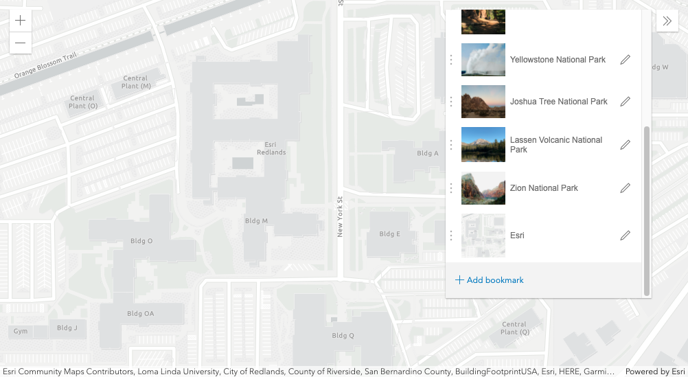
The Bookmarks widget now allows users to update a bookmark's extent and add a thumbnail.
We enhanced the LayerView in 2D MapViews by adding a fade-in and out transition to the LayerView when we turn the layer's visibility on and off.
The VectorTileLayer has an improved experience when loading and interacting with the map.
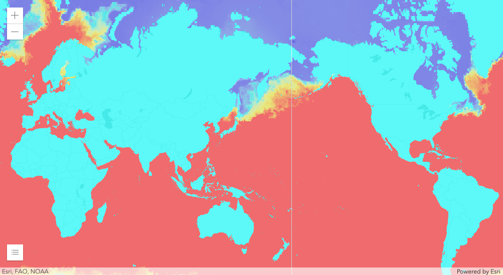
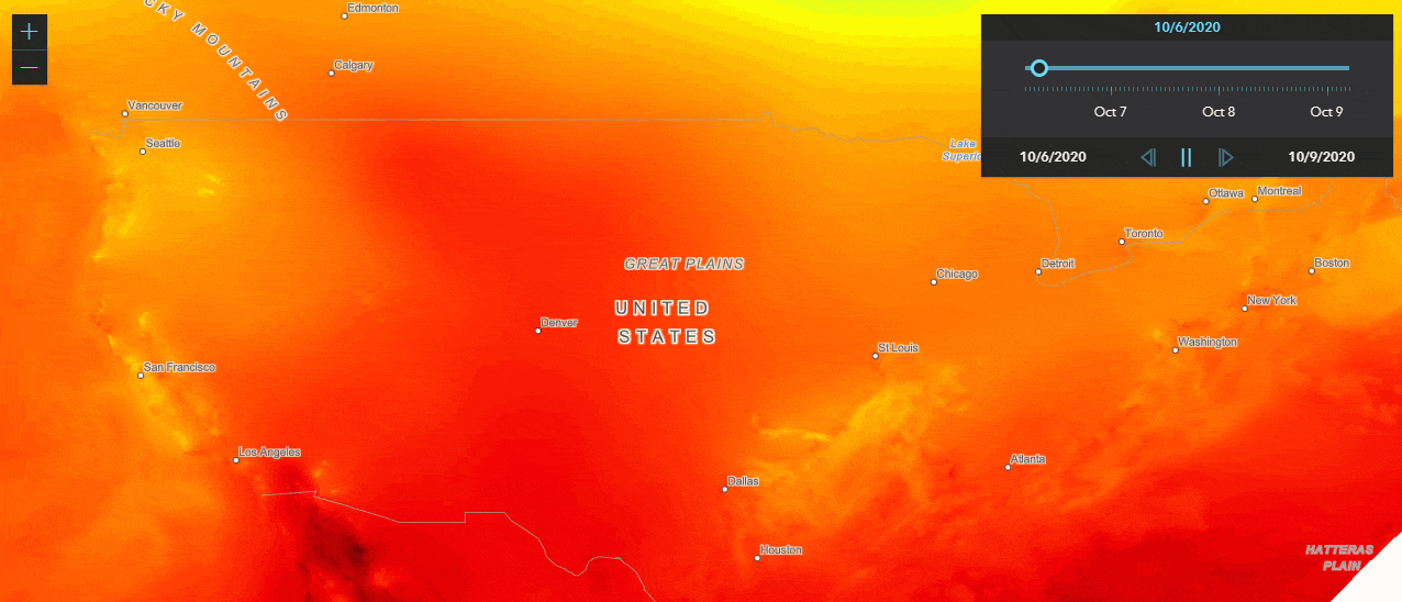
WMSLayer now supports layers that are time enabled. You can use the TimeSlider widget to animate your layers over a period of time, or you can set a timeExtent on the layer to only request data that falls within the given time extent.
Conclusion
There is so much more that’s new and exciting at 4.17 and 3.34. I hope this peer-reviewed blog entices your appetite to learn more. But before you do that, please check out our new guide topic: Breaking Changes. With this page, you can easily find all the breaking changes from every 4x release in one easy spot. So, if you are upgrading from say 4.10 -> 4.17, then scroll down on this page until you find 4.10, then scroll up to read the changes that apps will require to successfully migrate to 4.17.
Breaking Changes across all 4x releases
https://developers.arcgis.com/javascript/latest/guide/breaking-changes/index.html
References
Fun fact, if you’re still reading this, .34 is exactly double .17. So there’s that.
Release Blog
What’s New in ArcGIS API for JavaScript (October 2020)
4.17 Release Notes
https://developers.arcgis.com/javascript/latest/guide/release-notes/index.html
4.17 Samples
https://developers.arcgis.com/javascript/latest/sample-code/?search=4.17
3.34 What’s New
https://developers.arcgis.com/javascript/3/jshelp/whats_new.html
You must be a registered user to add a comment. If you've already registered, sign in. Otherwise, register and sign in.