- Home
- :
- All Communities
- :
- User Groups
- :
- Addressing
- :
- Questions
- :
- True Arcs, Geocoding and other musings
- Subscribe to RSS Feed
- Mark Topic as New
- Mark Topic as Read
- Float this Topic for Current User
- Bookmark
- Subscribe
- Mute
- Printer Friendly Page
True Arcs, Geocoding and other musings
- Mark as New
- Bookmark
- Subscribe
- Mute
- Subscribe to RSS Feed
- Permalink
Earlier today I discovered a short coming with creating a street address role locator in Pro 2.5.1 if the feature class contains true arcs. (See: ArcGIS Pro Create Locator fails (again/still) The Create Locator tool can't handle a true arc and will fail when they are present in the feature class. It's my understanding that the problem will be fixed in version release 2.6.
Full disclaimer: I'm going to let my old school flag fly freely here. I have never in my life created a true curve and I have no intention of ever doing so; I have never seen the point in them and have experienced problems with them in the past when it comes to geocoding. That said...
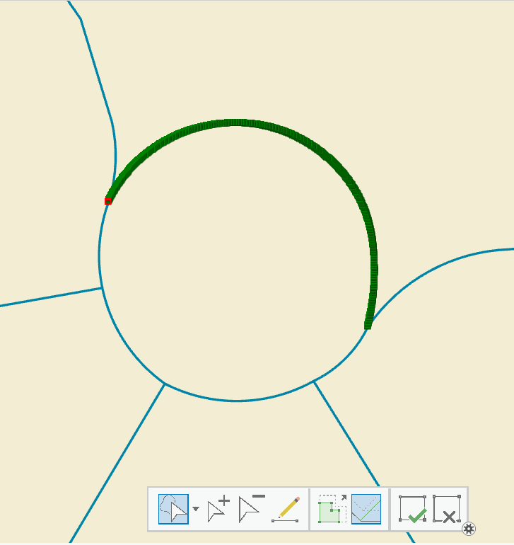
Over the past few hours I've learned more about true arcs than I have in the past 25 years. It seems that in transportation design, the cool, trendy thing is to have are Roundabouts: intersections that allow a continual flow of traffic instead of the traditional 4 way stop. And in order to represent these features in ArcGIS, the cool, trendy thing is use true arcs. Here is an example of a 5 way roundabout not far from where I live:
The direction of travel in the roundabout is counter clock wise.
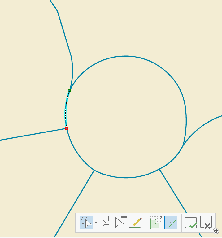
True arcs can have just two vertices (from/to node) or multiple as shown above. That makes it hard to find them, and I'm not aware of a specific tool or function that can identify them. I fooled around a little bit armed with the information provided in Counting vertices via Python and added a long integer field called VertexCount to my feature class calculating its value with !shape.pointcount! in the field calculator. I selected for just those records where VertexCount = 2. The problem with that is all the streets that run straight from one intersection to the next only have two vertices, but I was able to find a bunch of roundabouts including the one in my example.
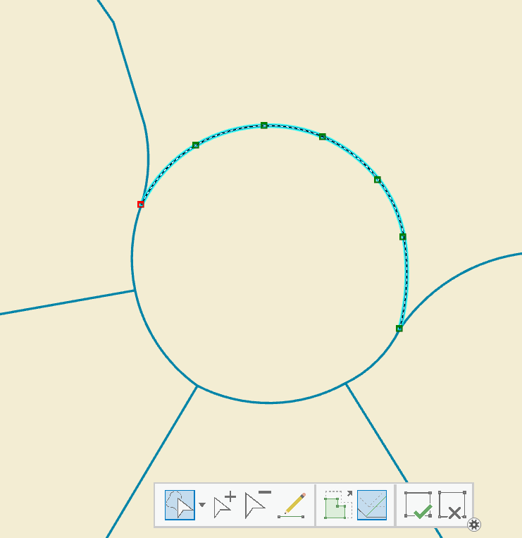
There are two methods with which to convert true arcs into traditional lines. You can export the feature class with true arcs to a shapefile, and then import the shapefile back into a feature class. Shapefiles don't support true arcs. Here is the same roundabout that I applied this method to:
You can see there are way more vertices from the conversion to shapefile , and the shape itself looks okay to me.
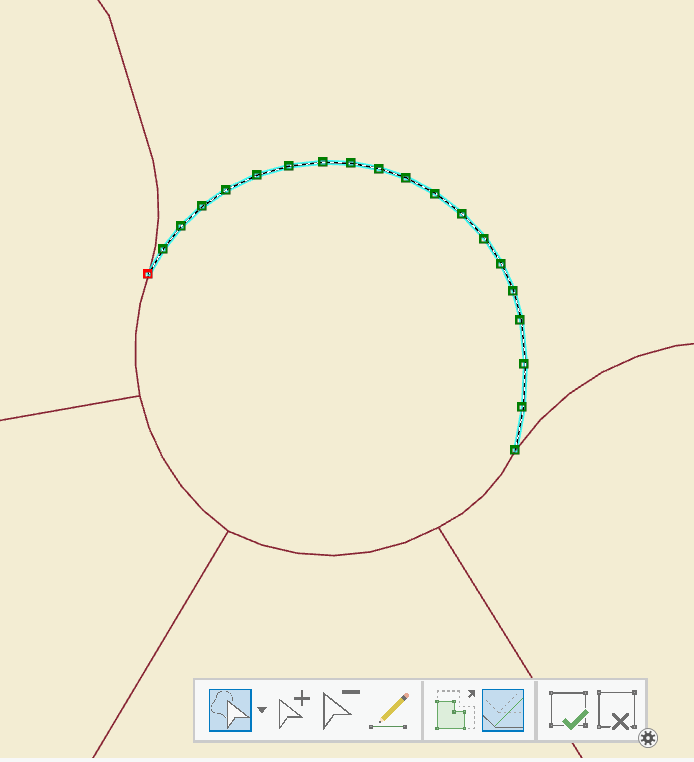
The other method is to use the Densify Tool ; if you apply this tool to an entire feature class, it will add vertices in a lot of places you don't want them, like those straight intersection to intersection segments. However, the cool thing about this tool is you get to set the interval of vertices, and as an added bonus it honors the selected set.
Let's pretend that I just added 5 true arcs to my centerlines representing a roundabout, but I know in another department, an old gray-hair guy insists true arcs mess with his geocoding. With the densify tool I can keep him happy and preserve the shape of my roundabout:
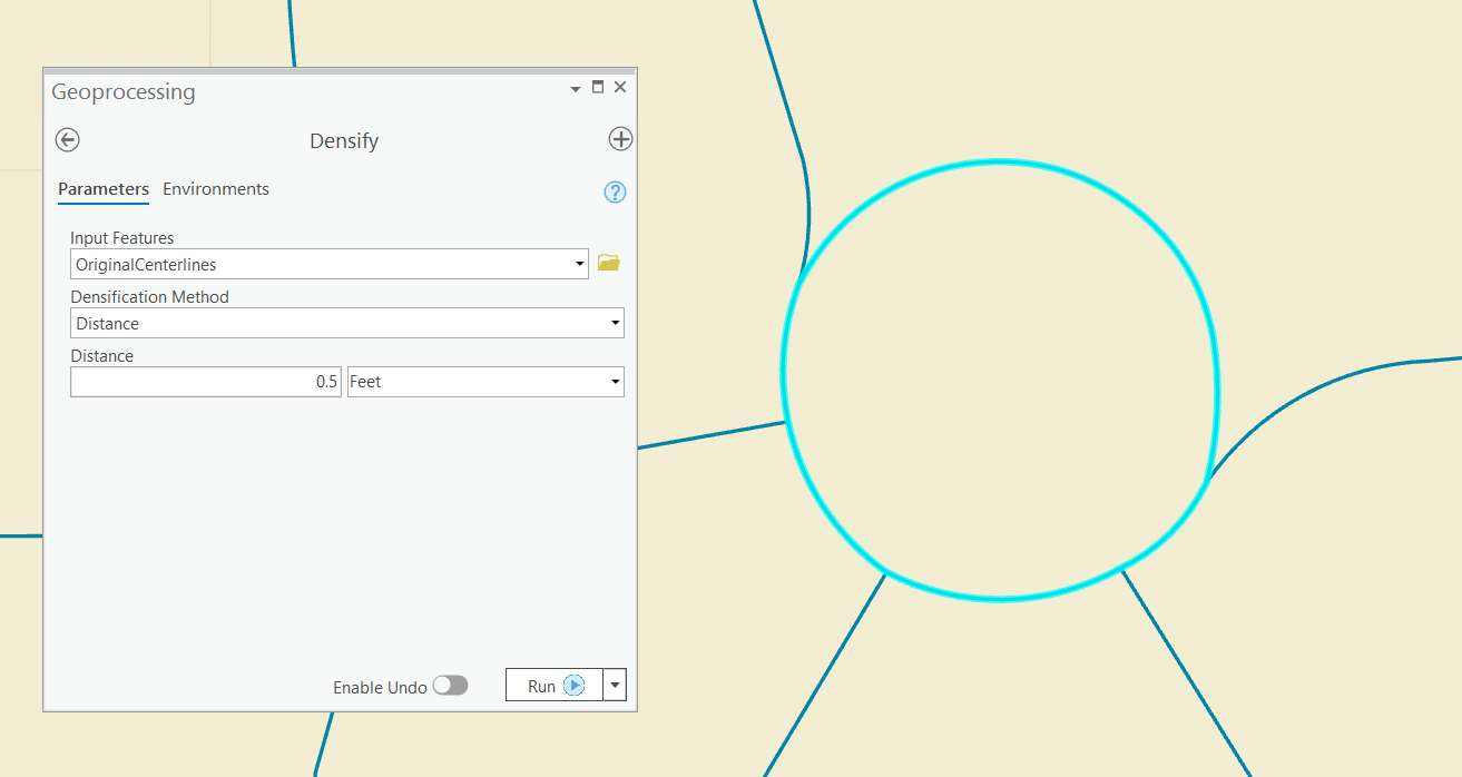
Okay, a 6 inch vertex interval is pretty extreme, but the old guy in the other department can really be a grouch:
Now each segment of the roundabout has all sorts of vertices and looks really good, the single block straight line segments remain the same, and there are no more issues with creating a street address role locator in Pro 2.5.1.
Is this a great time to be alive or what?
- Mark as New
- Bookmark
- Subscribe
- Mute
- Subscribe to RSS Feed
- Permalink
In https://community.esri.com/thread/253750-address-data-management-solution-roads-vs-master-road-name Joshua Young mentions that the true curve issue has been addressed in 2.6. I just created a single role street address locator with create locator and he's spot on. I didn't get any errors in creating the locator.
I've officially mellowed my stance in true curves now... (but I'm still not gonna break my perfect record of never creating one)
- « Previous
-
- 1
- 2
- Next »
- « Previous
-
- 1
- 2
- Next »