- Home
- :
- All Communities
- :
- Products
- :
- 3D
- :
- 3D Questions
- :
- Re: Clip a voxel
- Subscribe to RSS Feed
- Mark Topic as New
- Mark Topic as Read
- Float this Topic for Current User
- Bookmark
- Subscribe
- Mute
- Printer Friendly Page
Clip a voxel
- Mark as New
- Bookmark
- Subscribe
- Mute
- Subscribe to RSS Feed
- Permalink
Hi Daniel,
You can create slices to create an area of interest of the portion of the voxel layer that you are interested in.
https://pro.arcgis.com/en/pro-app/latest/help/mapping/layer-properties/voxel-layer-slices.htm
thanks,
Andrew
- Mark as New
- Bookmark
- Subscribe
- Mute
- Subscribe to RSS Feed
- Permalink
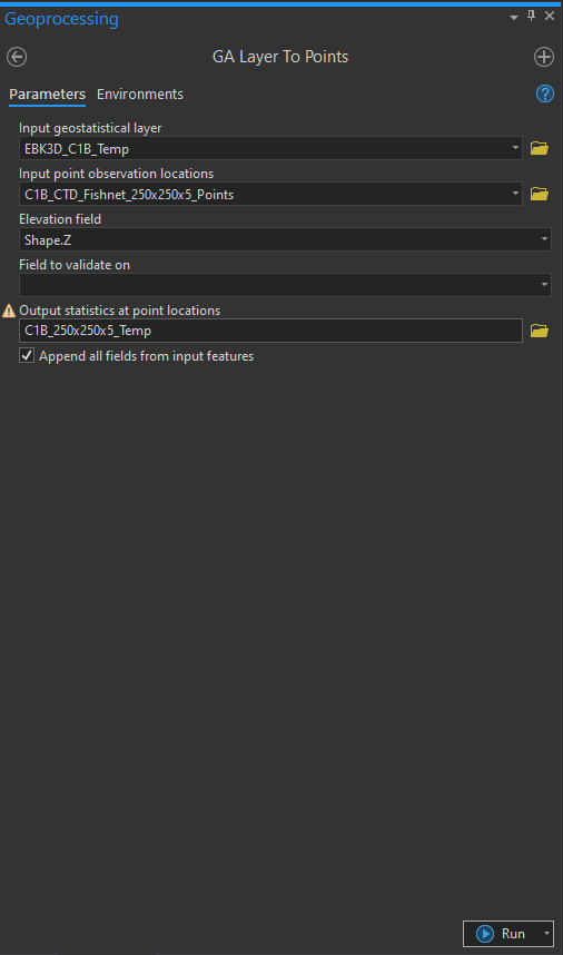
I created a GA layer with EBK3D and also the minimum bounding volume (MBV) of the samples used in the interpolation. I'm trying to create a VoxelLayer clipped by the MBV:
- I built a generic 3d fishnet (point grid);
- I clipped the fishnet according to the samples MBV;
- And I used this clipped fishnet to export the prediction values of EBK3D at the fishnet points locations (GA Layer To Points);
But when I try to convert this points to NetCDF (to open it as a voxel layer) I get an error.
If I try to export the the prediction values of EBK3D directly to NetCDF (GA Layer 3D To NetCDF), using the clipped fishnet as custom export locations, the NetCDF file is created but when I try to open it says it has errors.
Do you know how to solve this?
- Mark as New
- Bookmark
- Subscribe
- Mute
- Subscribe to RSS Feed
- Permalink
Hi,
Can you post what errors you are seeing?
thanks,
Andrew
- Mark as New
- Bookmark
- Subscribe
- Mute
- Subscribe to RSS Feed
- Permalink
@Andrew--Johnson
Thanks for the reply.
I exported the "GA Layer 3D To NetCDF" with the configuration in the picture (Error_1a.png). When I "Add Voxel Layer" I get the error in the picture (Error_1b.png).
I exported the "GA Layer 3D To Points" without problems (Error_2a.png). When I try to convert "Feature to NetCDF" (Error_2b.png) I get the error in the picture (Error_2c.png).
The fishnet that I'm using has the following resolution (250 m horizontal, 5 m vertical). Does the vertical resolution needs to be the same has the horizontal?
Thanks,
- Mark as New
- Bookmark
- Subscribe
- Mute
- Subscribe to RSS Feed
- Permalink
Based on the warnings in the screenshots it looks like this NetCDF is not a true volumetric dataset. Also the elevation spacing does not have to be the same as the XY spacing. I'd recommend taking a look at the resource below. It provides a variety of workflows for creating volumetric netCDF data from point data. There's also links to learn lessons that provide detailed steps on how to setup the tool parameters to ensure the output is a volumetric netCDF.
https://pro.arcgis.com/en/pro-app/latest/help/mapping/layer-properties/create-a-voxel-layer.htm
thanks,
Andrew
- Mark as New
- Bookmark
- Subscribe
- Mute
- Subscribe to RSS Feed
- Permalink
Thanks for the reply. The workflows don't exactly match what I am trying to do.
When I create the NetCDF from the GA Layer using "3d gridded points" (instead of "custom 3d points") it works fine.
So, I'm wondering if the "custom 3d points" need to be a cubic fishnet? I've attached a picture of my custom 3d points and the minimum bounding volume.
Another option would be to clip/mask the resulting NetCDF using the "3d gridded points" method with the minimum bounding volume? Is it possible?
Thanks,
- Mark as New
- Bookmark
- Subscribe
- Mute
- Subscribe to RSS Feed
- Permalink
Hi - did you end up resolving this? I am getting the exact same errors trying to use the Custom 3D Points option despite having a cubic grid of equally spaced 3D points. @Andrew--Johnson / @EricKrause
- Mark as New
- Bookmark
- Subscribe
- Mute
- Subscribe to RSS Feed
- Permalink
Hi @GarethNash,
I'm only seeing this thread now. The "Custom 3D points" option will produce a netCDF file with predictions at the specified location, but it isn't configured in a way where it can be represented as a voxel layer. Only the gridded points option can produce a voxel layer.
- Mark as New
- Bookmark
- Subscribe
- Mute
- Subscribe to RSS Feed
- Permalink
Thanks for the response @EricKrause
I've attached two images below. Both are the result of me opening the resultant NetCDF file with python and printing a few factual statements about the file.
You can see the one created with 3D Gridded Points clearly has correct dimensions etc. whereas the one created with Custom 3D Points doesnt appear to have created voxels and there's some clear issues with 'RecordID' which is not a field in my input dataset. The inputs GA layer to both of these were identical.
I would be fine with the tool producing the predictions at specified locations as I can build a voxel model outside of GIS with python but the output doesnt appear to have any predictions in it.