- Home
- :
- All Communities
- :
- Products
- :
- 3D
- :
- 3D Questions
- :
- Re: Anchor points with OSGB to create Integrated M...
- Subscribe to RSS Feed
- Mark Topic as New
- Mark Topic as Read
- Float this Topic for Current User
- Bookmark
- Subscribe
- Mute
- Printer Friendly Page
Anchor points with OSGB to create Integrated Mesh Scene Layer
- Mark as New
- Bookmark
- Subscribe
- Mute
- Subscribe to RSS Feed
- Permalink
I am trying to using the Create Integrated Mesh Scene Layer Package using the OSGB format exported from Bentley Systems Context Capture. However, I was not given any anchor points. While the version of ArcPro I'm using (2.2) says anchor points are optional, the tool is not letting me run it unless an anchor point is provided.
I'm not finding good documentation about anchor points myself. Would someone please explain why an achor point would be needed in this case and how I can go about determining the center point of the dataset? It sounds to me like it should be something Context Capture should be providing as an output in addition to the OSGB dataset?
I would like to at least be able to run the tool in ArcPro without an anchor point to see the output, even if it wouldn't be in the right location.
Thanks!
- Mark as New
- Bookmark
- Subscribe
- Mute
- Subscribe to RSS Feed
- Permalink
Hi Mary,
We updated the doc for 2.3 to add some further clarification and make it clear that this is a required parameter.
Create Integrated Mesh Scene Layer Package—Data Management toolbox | ArcGIS Desktop
Here's the details
Similar to other 3D graphic formats, the Open Scene Graph Binary (OSGB) format does not natively support specifying or capturing the coordinate system of the model. Typically, OSGB files are output in a Cartesian coordinate system that locates data at fixed coordinates. The x-, y-, z-coordinates of the model are not inherently geographic locations; instead, they are locations relative to an arbitrary geometric origin (0, 0, 0). One such typical coordinate system used for such models is ENU (Easting-Northing-UP) convention, where the x-axis can be thought of as an easting direction and the y-axis as a northing direction, and the z-axis is up. Models in ENU convention are directly translatable to a UTM coordinate system. This tool will project the output scene layer package from a given UTM coordinate system to the coordinate system specified by the Anchor Point parameter. If the scene layer package output is expected to be in the same coordinate system as the input data, specify an anchor point with a matching spatial reference to the input OSGB file.
Depending on the author of the OSGB files, a metadata file may be included that reveals the local reference grid along with the center point of the Open Scene Graph model.
Did context capture ouput a metdata.xml file with this dataset?
thanks,
Andrew
- Mark as New
- Bookmark
- Subscribe
- Mute
- Subscribe to RSS Feed
- Permalink
Hi Andrew,
Thanks! Yes, the CC output does provide the metadata.xml file which I now see has the coordinates for the anchor point with its reference system.
CC exported about 6,000 OSGB files, but I am only getting a partial mesh of one tile to show up for me, in the wrong location. All of the tiles should go along four miles of eastside of the river shown in the picture with the anchor point.
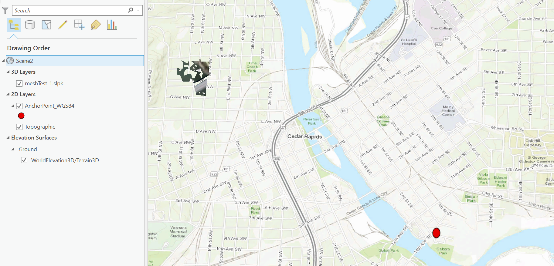
It might be worth noting in the documentation that the anchor point should be projected to WGS 84 before running the mesh. CC provided the anchor point in a different coordinate system and when I first ran the mesh tool, the bounding box read the units which were supposed to be represented in feet as decimal degrees.

Results from validating the slpk:

Any help on trying to get all of the mesh to display in the right location would be appreciated.
Thank you!
Mary
- Mark as New
- Bookmark
- Subscribe
- Mute
- Subscribe to RSS Feed
- Permalink
Hi Mary,
How large is the entire dataset of OSGB files? Would you be able to provide those via FTP so I can take a deeper look on this end?
thanks,
Andrew
- Mark as New
- Bookmark
- Subscribe
- Mute
- Subscribe to RSS Feed
- Permalink
Yes, the files combined are ~650MB.
Would you please share your email address with me so I may send you a link?
- Mark as New
- Bookmark
- Subscribe
- Mute
- Subscribe to RSS Feed
- Permalink
perfect, my email address is [email protected]
- Mark as New
- Bookmark
- Subscribe
- Mute
- Subscribe to RSS Feed
- Permalink
As a follow up if anyone is wondering, Bentley CC provides the anchor point information within the metadata.xml output with the OSGB dataset