- Home
- :
- All Communities
- :
- Products
- :
- 3D
- :
- 3D Mapping Questions
- :
- Polygon Extrusion Problem in ArcScene!
- Subscribe to RSS Feed
- Mark Topic as New
- Mark Topic as Read
- Float this Topic for Current User
- Bookmark
- Subscribe
- Mute
- Printer Friendly Page
Polygon Extrusion Problem in ArcScene!
- Mark as New
- Bookmark
- Subscribe
- Mute
- Subscribe to RSS Feed
- Permalink
Hi,
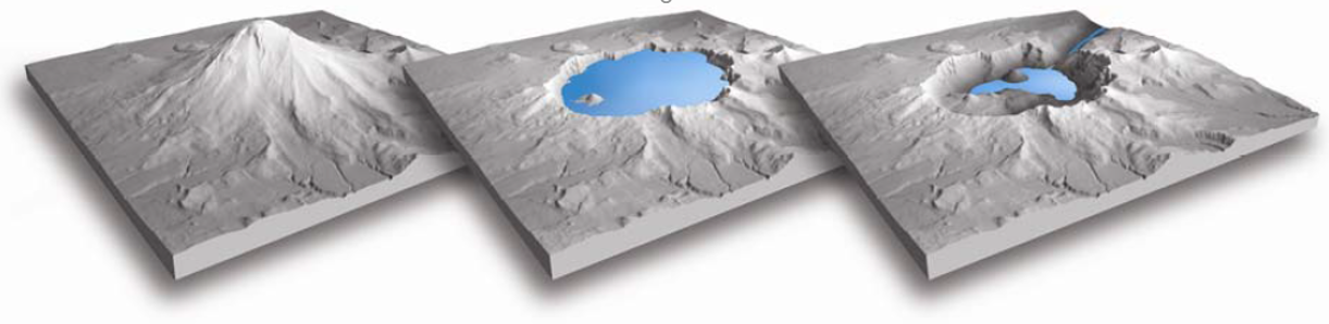
I am intending to extrude my polygon as though it is the surface itself lifted up and achieve visualization like block diagram. The objective is to achieve the final results as below (this one has been created by Aileen Buckley, she is an expert Cartographer at ESRI.
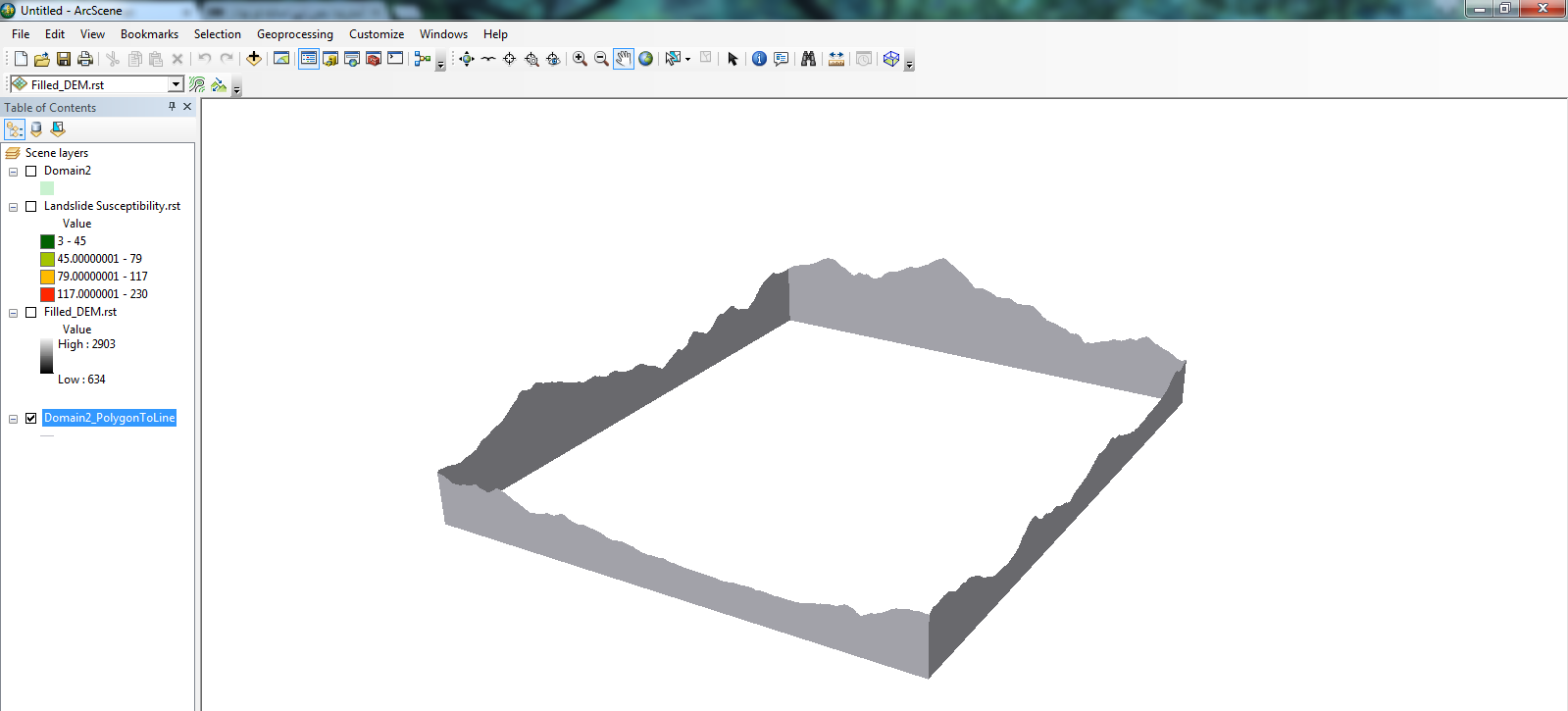
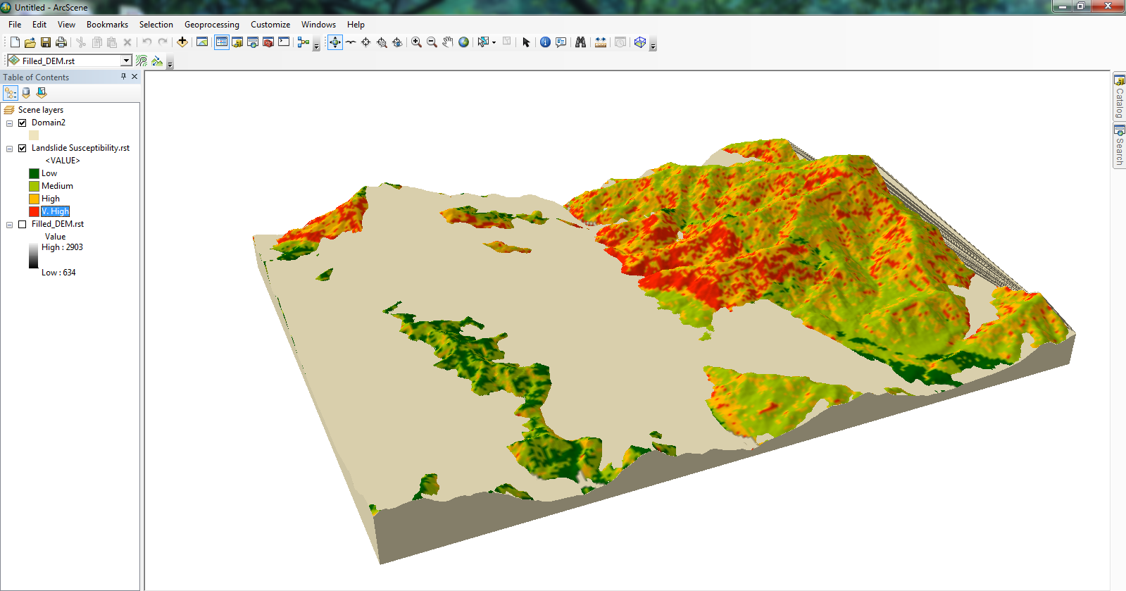
My inserted rasters are already having projected coordinate system and I have floated my Landslide Susceptibility raster over the DEM in ArcScene 10.3. However, results are inserted as below, surely not acceptable.
What might be the root cause of the problem and how would I solve it?
- Mark as New
- Bookmark
- Subscribe
- Mute
- Subscribe to RSS Feed
- Permalink
There is assigning base heights and extrusion and vertical exaggeration which enable you to enhance 3D in arcscene
Setting base heights for 3D features—Help | ArcGIS for Desktop and
Vertical offsets for feature layers—Help | ArcGIS for Desktop
amongst others.
The base heights can be used for simple layer separation with respect to an initial surface giving you that offset look. You can extrude and exaggerate other surface etc.
You will just have to experiment
- Mark as New
- Bookmark
- Subscribe
- Mute
- Subscribe to RSS Feed
- Permalink
I have already provided base height to the overlaid raster and extruded my polygon!
- Mark as New
- Bookmark
- Subscribe
- Mute
- Subscribe to RSS Feed
- Permalink
each layer can have an offset from the base height... read those help topics carefully
- Mark as New
- Bookmark
- Subscribe
- Mute
- Subscribe to RSS Feed
- Permalink
Thanks, Dan I resolved the problem!
The help was helpful:-) This works but requires much attention.
.png)
- Mark as New
- Bookmark
- Subscribe
- Mute
- Subscribe to RSS Feed
- Permalink
Nasir,
Can you describe what you did to make your data work for you? Was it 'simply' setting offsets and adjusting base heights?
- Mark as New
- Bookmark
- Subscribe
- Mute
- Subscribe to RSS Feed
- Permalink
Dear Adrian,
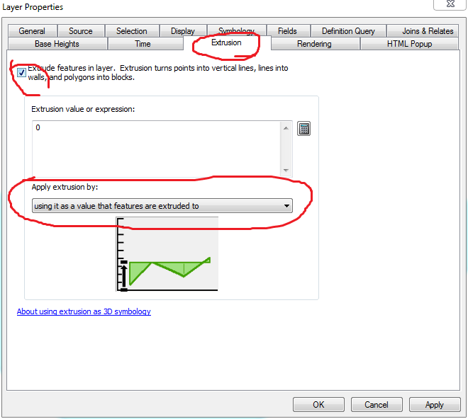
I simply converted my polygon (Raster Domain) to polylines using 'Polygon to Line' tool available in Data Management toolbox
2. In polyline properties, check 'extrude features' and set 'using it as a value that features are extruded to'
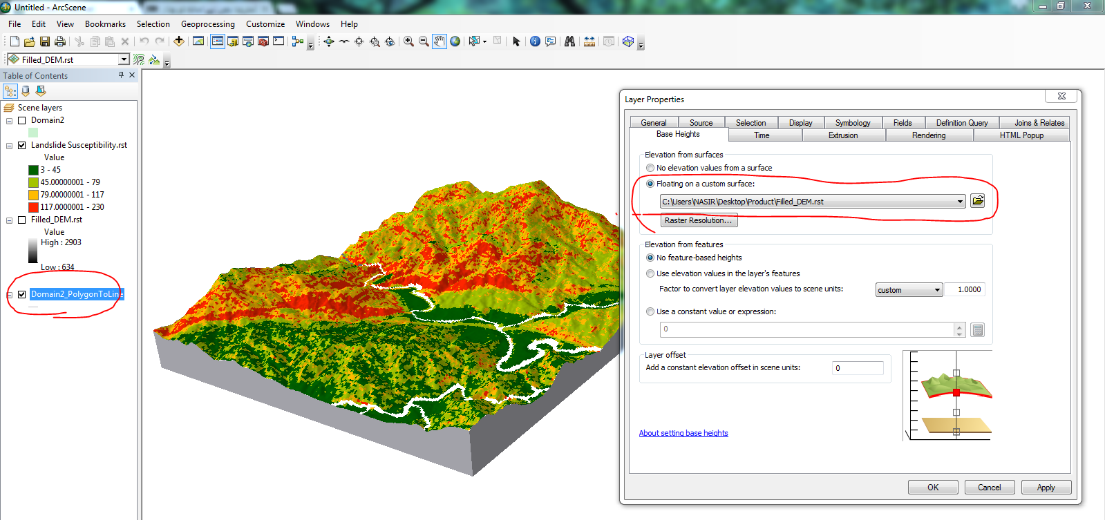
3. in the Base Heights Tab, set base height 'floating on a custom surface' and choose the DEM as input
I have inserted following scree shots also that would help you to do the job.