- Home
- :
- All Communities
- :
- Products
- :
- ModelBuilder
- :
- ModelBuilder Questions
- :
- Model Builder / Python Tool Construction: Raster S...
- Subscribe to RSS Feed
- Mark Topic as New
- Mark Topic as Read
- Float this Topic for Current User
- Bookmark
- Subscribe
- Mute
- Printer Friendly Page
Model Builder / Python Tool Construction: Raster Summation
- Mark as New
- Bookmark
- Subscribe
- Mute
- Subscribe to RSS Feed
- Permalink
SOLUTION FOUND! See bottom of post below for original problem
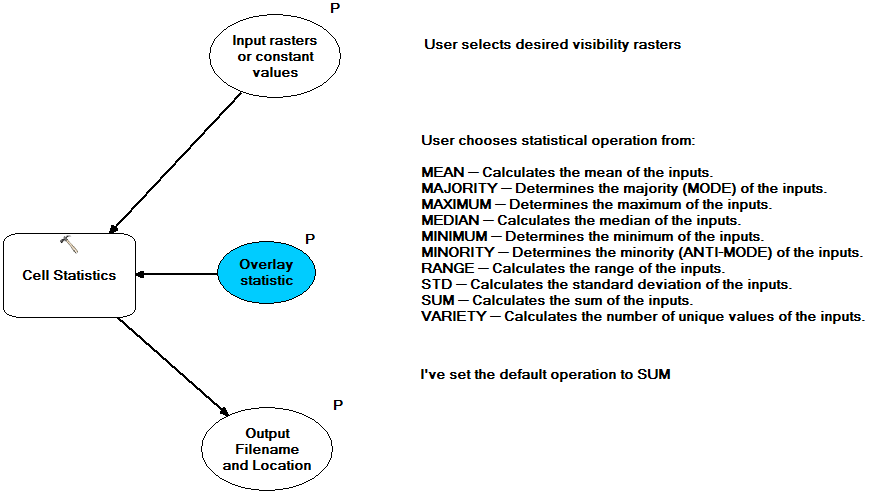
My solution: I used the Cell Statistics tool and set the tool's inputs as parameters. My only issue with it is that the user cannot drag groups from the table of contents into the input dialog part, but that is a minor complaint.
Now I am going to try to do some fancier stuff like add it to the current mxd with a specific symbology and add fields in the output raster to help show what areas are being seen from what trails.
______________________________________________________________________________
I'm trying to make a user-friendly tool for a colleague of mine. He would like to be able to ask ArcMap something to the effect of: "I'm going to hike all of X trail to Y canyon and follow Y's creek until it ends. What parts of the mountains will be visible to me along that route. And have it put in the map as a Layer so I can play with several symbolization schemes"
I currently have visibility rasters for every individual trail and creek and they all have the same extent. I can manage to sum any number of these rasters, but only if I know them in advance and use the Raster Calculator to do so. Trying to create a multi-variable list as a model parameter that the end user can input whatever rasters they want is where I run into difficulty.
I came up with 2 different ways to approach this but I hardly know ModelBuilder well enough, and Python hardly at all, in order to do get it to do what I intend it to do:
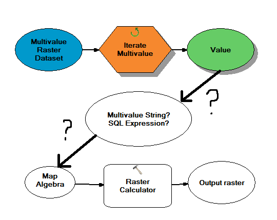
1. Somehow use the list of rasters to be summed to create a Map Algebra expression?
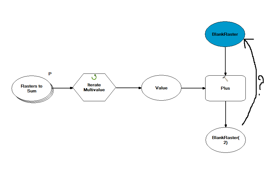
2. Have a kind of looping Plus tool that starts with a blank raster of the same style and adds one of the rasters from the list each time using the previous loop's output as the input? But you can't do that: Error 000670
Help!