- Home
- :
- All Communities
- :
- Products
- :
- ArcGIS Dashboards
- :
- ArcGIS Dashboards Questions
- :
- Re: map zoom level when clicking on item list
- Subscribe to RSS Feed
- Mark Topic as New
- Mark Topic as Read
- Float this Topic for Current User
- Bookmark
- Subscribe
- Mute
- Printer Friendly Page
- Mark as New
- Bookmark
- Subscribe
- Mute
- Subscribe to RSS Feed
- Permalink
- Report Inappropriate Content
Is it possible to set the map to zoom to a particular level when clicking on an item in a list?
Solved! Go to Solution.
Accepted Solutions
- Mark as New
- Bookmark
- Subscribe
- Mute
- Subscribe to RSS Feed
- Permalink
- Report Inappropriate Content
For polylines and polygons, the app zooms to the extent of the feature.
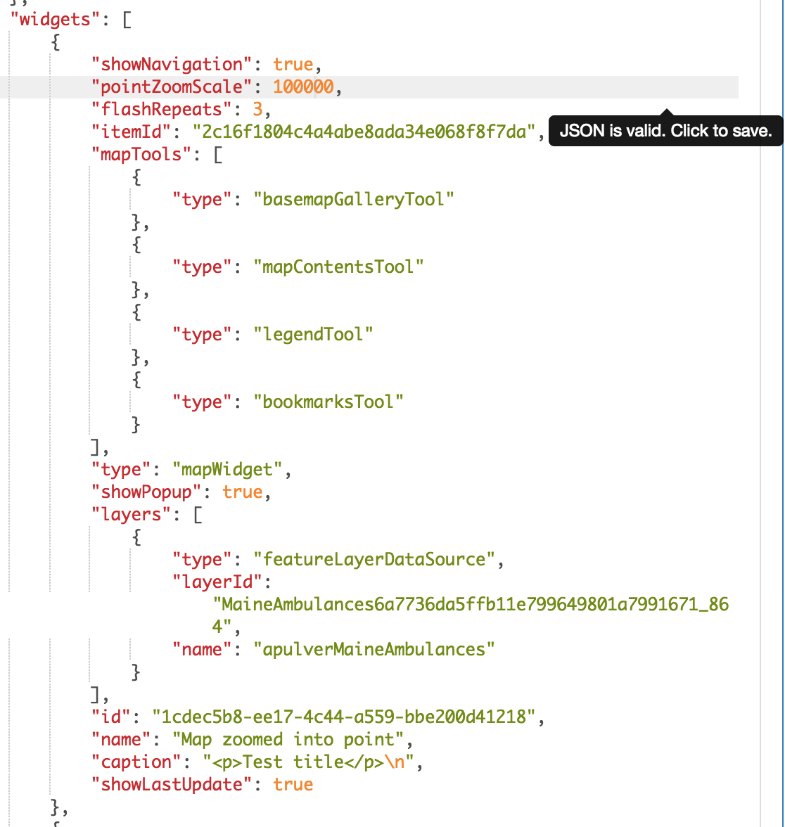
For points, there is a "pointZoomScale" property that can be added/modified in the dashboard json (via AGO Assistant or other) to set a specific zoom scale. This property is not exposed to the dashboard creator at this time and must be manually changed in the json.
The app currently defaults to 10,000. So setting this property to a value like 1,000 will allow the map to zoom in more. The setting is per-webmap.
- Mark as New
- Bookmark
- Subscribe
- Mute
- Subscribe to RSS Feed
- Permalink
- Report Inappropriate Content
For polylines and polygons, the app zooms to the extent of the feature.
For points, there is a "pointZoomScale" property that can be added/modified in the dashboard json (via AGO Assistant or other) to set a specific zoom scale. This property is not exposed to the dashboard creator at this time and must be manually changed in the json.
The app currently defaults to 10,000. So setting this property to a value like 1,000 will allow the map to zoom in more. The setting is per-webmap.
- Mark as New
- Bookmark
- Subscribe
- Mute
- Subscribe to RSS Feed
- Permalink
- Report Inappropriate Content
Make sure to have the correct capitalization or it will not respect the parameter:
"pointZoomScale"
- Mark as New
- Bookmark
- Subscribe
- Mute
- Subscribe to RSS Feed
- Permalink
- Report Inappropriate Content
thanks this worked, however my JSON did not have this parameter to begin with, I had to add it.
- Mark as New
- Bookmark
- Subscribe
- Mute
- Subscribe to RSS Feed
- Permalink
- Report Inappropriate Content
Correct, this is a parameter that we had to add to this JSON, it was not already there.
- Mark as New
- Bookmark
- Subscribe
- Mute
- Subscribe to RSS Feed
- Permalink
- Report Inappropriate Content
I want to zoom to a polygon (buildings) and show some of the surrounding area for context. Is there a polygonZoomScale property too? I tried it but nothing happened.
Paul
- Mark as New
- Bookmark
- Subscribe
- Mute
- Subscribe to RSS Feed
- Permalink
- Report Inappropriate Content
I have the same issue as well. The zoom to polygons is not very good. Is there a setting that can be changed for polygons? Aaron Pulver
- Mark as New
- Bookmark
- Subscribe
- Mute
- Subscribe to RSS Feed
- Permalink
- Report Inappropriate Content
Did anyone ever provide a solution to change the zoom to extent for polygons?
- Mark as New
- Bookmark
- Subscribe
- Mute
- Subscribe to RSS Feed
- Permalink
- Report Inappropriate Content
How do you get to the dashboard json in order to modify this parameter?
- Mark as New
- Bookmark
- Subscribe
- Mute
- Subscribe to RSS Feed
- Permalink
- Report Inappropriate Content
Hello Matt,
You can use ArcGIS Online Assistant to get the Dashboard's JSON. However, please be careful when editing the JSON configurations as it could cause errors with the Dashboard. It is recommended to save a copy of the Dashboard, rather than editing the actual Dashboard.
Best,
Kanin