- Home
- :
- All Communities
- :
- Products
- :
- ArcGIS Pro
- :
- ArcGIS Pro Questions
- :
- Re: ArcGIS Pro Ortho Mapping Error
- Subscribe to RSS Feed
- Mark Topic as New
- Mark Topic as Read
- Float this Topic for Current User
- Bookmark
- Subscribe
- Mute
- Printer Friendly Page
ArcGIS Pro Ortho Mapping Error
- Mark as New
- Bookmark
- Subscribe
- Mute
- Subscribe to RSS Feed
- Permalink
- Report Inappropriate Content
Hi All,
I’ve tried to process the dataset Banana Plant, from Drone2map tutorial, using ArcGIS Pro Ortho Mapping but it didn’t work. During the final block adjustment I’ve got the follow message:
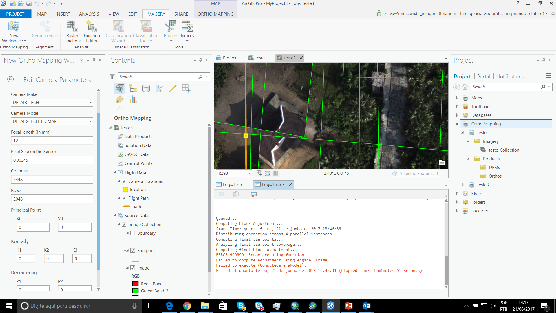
The camera parameters were loaded from a the CSV file "Geolocation", part of this tutorial dataset and I didn't change any Ortho Mapping default configuration.
I would like to get some help on this.
Thanks!
- Mark as New
- Bookmark
- Subscribe
- Mute
- Subscribe to RSS Feed
- Permalink
- Report Inappropriate Content
Leonardo,
It might be a good idea to tag Drone2Map for ArcGIS to get their input as well. Take a look at this thread:
https://community.esri.com/thread/180398
They may have had the same issues as you have had.
Have you tried searching directly for those error messages or for that dataset (and searching particularly in GeoNet)? It might bring up some more help.
- Mark as New
- Bookmark
- Subscribe
- Mute
- Subscribe to RSS Feed
- Permalink
- Report Inappropriate Content
Adrian,
I've tried also with the sample dataset Asphalt Plant, that is working well in Drone2Map, but it didn't work either with ArcGIS Pro Ortho MApping. The processing stopped with the same error message.
- Mark as New
- Bookmark
- Subscribe
- Mute
- Subscribe to RSS Feed
- Permalink
- Report Inappropriate Content
This is a really broad and generic message but maybe the tool you're using has a help list and you can look up that 'failed to execute' message?
000622: Failed to execute (). Parameters are not valid.—Help | ArcGIS Desktop
- Mark as New
- Bookmark
- Subscribe
- Mute
- Subscribe to RSS Feed
- Permalink
- Report Inappropriate Content
I'm getting the same "failed to execute (computecameramodel)" that you are getting above, but with an entirely different dataset. This "compute camera model" function seems to be bundled in with the block adjustment function, but for some reason it is not liking our input parameters.
There doesn't seem to be much troubleshooting info regarding this function online yet, but hopefully someone else has figured out what the problem is already?
- Mark as New
- Bookmark
- Subscribe
- Mute
- Subscribe to RSS Feed
- Permalink
- Report Inappropriate Content
Hey all! I'm having the same issue with the Compute camera model! Quite new to Arcgis as well so is there an error log file that could help in narrowing down the issue?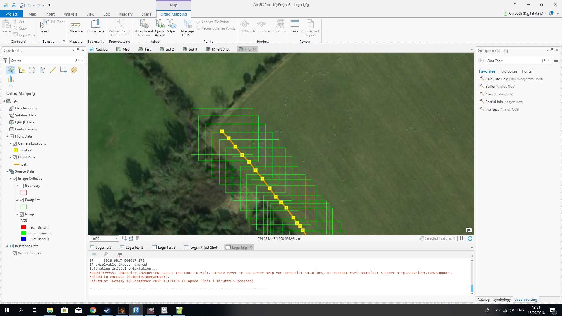
- Mark as New
- Bookmark
- Subscribe
- Mute
- Subscribe to RSS Feed
- Permalink
- Report Inappropriate Content
Ghazzali,
Maybe it would be best to start a new thread, make sure it is a Question (not discussion) and place it in the Drone2Map for ArcGIS group space (if this is a Drone 2 Map issue). I am not sure you will get assistance on this thread for that issue. I hope this helps!