- Home
- :
- All Communities
- :
- Products
- :
- ArcGIS for Power BI
- :
- ArcGIS for Power BI Blog
- :
- Location matching in ArcGIS Maps just got better
Location matching in ArcGIS Maps just got better
- Subscribe to RSS Feed
- Mark as New
- Mark as Read
- Bookmark
- Subscribe
- Printer Friendly Page
- Report Inappropriate Content
ArcGIS Maps for Power BI brings the best parts of the ArcGIS platform together into one awesome package. When pieces of ArcGIS get better, the ArcGIS Maps visual that utilize those pieces get better too! That's exactly what happened last night when the ArcGIS world geocoding service updated - you now have better location matching in Power BI.
What exactly got better?
The update last night was to the world geocoding service, which is used to provide points when you use the Location field well. Geographic boundaries (like states, ZIP codes, and other areas) are provided by Esri geoenrichment services and were not affected by the update last night.
What changes will I notice?
- You can now search for addresses in more countries than before. Previously the World Geocoding service boasted support for address-level geocoding in 109 countries. The list has expanded to an even more impressive 135 countries. We’ve also updated the reference data for most countries and added new authoritative address data sources for Australia (G-NAF) and Austria (BEV).
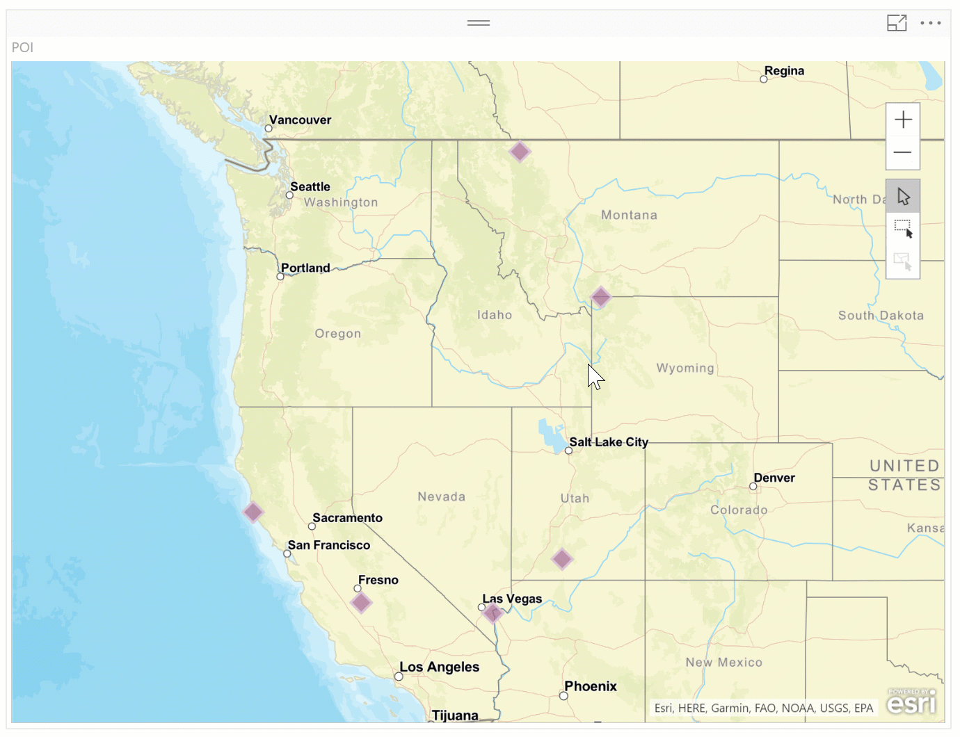
- We’ve enhanced the behind-the-scenes matching logic for better handling of poorly-formed address searches. Geocoding in the USA consistently yields high match rates, but your address database may include questionable addresses with misspellings or extra information that can’t be geocoded, such as person names. The enhanced service is capable of handling this type of incorrect information. Below are a few examples of how these improvements can boost geocoding match rates even higher.
- Our Defense and Intel users have always been able to easily search for MGRS (Military Grid Reference System) coordinates in ArcGIS Desktop. Unfortunately it wasn’t so simple to do the same in ArcGIS Maps for Power BI. For the first time, you will be able to search for MGRS coordinates – along with postal codes, addresses, populated places, and points of interest. Additionally, you can now search for latitude/longitude coordinates in different formats, such as degrees-minutes-seconds (DMS), and can also find United State National Grid (USNG) coordinates (although we recommend you continue to use the Latitude and Longitude field wells when mapping coordinates).
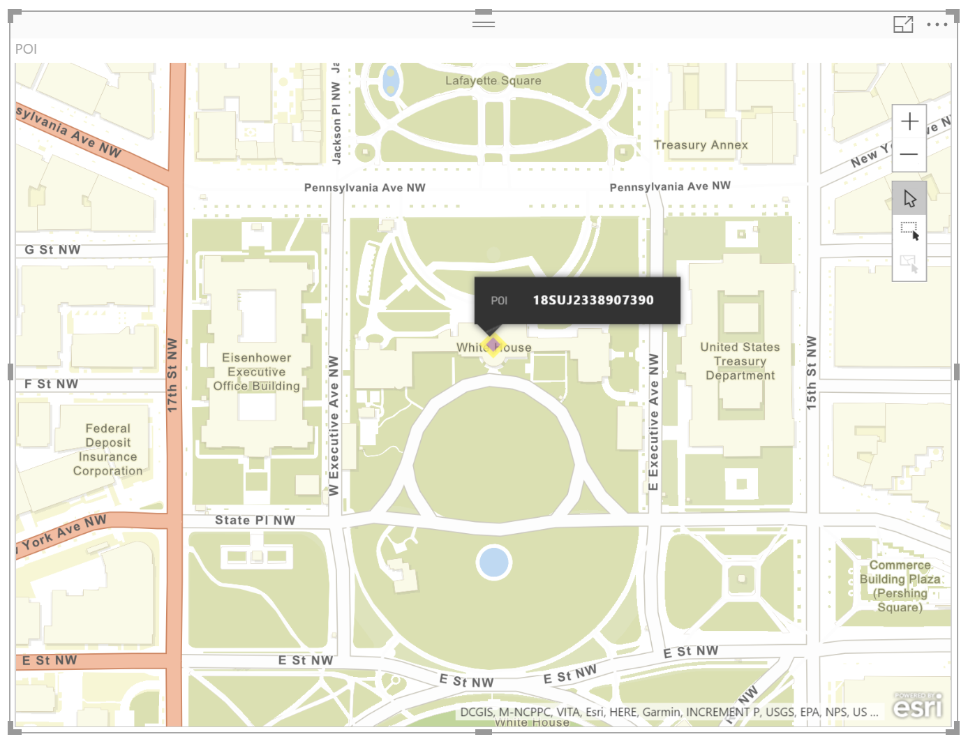
- Another useful feature in the updated service is the ability to locate Point of Interest (POI) names. You may have tables that include both addresses and place names, and in the past when you tried to batch geocode them there were no matches for the place names. There’s no longer such a disconnect which means you can batch geocode addresses, postal codes, and POIs, or any combination of these in the same field.
Keep an eye on the blogs here on the GeoNet site for the latest updates to ArcGIS and the ArcGIS Maps visual!
You must be a registered user to add a comment. If you've already registered, sign in. Otherwise, register and sign in.