- Home
- :
- All Communities
- :
- Global
- :
- Europe
- :
- GeoDev Germany
- :
- GeoDev Germany Blog
- :
- View, evaluate and modify ArcGIS Runtime caches wi...
View, evaluate and modify ArcGIS Runtime caches with the Runtime Explorer
- Subscribe to RSS Feed
- Mark as New
- Mark as Read
- Bookmark
- Subscribe
- Printer Friendly Page
Introduction
But if the product of this export is also valid and displayed correctly in the mobile client you will not see it until you open the caches in it. So: How can you be sure, that your caches are valid as expected?
In fact, there is currently no standard tool for checking caches. So if you have not completed any application, you had no way to check the data export.
View the mobile content
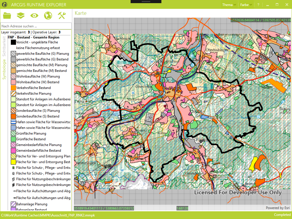
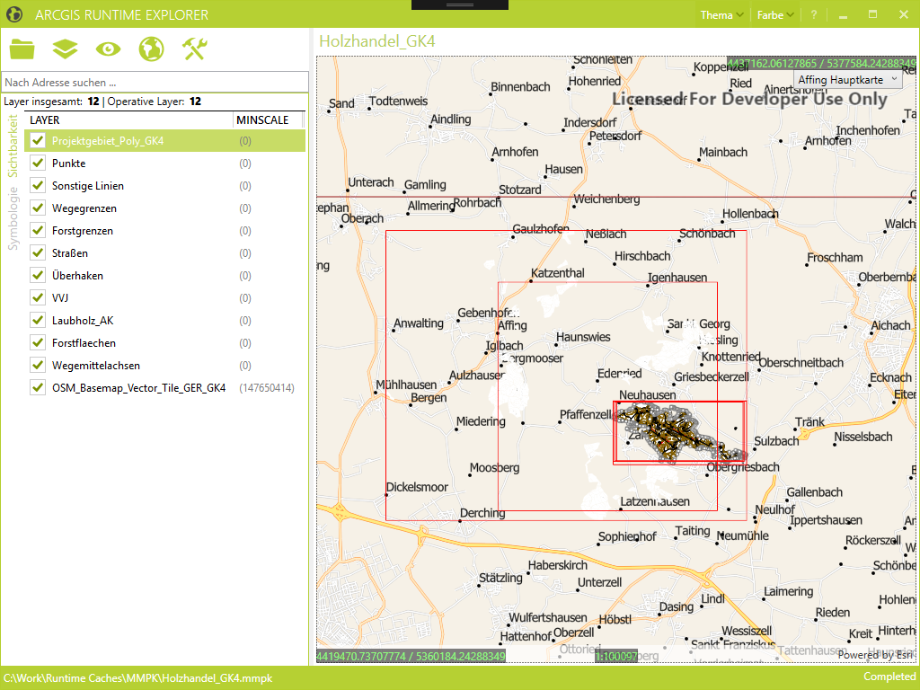
This application was created by Esri Germany developers to facilitate their daily work. Just open and check a mobile geodatabase or the newer mobile map package format? No problem. It even supports multiple maps of an MMPK, as well as embedded locators. Raster data is also supported, both as part of the caches and as additional content to easily orient yourself. All data is displayed in a map, along with a legend with all symbols.
Even bookmarks are evaluated and can be displayed.
So far all the standard functionality that one would expect from a finished client.
Get a deep insight
But there is a lot more in this tool. It shows a lot of little additional information that you would not get so obvious in most other applications.
How many layers does the cache actually have and how many are editable?
Are all layers currently visible or are individual elements just hidden due to the current scale?
Where is my map extend and how tall is it?
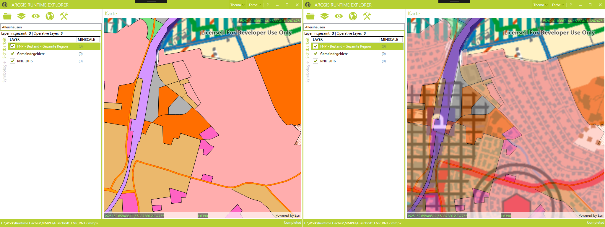
What is the extend of each layer? Is it congruent with other layers or are they different?
Do things that no one has ever done before
But it's not just about looking at data. I am even able to manipulate this data.
For example: I do not want to zoom in too deeply into the map because the background map will otherwise blur. From when that is the case I would like to test out and set therefore on the Map object the MaxScale property.
In addition, I should not be able to zoom out more than on my country, so just try it quickly, as this fits best in the map, read off the scale factor and enter as MinScale property - done.

Practically, I can adjust the transparency so that I get the best possible view.
Perfect Tool?
What is perfect? But it helps a lot if you do not have to put the same functions into an application over and over again just to look at a mobile cache. And this tool provides just a lot more information and possibilities.
In addition, the tool is maintained and further developed, because it is just used.
Moreover, because it is under a free Apache license, anyone can make changes to it and also give it back and thus contribute to the improvement of the tool.
Therefore: it's free, use it!
You must be a registered user to add a comment. If you've already registered, sign in. Otherwise, register and sign in.