GeoDev Germany Blog

cancel
Showing results for 
Show  only  | Search instead for 
Did you mean: 

Other Boards in This Place

Latest Activity

(301 Posts)
AlexanderErbe
Esri Regular Contributor

Der diesjährige Esri Developer Summit findet virtuell vom 6.- 8. April statt.

Read more...

more
0 0 887
AlexanderErbe
Esri Regular Contributor

Am 12.09.2019 fand wieder ein GeoMob Meetup in München statt. Das Thema war diesmal „Spatial Analytics, Machine Learning and AI“. Vielen Dank an das Organisationsteam Bree Harrison, Abhishek Manandhar und natürlich an Muthukumar Kumar, Managing Editor der Blog-Plattform Geoawesomeness.com, der diese Meetups unter dem Brand GeoMob in Deutschland initiierte.

Gehostet wurde es diesmal im Werk 1, einer coolen Location für Startups und Gründer. Pizza und Getränke wurden von Esri gesponsert, die Rahmenbedingungen waren somit schonmal rundum gelungen.

Das Meetup war inhaltlich gut organisiert, neben 5-zehnminütigen Vorträgen, 3 Lightning Talks und einer Kurzvorstellung des Sponsors Esri gab es in der Pause und auch danach genügend Zeit zum Networken. Die ca. 60 Teilnehmer bestanden aus Studenten, Start-ups und Unternehmen. Ca. 45% davon waren Entwickler.


Das Programm selbst war wieder sehr hochwertig:

Vorträge: 

  1. Eberhard Hansis von der Vebeto GmbH stellte das GitHub Projekt „theywillcome“ vor, eine OSM Straßennetzwerk-Analyse mit Python.
  2. Michael Heißmeier, Vorsitzender der Training Working Group bei der non-profit Organisation und global Community HOTOSM, erzählte über „Humanitarian Mapping“ mit OSM Daten und wie ihre Machine Learning API dabei unterstützt.
  3. Corinne Frey and Katrin Rusch zeigten Beispiele, wie Geoprocessing and Geoanalytics bei Vodafone eingesetzt werden.
  4. Dirk Wilfling, Co-Founder des Start-ups Algoly, stellte einen Algorithm Builder vor, mit dem ohne Programmierkenntnisse unterschiedlichste Daten orchestriert und ausgewertet werden können.
  5. Gernot Rücker, Co-Founder der ZEBRIS GbR, erzählte über firemaps.net, einem Projekt zur Unterstützung von Brandüberwachung mithilfe von Satellitenbildern.


Lightning Talks:

  1. Florentyna Smith von SpaceTec Partners stellte das Copernicus Accelerator Programm vor.
  2. Nabin Raj Gaihre von TFE Energy erzählte, wie mit Satellitendaten und Geodatenanalye Dörfer identifiziert und nachhaltig mit Strom versorgt werden können.
  3. Henrique Köhler stellte VolksNav vor, einer in seinen Augen intuitiven Alternative zur klassischen Navigation.


Sponsor:

  • Alexander Erbe vom Sponsor Esri Deutschland informierte mit einer Story Map über das ArcGIS Developer Program, die European Developer Summit und das Esri Startup Program.

Anschließend gab es noch eine spannende Diskussionsrunde mit allen Vortragenden. Insgesamt war es ein inspirierendes Event, die Teilnahme war wieder lohnenswert.


Euer GeoDev Germany Team

more
2 0 1,059
AlexanderErbe
Esri Regular Contributor

Der zweite GeoMob Munich mit dem Thema „Maps, Machine learning and AI“ fand am Abend des 18.07.2019 statt. Vielen Dank wieder an Muthukumar Kumar, Managing Editor der Blog-Plattform Geoawesomeness.com, der diese Meetup-Reihe unter dem Brand GeoMob in Deutschland initiiert und organisiert. Gehostet wurde es diesmal auf dem Google Campus in München. Google sorgte auch mit Snacks und Getränken für das Wohlbefinden der Teilnehmer, herzlichen Dank dafür.

Der Abend war gut organisiert, in der Pause und nach den Vorträgen gab es genügend Zeit zum Networken, was auch ausgiebig getan wurde. Die ca. 70 Teilnehmer setzten sich zusammen aus Studenten und Vertretern von Start-ups und Unternehmen. Ca. 40 % waren Entwickler.


Das Programm war sehr interessant, es wurden sieben 10-minütige Vorträge gehalten:

  1. Wolfgang Deigele, Master Student der TU München, erzählte über Deep Learning bei der Rasteranalyse mit ArcGIS Pro zur Erkennung von Sturmschäden in Wäldern
  2. EIXOS Economic Observatory präsentierten, wie sie die wirtschaftliche Aktivität in Städten mit Hilfe von maschinellem Lernen und KI überwachen?
  3. Ines Kühnert, Project Manager bei AZO, stellte die Galileo Masters International Innovation Competition
  4. Cassi Welling, COO bei Hawa Dawa GmbH, präsentierte, wie Daten über die Luftqualität in Städten mit Hilfe von Machine Learning und KI überwacht und ausgewertet werden.
  5. Elizabeth Duffy, Business Development bei UP42, stellte eine Entwicklerplattform mit skalierbaren Modulen zur Erstellung von Geo-Lösungen vor.
  6. Aleksander Buczkowski, Senior Manager bei Drone Powered Solutions, PwC, berichtete über die Inspektion von Objekten mit Dronen (z.B. im Energiesektor) und anschließende Auswertung der Bilder mit Hilfe von maschinellem Lernen und KI.
  7. Bilge Kobas, Architektin und Co-founder von Bits’ n Bricks, stellte Ihre Herangehensweise und Lösungen für die Stadtplanung vor. Vom Data Mining über Datenprozessierung, Analyse bis zur Visualisierung.


Anschließend gab es noch eine spannende Diskussionsrunde mit allen Vortragenden. Der nächste GeoMob Munich wird am 12.September stattfinden, wir freuen uns Euch dort wieder zu sehen.


Euer GeoDev Germany Team

more
0 0 838
AlexanderErbe
Esri Regular Contributor

Am Abend des 11.04.2019 fand das Meetup #geomobMUC zum Thema „Maps for Machines and Geospatial Applications“ statt. Vielen Dank an Muthukumar Kumar, Managing Editor der Blog-Plattform Geoawesomeness.com, der dieses erste #geomob-Meetup in Deutschland initiierte und organisierte (#geomob sind eine Reihe von Events, die auch in London und Barcelona stattfinden). Gehostet wurde es in der Münchner Firmenzentrale der Firma NavVis, einem innovativen Lösungsanbieter für die Digitalisierung und Visualisierung von Innenräumen. Esri Deutschland sponserte das Event und sorgte unter anderem mit Bier und Brezn für das Wohlbefinden der Teilnehmer.

Quelle: meetup.com


Der Abend war straff und gut organisiert, in der Pause und nach den Vorträgen gab es genügend Zeit zum Networken und Socializen. Interessant zum Start war eine Live-Umfrage für die ca. 70 Teilnehmer:

  • Die Teilnehmer waren bunt durchmischt und stammten von einer Vielzahl von kleinen und großen Firmen und Organisationen aus München aber auch aus anderen Landesteilen.
  • 45% waren Entwickler, 23% Studenten
  • Machine Learning war das Wunschthema des nächsten #geomobMUC Meetups


 Hauptteil der Veranstaltung waren 6 hochwertige, 10-minütige Vorträge:

  • Lorenz Lachauer, Head Solution Factory Team bei NavVis, erzählte über die Herausforderungen und Möglichkeiten bei der Erfassung, Visualisierung und Nutzung von Daten für Indoor.
  • Dario Manns, Co-Founder von FairFleet, präsentierte die technischen Aspekte des Backends hinter ihrem globalen Drohnen-Dienst.
  • Yashar Moradi, CTO von CloudEO, erzählte über ihre Vision einer Geospatial Market Platform.

Vor der Pause informierte Matthias Schenker von Esri über die Power von Storymaps und über ArcGIS for Developers für einen leichten Einstieg in die Entwicklung von Geo- und GIS Apps.

  • Johannes Start, Product Owner von Artisense.ai, gab einen interessanten Einblick in ihre Technologie zur Erstellung von Karten für autonome Systeme.
  • Jed Sundwall, Global Open Data Lead von Amazon Web Services, erzählte über freie Daten in Earth on AWS.
  • Siegfried Hartmann, Founder von Analytical Semantics, berichtete über das Analytical Semantics Widget, einer dynamischen Verbindung zwischen Informationsmanagement und Geoinformationssysteme von Esri.


Anschließend gab es noch eine spannende Diskussionsrunde mit allen Vortragenden zu technischen Fragen, aber auch Allgemeines wie beispielsweise zur Gründung von Startups.

Quelle: meetup.com

Insgesamt war es ein tolles und inspirierendes Event. Wir freuen uns auf zwei weitere geplante #geomobMUC Meetups in diesem Jahr in München, und wir würden uns freuen Euch dort (wieder) zu sehen 🙂


Euer GeoDev Germany Team


Impressionen :

Matthias Schenker, Esri (Quelle: Twitter)

Quelle: Twitter

Quelle: meetup.com

Muthukumar Kumar (Quelle: meetup.com)

more
0 0 881
StephanKünster
Occasional Contributor II

Since 2006, the Esri DevSummit Europe has been the largest, longest-running conference for developers building next-generation apps with advanced GIS technology.


Yet it's more than just a conference--it's a productivity event. After all, you are building apps that help millions of users successfully better our world, in so many different ways.


Berlin is where the brightest minds in geodevelopment gather to take users inside the future of app-building with location intelligence. This starts with hands-on training on the latest tools and advanced technology, enabling the user community to continue doing great things.


The growth of ArcGIS, and what it can do, is growing at a break-neck pace. Given that It will have been six months since the Developer Summit event in Palm Springs, California—and six months until the next one—there is so much that you will be seeing for the first time in Berlin.


Your attendance is critical to ensure you are aligned with Esri, as we move forward. There’s no other event to learn and get hands-on with the latest capabilities and functionality of ArcGIS, directly from the lead developers who are building the technology.

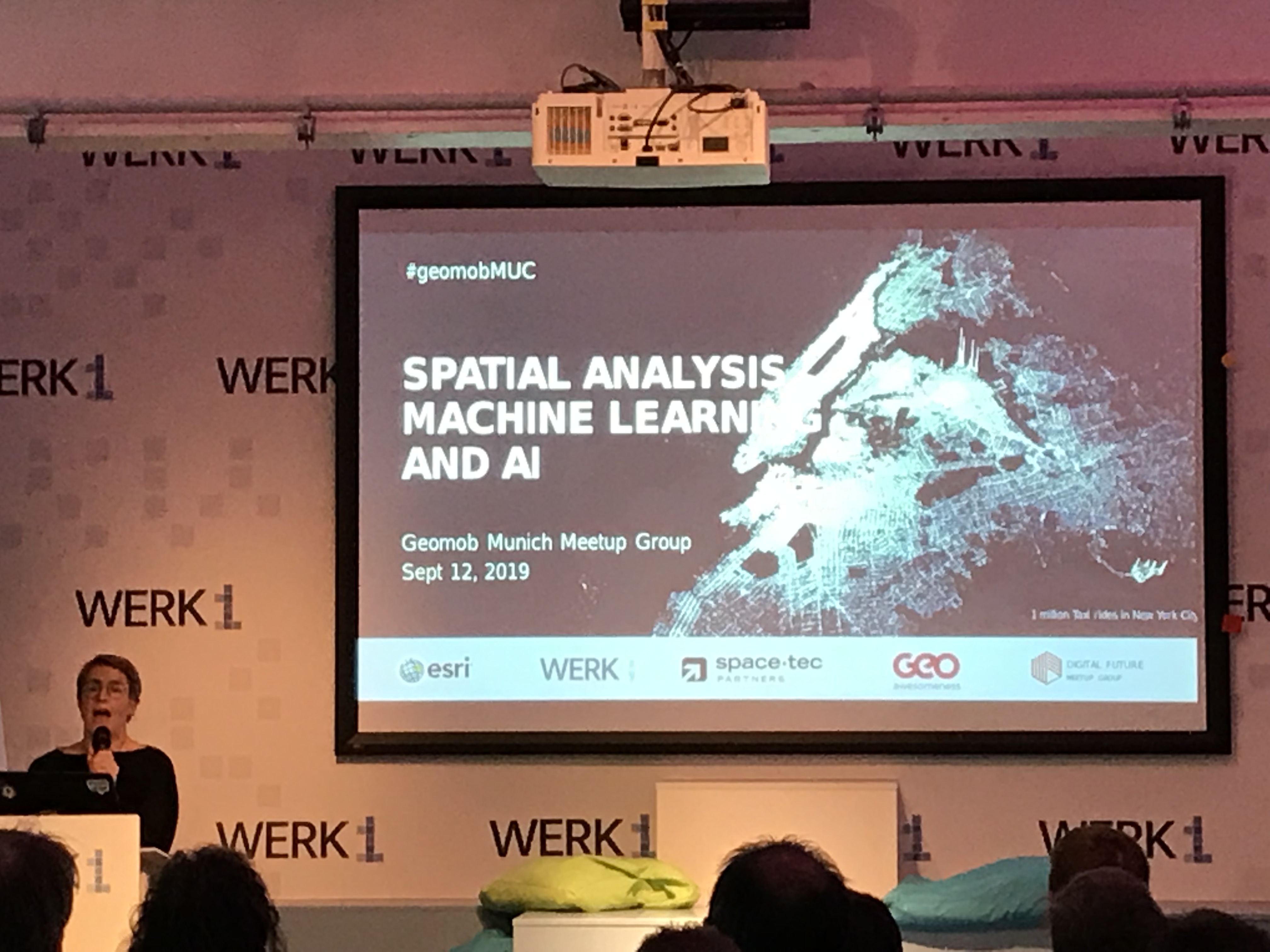
Esri Developer Summit Europe 


more
0 0 492
LarsSchmitz
Regular Contributor II

Der Esri Developer Summit 2018 naht mit Riesenschritten und wir hoffen, möglichst viele von Euch vor Ort begrüßen zu dürfen. Ihr schafft es nicht nach Palm Springs? Kein Problem! Wir haben eine neue #GeoNet Gruppe für Euch eingerichtet. Dort könnt Ihr u.a. Live Chats zur Plenary folgen, Euch an Diskussionen beteiligen oder einfach nur Fragen stellen. Schaut doch mal vorbei unter https://community.esri.com/community/events/devsummit

more
1 0 393
LarsSchmitz
Regular Contributor II

Hey fellow geo geeks.

Last week we have been hosting our last geodev meetup for this year. The topic this time was "The Power of Scripting" and it was all about automating your work, be it analysis or administrative talks. It turned out that December 6th (aka Santa Claus) was not a perfect timing, so many thanks to those of you who made it anyhow! And for those of you who couldn't make it, don't worry, we've got you covered with recordings.

Chenyu Zuo, TU München: Mining traffic information from social media data

Social media has become prevalent in the last decade. People publish various topics, for instance food, work, traveling, sports, health, on a variety of social media platforms on a daily basis, which reflect a wide range of socioeconomic phenomena and human behaviors. The rich social media data can also be used for traffic information extraction and analysing. For example, where and when do people complain about public transport services? How is traffic congestion related to traffic accidents? Which kinds of people activities are related to traffics. Ming such information is very interesting and challenging. In this talk, we hope to provide you solutions for events extraction from textual data and innovative ways of geo-data analysing.

Jan Wilkening, Esri Deutschland: R for GeoGeeks - The Interface between R and GIS

Interesting things happen at the interface of GIS and the popular scripting language R: GIS users can profit from the broad range of publicly available R scripts, while R users can profit from the power of user-friendly GIS. This talk shows GIS users what R is and how they can use it for their daily work. For those more familiar with R, the talk will also highlight how R users can enhance their R routines with GIS.

Alexander Erbe, Esri Deutschland:The ArcGIS Python API

The powerful ArcGIS API for Python lets you script and automate tasks in ArcGIS using a Pythonic library. With the Python API, you can streamline data analysis, content management and web GIS administration. This lecture will give you a brief overview of the possibilities based on some practical examples, e.g. the convert of OSM data using the OSM API to ArcGIS feature services.

Enjoy your christmas break! 

Alex and Lars

Geo DevelopersPythonGIS Developersa.erbeesri-de-esridisthttps://community.esri.com/groups/esri-deutschland-partner-community?sr=search&searchId=4e07ff40-e3e...

more
1 0 877
StephanKünster
Occasional Contributor II

Wherever many people come together, challenges arise. Both in outdoor areas, but especially within buildings, it can quickly "bump" somewhere. This is not uncommon in major events such as concerts or sporting events with several thousand visitors. But even with a few hundred people, the single toilet can be crowded before, or provide a lecture room not enough space for all participants.

Would not it be nice to be able to see live on a map of the building, how crowded a specific place is, if there is still space available, and whether it is worth taking the road at all?

And would not it be nice for the organizer to always have an up-to-date overview of the utilization of individual areas of the building during the event, and perhaps proactively avoid bottlenecks?

Would not it be great if you could use the results of a current event to be better prepared for follow-up events?

This is precisely the question we asked ourselves in advance of this year's Esri Developer Summit in Berlin .

Together with our startup partner, Square Metrics  , we have developed a demo scenario in which iBeacons are used to measure the occupancy of specific locations in the building by measuring when and how often a particular beacon is triggered by the approach of a participant becomes.

The (anonymous!) Information sent by each beacon was first sent to the Proximity DMP of Square Metrics, where the individual beacons were registered and organized. From there, every single event was sent in real-time to the ArcGIS backend, where a GeoEvent server received the information, evaluated it in real-time and saved it for later analysis. The following graphic shows an overview of the components used and the interaction between them.

The graph also makes it clear that ArcGIS Enterprise can be upgraded to a full-fledged IoT platform in conjunction with external device management .

This allowed us to show on a map how many times a particular sensor was triggered, both when entering a certain area and when leaving it. If you now place a beacon in a room, you can quickly calculate how many people went in and out at a certain time. Compared with the actual capacity, one can quickly create an indicator that indicates whether a particular room is overcrowded or whether there are still free seats available.

Hotspots and coldspots can be identified quickly and thus conclusions can be drawn as to which lectures are good and which are less well received by the audience.

Taking into account not only a single beacon, but all the sensors distributed in the building, you can even detect motion profiles, for example, whether or not there is a connection between certain places (and content presentations). For example, did a Javascript developer also attend .NET lectures, or was he in the cafeteria at those times?

With all this information, you can react to specific events during the event and then analyze the current event so that the following events are adapted to the behavior of the participants.

No more congestion in front of the toilet, always a free seat in the lecture - it does not have to remain a utopia: with iBeacons and ArcGIS as a real-time IoT platform!

more
3 0 635
LarsSchmitz
Regular Contributor II

Vom 3.-9.3. findet wieder der Esri Developer Summit in Palm Springs, Kalifornien, statt. Wir möchten Euch einladen, dort Eure Arbeit vorzustellen. Es ist wirklich eine einmalige Gelegenheit, vor so einem Publikum zu stehen und die eigenen Ergebnisse zu präsentieren. Letztlich lebt ein solches Event auch von Euren Beiträgen.

Ihr habt noch bis zum 12. Januar Zeit, Euren Vortrag einzureichen. Ihr könnt über Tools, Technologien, Innovationen, Lessons Learned, gelöste Probleme oder schlicht über Euer eigenes Projekt mit ArcGIS berichten.

Haben wir Euer Interesse geweckt? Dann geht es hier zur Anmeldung. Viel Glück! 🙂

DevSummit Apps

more
0 0 318
LarsSchmitz
Regular Contributor II

Aus den am Ernst-Reuter-Platz in Berlin erhobenen Verkehrsdaten sollen Anwendungen entwickelt werden, die das Leben, Arbeiten oder den Verkehr vor Ort optimieren. Bis Mitte Dezember können Interessierte ihre Lösungen einreichen.

Gemeinsam mit der Berliner Senatsverwaltung für Wirtschaft, Energie und Betriebe und dem DAI-Labor der TU Berlin ruft Cisco jetzt zum Ideenwettbewerb „Smart City Berlin – Ernst-Reuter-Platz“ auf. Wie das Unternehmen mitteilt, richtet sich der mit 30.000 Euro dotierte Wettbewerb an Studierende und Startups aus Berlin. Sie sollen aus vorhandenen Daten Ideen entwickeln, die das Leben, Arbeiten oder den Verkehr vor Ort für alle besser machen. Bis zum 17. Dezember 2017 haben die Teilnehmer Zeit, ihre Lösungen einzureichen. Die Preisträger werden laut Cisco im Januar 2018 bekanntgegeben. Am Ernst-Reuter-Platz befindet sich das DAI-Labor.

Alle weiteren Infos könnt Ihr auf www.kommune21.de lesen (Originaltext).

Bildergebnis für ernst-reuter-platz

more
2 0 490
12 Subscribers
Labels