- Home
- :
- All Communities
- :
- User Groups
- :
- Conservation GIS
- :
- Documents
- :
- Jane Evgeniya Elkina, Russia
- Subscribe to RSS Feed
- Mark as New
- Mark as Read
- Bookmark
- Subscribe
- Printer Friendly Page
Jane Evgeniya Elkina, Russia
Jane Evgeniya Elkina, Russia
Navigation: 2015 Scholar Project 2015Conference ReferenceProject CommunitiesPage ConservationGIS Scgis.org
Jane Evgeniya Elkina, Transparent World, Russia
xChapter xRemote xImagery xAgriculture xMonitoring xVegetation xForest x2015Scholar x2015Talk xTalk xScholar xRussiaChapter xeurope x2017RussiaConference xRussiaConference
2019 Status: LINKEDIN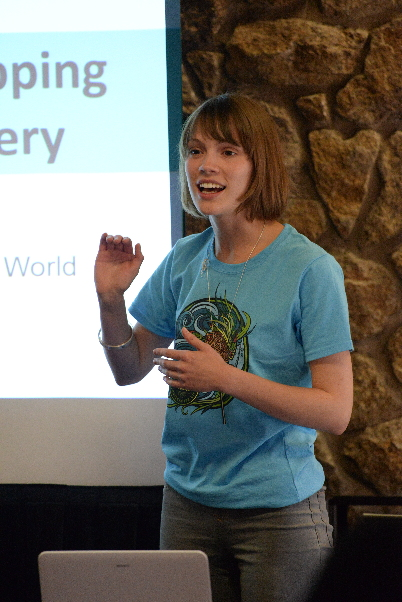
Interest in remote sensing, GIS, environment, conservation and agriculture satellite-based monitoring. Passion for working for nonprofits, international and countrywide projects. Love to learn and share knowledge.
2016-2019 GIS Analyst at Space Research Institute (IKI), Russian Academy of Sciences
Working for Terrestrial Ecosystems Monitoring Laboratory in the field of agriculture monitoring. Performing the crop identification and crop status assessment using remote sensing data, like satellite imagery and vegetation indices timeseries. Creating methodologies for crop monitoring using GIS and RS data. Developing the web-based environmental monitoring system VEGA. Preparing documentation, tutorials and teach users. Ph.D. student.
VOLUNTEER: Started to participate at Greenpeace activity at school, making donations and taking part in Greenpeace Russia reforestation project. Now volunteer in Society for Conservation GIS (SCGIS) Russian chapter.
2017 SCGIS Status: co-organizer of the 3d SCGIS Russia Conference
2017 Conference Organizers: Anastasia Philippova, Anna Komarova, Ilona Zhuravleva, and Evgeniya Elkina
“The conference of the Society for Conservation GIS and Greenpeace in 2013 became a powerful impulse in my development and study of GIS and remote sensing. I learned about the existence of the international SCGIS, and so far my colleagues (from Greenpeace and other environmental organizations) are my main source of inspiration. Now I work in the department of Satellite Monitoring SRI of RAS, where scientific and applied research of vegetative cover is conducted. I will be glad to share my experience with space imagery. My contribution to our conference is the organization of a webcast, so that those who could not come personally could join us.”
2015 SCGIS Conference Paper:

“Mapping Plantations: Detecting Plant Species Using Landsat Images”
* Presenter: Jane Evgeniya Elkina, Transparent World, Russia
This work represents experience in identification and classification of plantations in Brazil and Indonesia. We used satellite imagery to both digitize manually and identify plantations using machine learning techniques utilizing artificial neural net works. One of the problems we faced was having to use freely available Landsat imagery for plant species recognition rather than higher resolution sources. The project resulted in making a map of plantations and building a database containing spectral reflectance of images, plantation shape types, and other direct and indirect indicators for detecting types of plants in Brazil (potentially applicable to other regions). Additionally, this work was incorporated in the Global Biodiversity Information Facility (GBIF) project to share our field data with broader research community

2015 Scholar Profile:
Ms Elkina Evgeniya
*-Organization name: Non-commercial Partnership "Transparent World"
*-Organization full street address: Russian Federation, Moscow region, town Rumyantsevo, business-park “Rumyantsevo”, entrance 8, room 531
*-Organization full mailing address, if different: Russian Federation, Moscow, Rossolimo street, 5/22, 119021
*-Country: Russian Federation
*-Work phone with country and area code: +007 (495) 739-73-85
*-Work fax with country and area code: +007 (495) 739-73-85
*-Main email: [email protected]
*-Organization Web site URL if any: http://www.transparentworld.ru/
the work that your current organization does:
“Transparent world” is a non-profit, non-governmental organization (NGO) that was established in 2000. Its mission is to democratize access to satellite information and to promote its integration into non-military decision-making.
In ten years TW made a number of successful projects, including:
-Identification and Mapping of High Conservation Value Forests (HCVF)
The TW team is a world leader in the HCVF area. The project of a global scale was mapping of intact forest landscapes (IFL). This type of HCVF is critically important for biodiversity protection at a landscape level and mitigating global climate change. Global maps of IFL created using unified criteria provide an overlook over state of such forests globally (www.intactforests.org).
-Web services as a tool to analyze and monitor threats to valuable nature areas
The web services include spatial data visualized on the background of satellite images or topographic maps, linked with text description of the problem. They include data on ecosystems and threats to them. Some of them are:
HCVF of Primorsky Kray (http://gis.transparentworld.ru/en/primorie/),
Intact Forests of Karelia (http://gis.transparentworld.ru/en/kareliaks/, http://gis.transparentworld.ru/en/karelia/)
Radar monitoring of Oil and Gas Deposites at the Kaspian and Sakhalin Shielf (http://maps.transparentworld.ru/en/shelf.html)
Russian protected areas (http://gis.transparentworld.ru/en/russia/, http://gis.transparentworld.ru/en/russiaks/)
Monitoring of water pollution in mining of placer gold (nedra.kosmosnimki.ru) - As part of the project already has an inventory of existing, planned and retained placer gold deposits (requires continued work in this direction is to create a complete database), and translated them into map view. I also took part in this project (read more at “Role in organization” part).
-Forestry Operations and Performance Monitoring Using Remote Sensing (2007-2009)
The aim of the project has been the development of a remote sensing technique for illegal logging monitoring based on high resolution satellite images.
- Producing a map of Federal protecting areas in Russia

your personal role in the organization: I work for TW since November 2014, and most of my working time now is devoted to mapping.
The project is about to make a map of all biggest plantations in the Earth and evaluate of climate change. This is a work in collaboration with World Resource Institute (www.wri.org). As a result we should present a vector map with all worlds’s biggest plantations and attributive information about plantation’s species and areas. We should do verification and make a statistical report of what we’ve done. My task is to make a DB of species. It will allow people who are faced with the task of identification vegetation in the Landsat images identify species with a certain probability. This database will be like a tutorial and will be based on materials that we have gathered during our work: spectral reflectance of different plants, plantation geometry and other direct and indirect indicators. Since the Plantation project will be continued in other countries, such a base is a necessary. Moreover, my plan - use the results of our work in the fields (verification plantations) for research purposes. Points, collected from the field I’ll put in GBIF - Global Biodiversity Information Facility (www.gbif.org) portal.GBIF is a platform for sharing biodiversity data for re-use, it is providing evidence for research and decisions, collaborating as a global community.
It allows anyone, anywhere to access data about all types of life on Earth, shared across national boundaries via the Internet. Transparent World will be the first organization in GBIF from Russia. Russia is not a member of this international project, but we, as a country, have a lot of valuable information, and someone should be case for all Russian scientific society. Transparent World has an extensive plans for the nearest future: there are works on Plantation project, projects devoted to illegal logging monitoring with environmental investigation agency, and works on Monitoring of water pollution in mining of placer gold project.
This project is made not only for Russia, but for Mongolia also. My colleague, Alexandra Loshkareva, has created a web-service, a map, where people can point a polluted rivers because of gold mining. I’ve just started to work on this project, detecting wasted rivers in Amur region. My aim is to find the connection between suspensions in the water (river) and river spectral characteristics on Landsat image. It will allow to determine from the images as far pollution standards are exceeded in the water. Which will effectively pay attention to government and the public on environmental crimes. Also, the purpose of this project is dissemination of information about the possibility of free use of images to find pollutions in the water in different regions and countries. There is a plan to make a workshop for the local nature protecting organizations in the Altai region to tell them how to detect the pollutions and mark them on the map. I am preparing for is the workshop, and I hope that we will make it in other regions of the country also. Another project, where I want to participate, is creating a web service on the territory of Russia, which displays information about completed projects of NP “Transparent World”. Non-profit organizations, like Transparent World, hold on people who can engage in various projects and know various work tools. It has no opportunities to take a lot of highly specialized professionals, so each employee must be very "high-quality" and miscellaneous. My goal is to become such a team member.
Your history in conservation: Nature conservation became my primary interest at school, since the time, when we collected the waste paper. I’ve graduated the university of informatics and statistics and didn’t know much I didn’t know about forestry, gis.
And at I started to work in Greenpeace (2011) – place, where I learned a lot of ecology and how it is important to educate people about it- and in 2013 I helped GIS-unit with organization the SCGIS conference in Russia. I’ve met the Alexandra Loshkareva from Transparent World and found out, that they work at unique nature protecting projects. After the conference I started to read “GIs-lab forum”.
When I started learn GIS, I just knew, that it is a special informatics system. I’m an “informatic specialist” in a technical sense, and up to 2013 have never worked with GIS. GIS-systems seemed to me like a pie: with layer of database, layer of visual effects, layer of analysis, layer of images. I had no idea, how it works together, and I started to ask everyone from Greenpeace Russia GIS department (I worked at another dep.) show me an examples of their work and how I can learn it.
I work for TW since November 2014, I’m mapper at Plantations project. I would like to be able to be useful in any of TW projects, to be able to create maps and systems for monitoring protected areas in order to prevent the destruction of valuable areas.
I care about not only the global problems, at the federal level, but also at the level of my district. I’m active member of two initiative groups in our district – “Save the Rostokino garden” and “Save the ponds of Losiniy Ostrov”.We monitor information, make infographics about the problem, makes meetings and take part in public hearings.
-
 Anonymous User