- Home
- :
- All Communities
- :
- User Groups
- :
- Conservation GIS
- :
- Documents
- :
- Andy Lyons, USA
- Subscribe to RSS Feed
- Mark as New
- Mark as Read
- Bookmark
- Subscribe
- Printer Friendly Page
Andy Lyons, USA
Andy Lyons, USA
Dr. Andy Lyons, Univ Calif Ag & Nat Resources
x2019TalkMap x2019ConfWorkshop&Camera x2018ConfWorkshop&Camera x2017ConfCamera xConference xCamera2017-2019 xDrone xEducation xResources xAgriculture xRemote xStatistics
2016-present: Statewide Program Coordinator for the Informatics and GIS Program, University of California, Division of Agriculture and Natural Resources 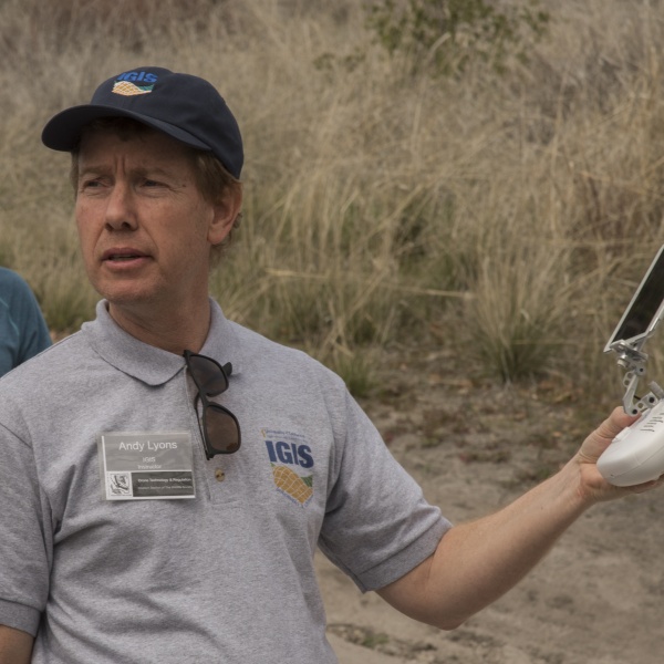
provides technical support in the area of GIS, informatics, and data analytics
2019 Conference Map Gallery Presentation
130 Mulford Hall #3114
Berkeley, CA 94720
[email protected]
https://twitter.com/andylyons10
https://www.linkedin.com/in/andy-lyons-46927750/
http://igis.ucanr.edu/People/?facultyid=32909
2019 SCGIS Pre-conference workshop instructor Sunday July 14th:
“Spatial Data Analysis with R” (Instructor: Andy Lyons)
Intro Bio from UCANR site
“I would like to welcome Andy Lyons as Academic Coordinator III in the ANR Informatics and GIS (IGIS) Statewide Program. Andy comes to ANR from Stanford and before that Berkeley, where he completed his PhD in ESPM. He has an exceptionally broad academic training, bridging both the social and natural sciences, with considerable experience within both academic and not-for-profit business environments. He has a strong combination of ecology, social science, data science, and computer applications (programming, data management, multimedia, web, modeling), and grant/report writing skills. He is also a gifted teacher, won awards for his teaching at Cal including an Outstanding Graduate Instructor Award in 2004, and has been one of our instructors at the GIF's Spatial Data Science Bootcamp.”
https://ucanr.edu/blogs/blogcore/postdetail.cfm?postnum=20437
PHOTOGRAPHER:
2017 to Present Member of the SCGIS Camera/News Team.
Examples of Andy’s Conference Photographic work:
 Program Coordinator
https://ucanr.edu/blogs/blogcore/postdetail.cfm?postnum=29016
Author: Andy Lyons Author: Shane Feirer
Published on: December 21, 2018
IGIS is pleased to release a new map of the ANR network. This poster-size map of the state includes 60 Cooperative Extension Offices, 9 RECS, and 6 affiliated campuses. The legend is accompanied by short descriptions of the main components of ANR, as well as logos of the Statewide Program and Institutes. As far as we know, this is the first attempt ever to map the entire ANR continuum.
https://dlab.berkeley.edu/training/working-geospatial-data-r
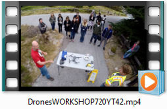
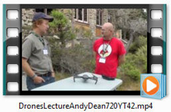
SCGIS 2018 Conservation Drones Hands-on Workshop
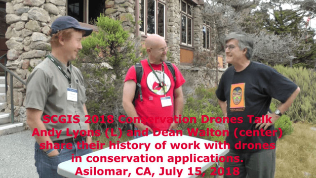
Scgis 2018 Asilomar hands-on conservation drones workshop by SCGIS Drone Experts Andy Lyons (BELOW far right) and Dean Walton (not shown) at the 2018 SCGIS Annual International Conference
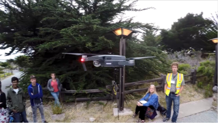
2018 Scgis Conference Hands-on Drone Workshop Films
SELECTED CHRONOLOGY:
Education
1989 Duke University BA Mathematics
2000 University of Florida Master of Science (MS) Wildlife Ecology and Conservation
2012 University of California, Berkeley Doctor of Philosophy (Ph.D.) Environmental Science
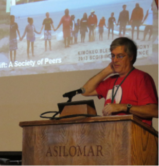
1997 Conservation GIS Community meeting at UC James Reserve that formally created the Society for Conservation GIS (photo RIGHT, Andy Lyons at the 1997 James Reserve Meeting)
https://dlab.berkeley.edu/training/working-geospatial-data-r
2015 "Andy Lyons is an alumni of ESPM and now teaches at Stanford. His research interests include modeling animal movement, land use change, the political economy of conservation, and sustainability narratives."
2017 SCGIS Conference Committee 2017 onward?
Bibliography
Peer Reviewed
Csillik, Ovidiu; Cherbini, John, et al.(2018). Identification of Citrus Trees from Unmanned Aerial Vehicle Imagery Using Convolutional Neural Networks. Drones. 2:39, 16.
Getz, Wayne M; Salter, Richard, et al.(2015). "Panmictic and Clonal Evolution on a Single Patchy Resource Produces Polymorphic Foraging Guilds." PloS one 10(8): e0133732.
Lyons, Andrew J.; Turner, Wendy C., et al.(2013). "Home range plus: a space-time characterization of movement over real landscapes." Movement Ecology 1(1): 1-14.
Lyons, Andrew (2013). "The Rise and Fall of a Second-Generation CBNRM Project in Zambia: Insights from a Project Perspective." Environmental Management51(2): 365-378.
Getz, Wayne M.; Fortmann-Roe, Scott, et al.(2007). "LoCoH: Nonparameteric Kernel Methods for Constructing Home Ranges and Utilization Distributions." PloS one 2(2): e207.
Ilir Bejleri; Paul Zwick, et al.(2002). "Integrated Approach for Identifying Potential Environmental Issues of Proposed Transportation Corridors." Transportation Research Record: Journal of the Transportation Research Board 1792: 93-100.
Lyons, Andy; Hogan, Sean (2017). Scaling Up Drone Science for Agriculture and Nature Resources through Cooperative Extension. CalGIS. Oakland, CalGIS. 1. May 23, 2017. https://calgis2017.locationcon.org/session/scaling-drone-science-agriculture-and-nature-resources-through-cooperative-extension
Lyons, Andy (2016). Drones for Ag. CA 4-H Newsletter. 8. October 2016.
Lyons, Andrew (2009). Monitoring Toolkit for Conservation Agriculture. Johannesburg, FAO Regional Interagency Coordination Support Office (RIACSO). http://www.andylyons.org/files/toolkits/ca_toolkit_2009-03-11.pdf
Lyons, Andrew J.; Mbewe, B., et al.(2005). Beyond Wallmaps: The Application of Spatial Technologies for Strengthening Land Management in Rural Zambia. Africa GIS Conference, Pretoria, South Africa, The Geo-Information Society of South Africa.
-
 Anonymous User