- Home
- :
- All Communities
- :
- Developers
- :
- JavaScript Maps SDK
- :
- JavaScript Maps SDK Blog
- :
- ArcGIS API for JavaScript (versions 4.4 and 3.21) ...
ArcGIS API for JavaScript (versions 4.4 and 3.21) releasing soon!
- Subscribe to RSS Feed
- Mark as New
- Mark as Read
- Bookmark
- Subscribe
- Printer Friendly Page
New ArcGIS API for JavaScript releases are just around the corner! Here is a preview of some of the new capabilities coming in early July.
(Note: These are some of the highlights; a full list of new capabilities and enhancements will be provided in the release notes.)
ArcGIS API 4.4 for JavaScript
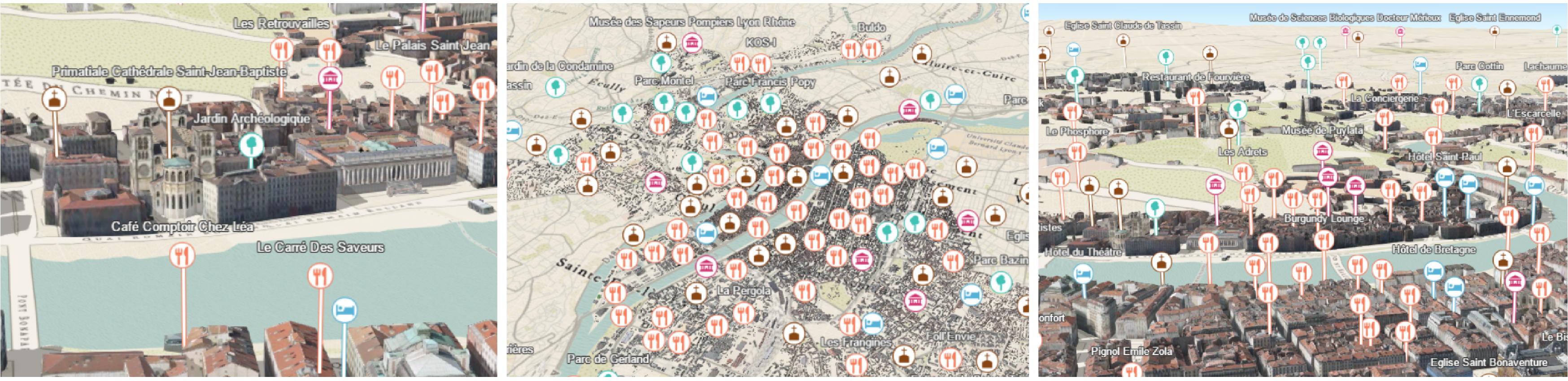
New styles for points in city landscapes:
Styling the point data in city scenes can now be done more effectively. Point graphics can be configured to display above buildings with the new relative-to-scene elevation mode. Callout lines can be used to better understand point locations (a callout is essentially extended from the top of the scene).
Highlight in 3D:
The ability to highlight features in a 3D scene, with options to configure the color and opacity of the highlight effect.
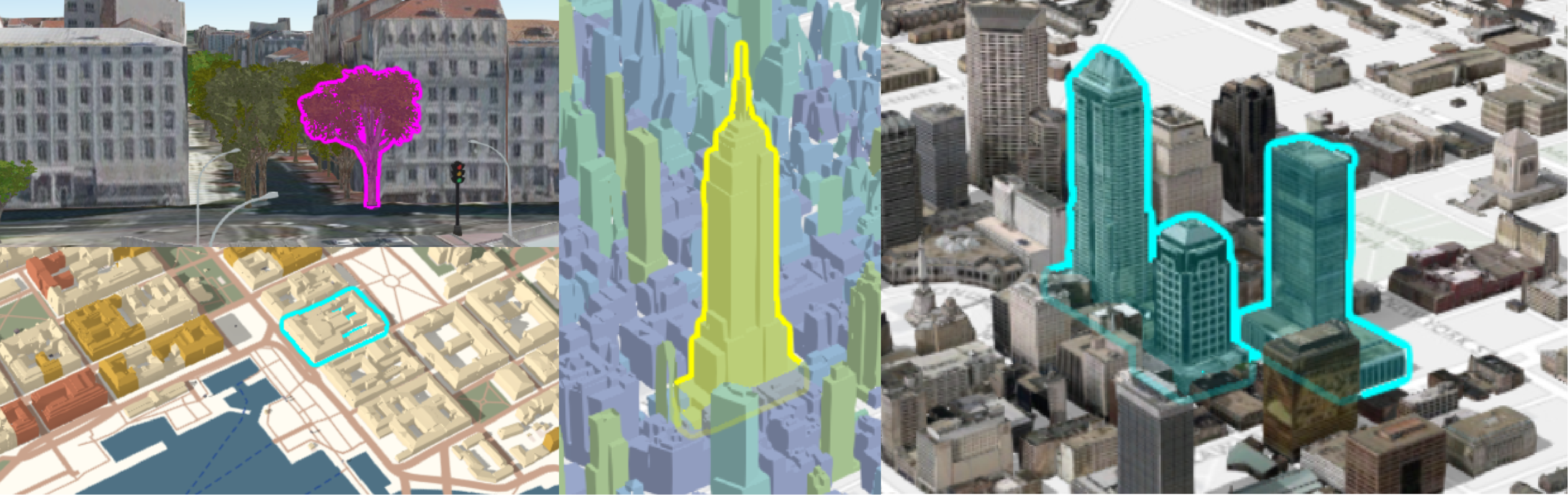
Styling building data:
We added the option to remove building textures to better emphasize thematic mapping of buildings, and also the option to make textures grayscale (one example of when you might want to do this is if you want to draw attention away from the buildings, and highlight a particular set of interest).
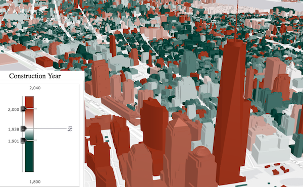
Smart Mapping
You can now automatically generate renderers for SceneLayers using SmartMapping. Generating type renderers with smart mapping is new to both 2D and 3D views. Note: When we reference smart mapping/generating renderers, we mean that the API creates smart defaults for your map/scene styles on the fly. This capability is typically used in data exploration type apps (as opposed to defining the styling explicitly in code).
PointCloudLayer enhancements
Added the ability to add natural lighting conditions to a point cloud layer in order to better distinguish objects.
Better web map support
Added support for Map Notes, WMS, and WMTS layers.
OGC support
Added support for WMS and WMTS layers.
VectorTileLayer printing
This release of the JavaScript API includes a support for vector tile layer printing through client-side image.
Arcade support in popups
Arcade expressions can now be applied in the popup’s content. This is useful for situations when you want to display data that isn't present as an attribute value in your FeatureLayer instance. Web maps that have been created in Portal or Online that contain popups with Arcade expressions will be honored in apps built with the JS API, and developers can also write Arcade expressions directly in their code.

Widget standardization
In this release, the following widgets have been updated to the widget framework, initially introduced at 4.2: Legend, Popup and Search widgets.
Custom Layers
The SDK will include documentation and samples for creating your own custom layers.
ArcGIS API 3.21 for JavaScript
Arcade support in popups
As described above.
VectorTileLayer printing
As described above.
(...plus minor enhancements and bug fixes)
You must be a registered user to add a comment. If you've already registered, sign in. Otherwise, register and sign in.