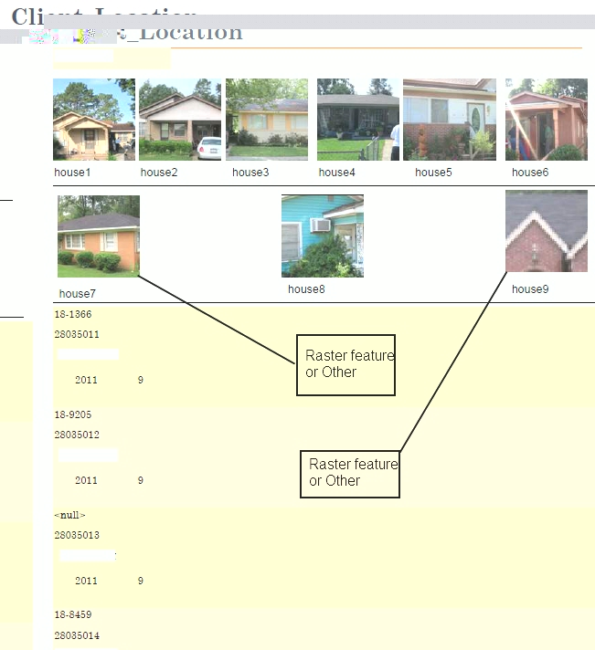
I am working on a geodatabase that has pictures. Each point is a house location in the database I have created a raster feature for each point. Is there a way to include the rasterfeature, or picture of the house into a report when it runs, or is there another way other than copy and paste the picture into the report ,one by one. the attchment below hopefully explains what I want. I have arc info 10
[ATTACH=CONFIG]13073[/ATTACH]