Turn on suggestions
Auto-suggest helps you quickly narrow down your search results by suggesting possible matches as you type.
Cancel
- Home
- :
- All Communities
- :
- Developers
- :
- Python
- :
- Python Questions
- :
- ExecuteError: ERROR 999999: Error executing functi...
Options
- Subscribe to RSS Feed
- Mark Topic as New
- Mark Topic as Read
- Float this Topic for Current User
- Bookmark
- Subscribe
- Mute
- Printer Friendly Page
ExecuteError: ERROR 999999: Error executing function.
Subscribe
5708
4
05-15-2013 04:57 PM
05-15-2013
04:57 PM
- Mark as New
- Bookmark
- Subscribe
- Mute
- Subscribe to RSS Feed
- Permalink
i got the this error message.
what's wrong to me?
Traceback (most recent call last):
File "C:/Users/Administrator/Desktop/arcpy/convert", line 36, in <module>
saveRaster = arcpy.PointToRaster_conversion( filename2, "RASTERVALU", outRaster2, "MOST_FREQUENT", "NONE", cellSize)
File "C:\Program Files\ArcGIS\Desktop10.0\arcpy\arcpy\conversion.py", line 1772, in PointToRaster
raise e
ExecuteError: ERROR 999999: Error executing function.
Failed to execute (PointToRaster).
# Import arcpy module
import arcpy, os
from arcpy import env
from arcpy.sa import *


# Set environment settings
arcpy.env.workspace = "C:/py2/extract"
arcpy.env.overwriteOutput = True

OutputFolder2 = "C:/py2/result"

# Loop through a list of files in the workspace
RasterFiles2 = arcpy.ListFeatureClasses()

print "POINT TO RASTER"
print RasterFiles2
print " "


# Set local variables
for filename2 in RasterFiles2:
    print "Processing: {0}".format(filename2)
    outRaster2 = os.path.join(OutputFolder2, filename2 + "_4x")
    valField = "RASTERVALU"
    assignmentType = "MOST_FREQUENT"
    priorityField = "NONE"
    cellSize = "0.035714286"

# Execute ExtractValuesToPoints
    saveRaster = arcpy.PointToRaster_conversion( filename2, valField, outRaster2, assignmentType, priorityField, cellSize)

print "done "
print arcpy.GetMessages()
4 Replies
05-15-2013
05:20 PM
- Mark as New
- Bookmark
- Subscribe
- Mute
- Subscribe to RSS Feed
- Permalink
why is your cellsize in quotes?
i got the this error message.
what's wrong to me?
Traceback (most recent call last):
File "C:/Users/Administrator/Desktop/arcpy/convert", line 36, in <module>
saveRaster = arcpy.PointToRaster_conversion( filename2, "RASTERVALU", outRaster2, "MOST_FREQUENT", "NONE", cellSize)
File "C:\Program Files\ArcGIS\Desktop10.0\arcpy\arcpy\conversion.py", line 1772, in PointToRaster
raise e
ExecuteError: ERROR 999999: Error executing function.
Failed to execute (PointToRaster).# Import arcpy module import arcpy, os from arcpy import env from arcpy.sa import * # Set environment settings arcpy.env.workspace = "C:/py2/extract" arcpy.env.overwriteOutput = True OutputFolder2 = "C:/py2/result" # Loop through a list of files in the workspace RasterFiles2 = arcpy.ListFeatureClasses() print "POINT TO RASTER" print RasterFiles2 print " " # Set local variables for filename2 in RasterFiles2: print "Processing: {0}".format(filename2) outRaster2 = os.path.join(OutputFolder2, filename2 + "_4x") valField = "RASTERVALU" assignmentType = "MOST_FREQUENT" priorityField = "NONE" cellSize = "0.035714286" # Execute ExtractValuesToPoints saveRaster = arcpy.PointToRaster_conversion( filename2, valField, outRaster2, assignmentType, priorityField, cellSize) print "done " print arcpy.GetMessages()
05-15-2013
09:53 PM
- Mark as New
- Bookmark
- Subscribe
- Mute
- Subscribe to RSS Feed
- Permalink
why is your cellsize in quotes?
My projection is GCS, so my cell size is quotes.. ^^
05-15-2013
11:24 PM
- Mark as New
- Bookmark
- Subscribe
- Mute
- Subscribe to RSS Feed
- Permalink
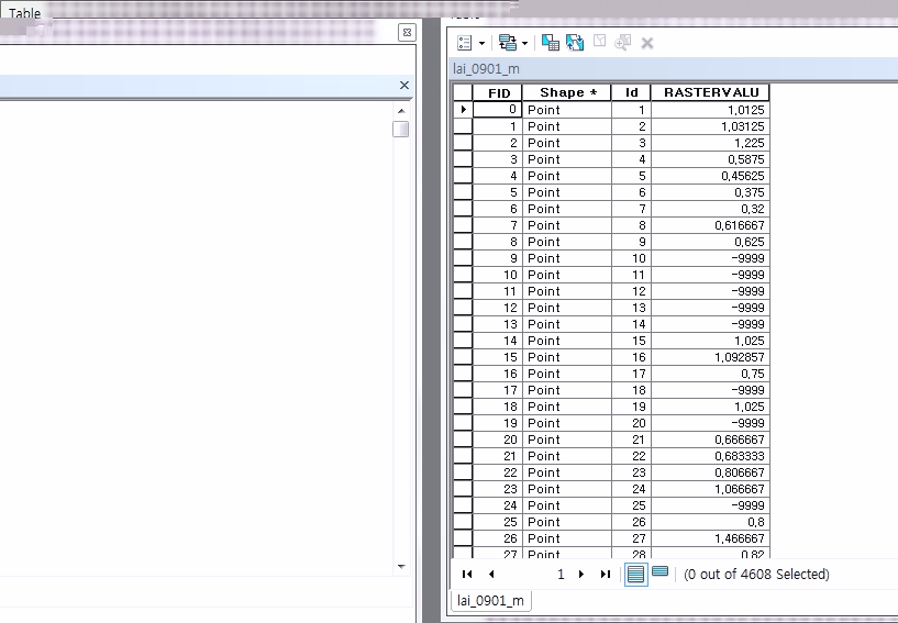
it is my attribut table in the shape file.
[ATTACH=CONFIG]24355[/ATTACH]
and, new code is here.
but i got it,
help me...TT
[ATTACH=CONFIG]24355[/ATTACH]
and, new code is here.
###########Point to Raster
# Import arcpy module
import arcpy, os
from arcpy import env
from arcpy.sa import *


# Set environment settings
arcpy.env.workspace = "C:/py2/extract"
arcpy.env.overwriteOutput = True

OutputFolder2 = "C:/py2/result"

# Loop through a list of files in the workspace
RasterFiles2 = arcpy.ListFeatureClasses()

print "POINT TO RASTER"
print RasterFiles2
print " "


# Set local variables
for filename2 in RasterFiles2:
    print "Processing: {0}".format(filename2)
    outRaster2 = os.path.join(OutputFolder2, filename2)
    value = "RASTERVALU"
    assignmentType = "MOST_FREQUENT"
    priorityField = "NONE"
    cellSize = "0.035714286"
# Execute ExtractValuesToPoints
    saveRaster = arcpy.PointToRaster_conversion( filename2, value, outRaster2, assignmentType, priorityField, cellSize)

print " "
print ":o) End Processing :)"
print arcpy.GetMessages()
but i got it,
Traceback (most recent call last):
  File "C:\Users\Administrator\Desktop\arcpy\convert", line 33, in <module>
    saveRaster = arcpy.PointToRaster_conversion( filename2, value, outRaster2, assignmentType, priorityField, cellSize)
  File "C:\Program Files\ArcGIS\Desktop10.0\arcpy\arcpy\conversion.py", line 1772, in PointToRaster
    raise e
ExecuteError: Failed to execute. Parameters are not valid.
ERROR 000840: The value is not a Raster Dataset.
ERROR 000840: The value is not a Raster Catalog.
Failed to execute (PointToRaster).
help me...TT
05-19-2013
07:06 PM
- Mark as New
- Bookmark
- Subscribe
- Mute
- Subscribe to RSS Feed
- Permalink
Oh, now I think I see the problem, although you may have more than one problem - I'll tell you what I think is the most likely candidate 1st. Is it true that you are listing point shapefiles for the input in the loop (even if it is just one iteration)?
The thing is, if a shp, the file has of course a .shp extension - you're feeding this into the output name. Your output location was specified as "C:/py2/result" and to that you're joining the input filename which is going to balk at the .shp extension...so if you strip that off, I think you may be okay --- you can do that something like the following, replacing your outRaster2 variable line in the loop:
outRaster2 = os.path.join(OutputFolder2, os.path.splitext(filename2)[0])
(that's GRID raster format; for jpg, etc, add the necessary supported file format extension, as in):
outRaster2 = os.path.join(OutputFolder2, os.path.splitext(filename2)[0] + '.jpg')
Sorry didn't see that sooner!
Two other things I question is the 'NONE' parameter value, maybe should be an empty string '', and I agree with the cell size as suggested before this post - should probably be numeric. If you run into further problems, maybe you should try leaving off some of these optional parameters to make sure it runs in minimal (or default) fashion at 1st. Then continue testing adding in your 'fine tuning' params to get just the output you desire.
Hope that helps.
-Wayne