I am using the ArcGIS API for JavaScript 3.32 for the development of widgets in Web AppBuilder. I have created a locally hosted GeoJson Feature Collection and instantiated it as a FeatureLayer in code (see code snippet below).
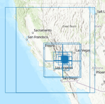
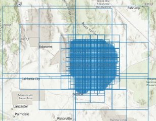
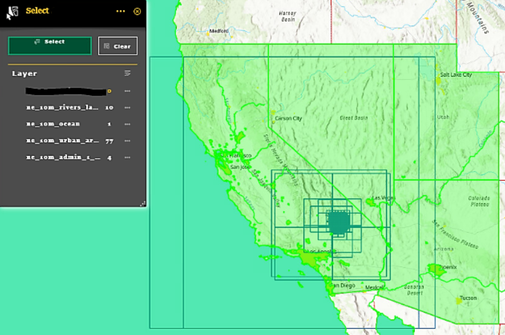
The issue I am having is that after the FeatureLayer is displayed on my Web AppBuilder map, I an unable to select it using the Select Widget unlike other MapService layers (that are comprised of shapefiles - see screenshot below). Any information on why this is the case and how to make the FeatureLayer selectable would be helpful.
// Add geojon layer code here
require([
"esri/symbols/SimpleFillSymbol","esri/symbols/SimpleLineSymbol",
"esri/geometry/Polygon", "esri/graphic", "esri/Color", "esri/layers/FeatureLayer"
], lang.hitch(this, function(SimpleFillSymbol, SimpleLineSymbol, Polygon, Graphic, Color, FeatureLayer) {
var sfs = new SimpleFillSymbol(SimpleFillSymbol.STYLE_SOLID,
new SimpleLineSymbol(SimpleLineSymbol.STYLE_DASHDOT,
new Color([255, 0, 0]), 2), new Color([255, 255, 0, 0.25])
);
// First we create an empty feature collection:
var featureCollection = {
"layerDefinition": null,
"featureSet": {
"features": [],
"geometryType": "esriGeometryPolygon"
}
};
//give the feature collection a layer definition:
featureCollection.layerDefinition = {
"geometryType": "esriGeometryPolygon",
"objectIdField": "ObjectID",
"drawingInfo": {
"renderer": {
"type": "simple",
"symbol": {
"type": "esriSFS",
"style": "esriSFSNull",
"color": [
31,
121,
180,
255
],
"outline": {
"type": "esriSLS",
"style": "esriSLSSolid",
"color": [31, 121, 180, 255], //110, 110, 110, 255
width: 0.4
}
}
}
},
"fields": [{
"name": "OBJECTID",
"type": "esriFieldTypeOID",
"alias": "OBJECTID"
},
{
"name": "RectangleID",
"type": "esriFieldTypeString",
"alias": "RectangleID",
"length": 10
},
{
"name": "section",
"type": "esriFieldTypeString",
"alias": "section",
"length": 2
},
{
"name": "lot",
"type": "esriFieldTypeString",
"alias": "lot",
"length": 3
},
{
"name": "space",
"type": "esriFieldTypeString",
"alias": "space",
"length": 4
},
{
"name": "spaceid",
"type": "esriFieldTypeString",
"alias": "spaceid",
"length": 10
},
{
"name": "Shape_Length",
"type": "esriFieldTypeDouble",
"alias": "Shape_Length"
},
{
"name": "Shape_Area",
"type": "esriFieldTypeDouble",
"alias": "Shape_Area"
}
]
};
//featureCollection object is in the correct format to be passed in to a FeatureLayer:
featureLayer = new FeatureLayer(featureCollection, {
id: 'myFeatureLayer',
// fields: fields, // This is required when creating a layer from Graphics
ObjectIdField: "OBJECTID", // This must be defined when creating a layer from Graphics
spatialReference: {
wkid: 4326
},
mode: FeatureLayer.MODE_AUTO // was MODE_ONDEMAND
});
function requestData() {
var requestHandle = esriRequest({
url: "url to local json file (generalized for privacy)",
callbackParamName: "jsoncallback"
});
requestHandle.then(requestSucceeded, requestFailed);
}
function requestSucceeded(response, io) {
//loop through the items and add to the feature layer
var features = [];
array.forEach(response.features, function(item) {
var attr = {};
//pull in any additional attributes if required
attr["section"] = item.properties.section;
var geometry = new Polygon({
rings: item.geometry.coordinates
});
var graphic = new Graphic(geometry);
graphic.setAttributes(attr);
features.push(graphic);
});
featureLayer.applyEdits(features, null, null);
}
function requestFailed(error) {
console.log('add geojson feature layer failed');
}
debugger;
map.addLayers([featureLayer]);
map.on('layer-add-result', requestData);
}));
// end geojson layer code
Screenshot showing that FeatureLayer is not selected by the Select Tool unlike other shapefile mapservices (blacked out FeatureLayer shows "0" selected features):