Turn on suggestions
Auto-suggest helps you quickly narrow down your search results by suggesting possible matches as you type.
Cancel
- Home
- :
- All Communities
- :
- Products
- :
- ArcGIS Pro
- :
- ArcGIS Pro Questions
- :
- Set Map and Database Spatial References for Projec...
Options
- Subscribe to RSS Feed
- Mark Topic as New
- Mark Topic as Read
- Float this Topic for Current User
- Bookmark
- Subscribe
- Mute
- Printer Friendly Page
Set Map and Database Spatial References for Projects/Templates
Subscribe
1137
1
01-06-2020 11:31 AM
01-06-2020
11:31 AM
- Mark as New
- Bookmark
- Subscribe
- Mute
- Subscribe to RSS Feed
- Permalink
My team and I create maps for airports throughout the United States. All of the projects will have the same databases, same features, same layouts, and so on. We generally work in State Plane Coordinates (and use NAVD88 height ft US), so as the airport location varies so does the projected state plane.
Our question is, when we create a new project and select a template that we want, is there an easy method for us to get it in the desired projection?
1 Reply
01-06-2020
09:06 PM
- Mark as New
- Bookmark
- Subscribe
- Mute
- Subscribe to RSS Feed
- Permalink
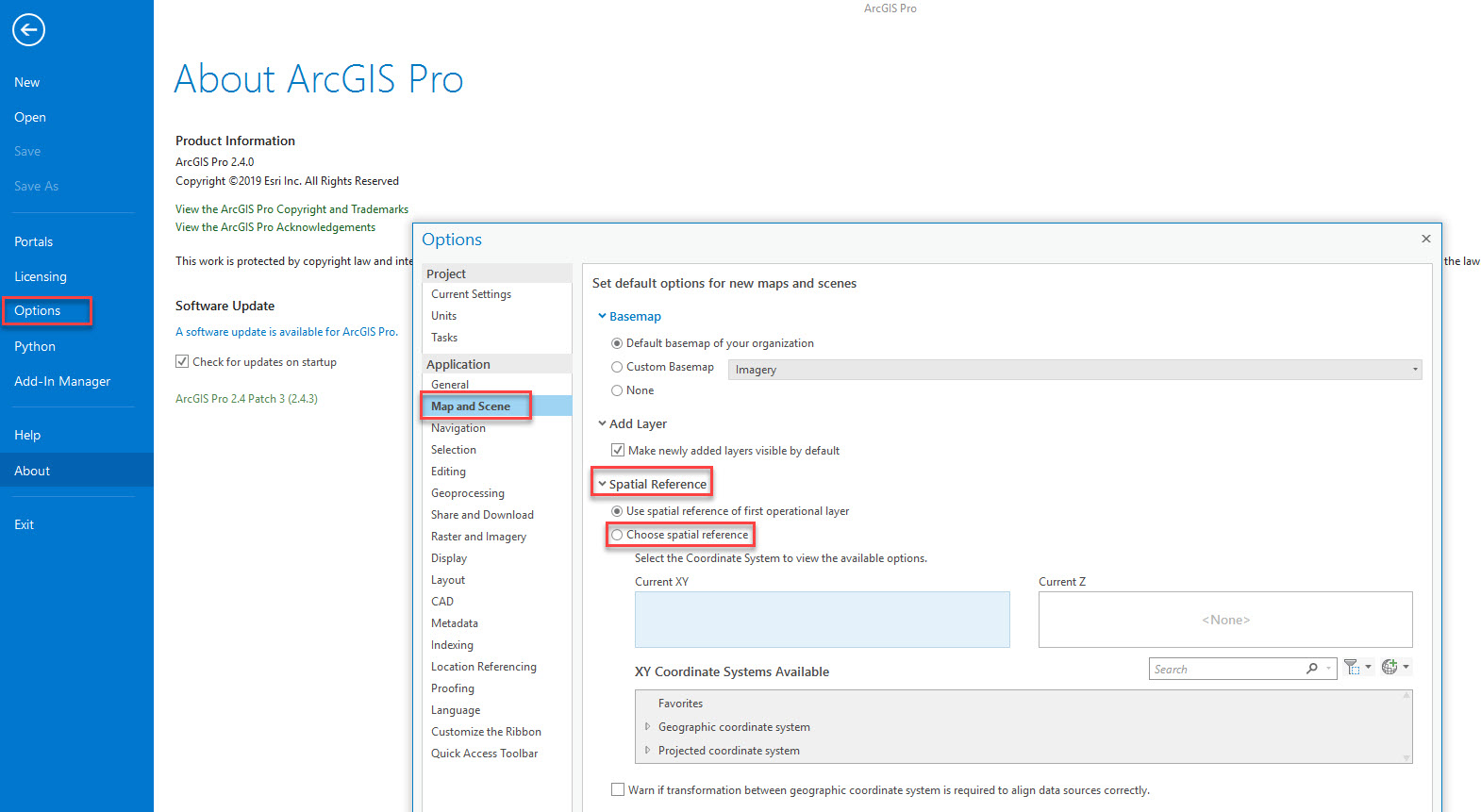
You can probably set the Default Spatial Reference as below: