I published a service with Mapping-WMS-KML capabilities by ArcGIS Server 10.2.The Mapping capability works well,but WMS capability caculates a wrong BoundingBox.How can I re-caculate the BoundingBox or set it manully?
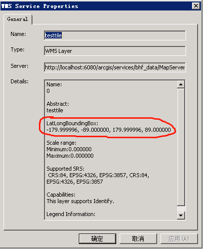
The latitude BoundingBox should be "-90.0,90.0" and the longitude should be "-180.0,180.0".This WMS service shows a converse result.