- Home
- :
- All Communities
- :
- Industries
- :
- Natural Resources
- :
- Petroleum
- :
- Petroleum Questions
- :
- Power Bi - Showing coordinates as lines instead of...
- Subscribe to RSS Feed
- Mark Topic as New
- Mark Topic as Read
- Float this Topic for Current User
- Bookmark
- Subscribe
- Mute
- Printer Friendly Page
Power Bi - Showing coordinates as lines instead of dots/ points
- Mark as New
- Bookmark
- Subscribe
- Mute
- Subscribe to RSS Feed
- Permalink
Hello,
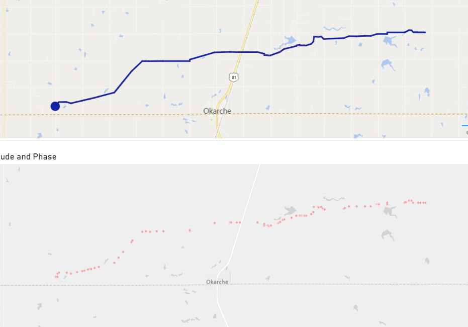
I work for a pipeline installation company and I wanted to plot the progress using ArcGis. While my data set have coordinates and different installation phases, all I can get are the dots plotted on Maps. I would like if I could change these dots in the form of Lines or dashes would be great. Also If I could specify the widths of individual phases will be of great use to define Right of Way etc.
Attached is the picture, below is the ArcGis and above is showing some another Visualization
Any help in this regards will be highly appreciated
- Mark as New
- Bookmark
- Subscribe
- Mute
- Subscribe to RSS Feed
- Permalink
The ArcGIS maps for PowerBI plug in does not allow for you to create lines.
If you publish your pipeline data to your ArcGIS Online, you can add the layer to your map as a reference layer or as a basemap.
This would be the better route because you could define the symbology in the web map meeting the requirements of specifying widths and it would support points, lines, and polygons.
You could then layer in your points later if you want to create visuals/charts from the data.