Turn on suggestions
Auto-suggest helps you quickly narrow down your search results by suggesting possible matches as you type.
Cancel
- Home
- :
- All Communities
- :
- User Groups
- :
- 911 GIS
- :
- Questions
- :
- Projection & Floating point files
Options
- Subscribe to RSS Feed
- Mark Topic as New
- Mark Topic as Read
- Float this Topic for Current User
- Bookmark
- Subscribe
- Mute
- Printer Friendly Page
Projection & Floating point files
Subscribe
1176
0
08-26-2019 11:36 AM
08-26-2019
11:36 AM
- Mark as New
- Bookmark
- Subscribe
- Mute
- Subscribe to RSS Feed
- Permalink
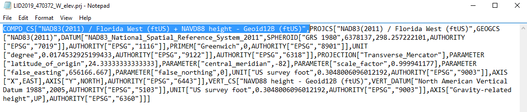
I have created a model with the goal to define the projection (XY & Z) of multiple .flt files within a single folder. The model and the single Define Projection Tool works if only trying to define the XY Coordinate Systen (CS), but not both XY & Z. After the model runs through, the projection stays unknown when I define both the XY & Z Coordinate System. I compared the .prj files, and when I remove the information about compound coordinate system (COMPD_CS), the projection is defined both XY & Z. Please see attachments. Does anyone know why this is happening and if there is a work around?
ModelBuilder, Projection, raster iterator#, flt, #floating point raster
0 Replies