- Home
- :
- All Communities
- :
- Products
- :
- ArcGIS Pro
- :
- ArcGIS Pro Questions
- :
- How do I wrap a Grid/Graticule around the 180° lin...
- Subscribe to RSS Feed
- Mark Topic as New
- Mark Topic as Read
- Float this Topic for Current User
- Bookmark
- Subscribe
- Mute
- Printer Friendly Page
How do I wrap a Grid/Graticule around the 180° line in ArcPro?
- Mark as New
- Bookmark
- Subscribe
- Mute
- Subscribe to RSS Feed
- Permalink
- Report Inappropriate Content
Hi all, I'm creating a series of maps covering areas around the Pacific islands, using ArcPro 2.3.0, and am having problems with the Lat/Long graticule/grid wrapping around the 180 ° line. When I insert a grid it only seems to run from -180° to +180° making mapping quite difficult as many countries straddle or are near to the 180° line.
With the coordinate systems there's a tick box to wrap the map around the 180° line is there a simple way or a tried and true method to do the same thing with grids/graticules?
I'm hoping someone has experienced this. thanks in advance for your help.
- Mark as New
- Bookmark
- Subscribe
- Mute
- Subscribe to RSS Feed
- Permalink
- Report Inappropriate Content
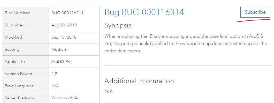
Sorry that you're seeing this, but it appears to be a bug: https://support.esri.com/en/bugs/nimbus/QlVHLTAwMDExNjMxNA==
I'd recommend going to that page and clicking the Subscribe button:
This will provide you with a notification of when it is fixed, as well as increment the count of affected customers.