- Home
- :
- All Communities
- :
- Services
- :
- Esri Training
- :
- Esri Training Questions
- :
- Basemap will not automatically project to match th...
- Subscribe to RSS Feed
- Mark Topic as New
- Mark Topic as Read
- Float this Topic for Current User
- Bookmark
- Subscribe
- Mute
- Printer Friendly Page
Basemap will not automatically project to match the data frame
- Mark as New
- Bookmark
- Subscribe
- Mute
- Subscribe to RSS Feed
- Permalink
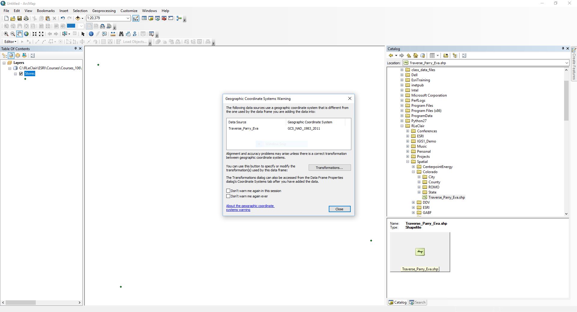
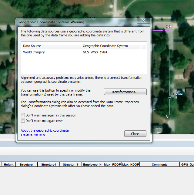
I just recently upgraded from ArcMap for desktop 10.4 Basic to ArcMap for desktop 10.6 Standard. Before I upgraded, I would add my shapefiles and the data frame would match the projection of the shapefile and then I would add in the basemap which would match the same projection as the data frame. Now when I do that and then add in the basemap, I get the geographic coordinate system warning because the basemap is in WGS 1984 and my data is NAD 1983. When I had basic, the basemap would automatically import to match the data frame but now it will not. I'm not entirely too sure how to do a transformation, but I do need the data to be accurately projected. Has anyone else experienced this before or know how to fix it?
- Mark as New
- Bookmark
- Subscribe
- Mute
- Subscribe to RSS Feed
- Permalink
So I think what's happening here is sometime in the past the "Don't warn me again ever" box was checked on your old installation of ArcMap 10.4 Basic. When you upgraded to ArcMap 10.6 Standard, this check setting was restored to factory settings to warn you about geographic transformations. To your question about how to fix geographic transformations from here on out, please review to this document.
- Mark as New
- Bookmark
- Subscribe
- Mute
- Subscribe to RSS Feed
- Permalink
Thank you!! I am going to attempt the transformation and hopefully that works. ArcMap was installed prior to me starting my job so maybe the person before had marked it as Don't ever warn me again. So the basemaps have to stay as a WGS 1984? And I have to transform my data to match the basemap?
- Mark as New
- Bookmark
- Subscribe
- Mute
- Subscribe to RSS Feed
- Permalink
So the basemaps are in WGS1984 Web Mercator as their coordinate system. Typically in ArcMap, there is no coordinate system defined for a new dataframe. The first layer (raster or vector) that's added defines the coordinate system for the data frame. If you add a basemap 2nd, then it projects on the fly to match the coordinate system of the data frame. That's the warning message you're now seeing. So you're ultimately transforming the basemap to your data.
- Mark as New
- Bookmark
- Subscribe
- Mute
- Subscribe to RSS Feed
- Permalink
Right, I started with a blank template and then added my shapefile which is NAD 1983 Illinois East (feet). So then the data frame matched my data and I added a basemap second which it still gives me that warning telling me that the basemap does not match. That is where my dilemma is because I thought the basemap should project on the fly to match the coordinate system of my data but it is not doing that for some reason.
- Mark as New
- Bookmark
- Subscribe
- Mute
- Subscribe to RSS Feed
- Permalink
The basemap will project on the fly. What ArcMap is attempting to resolve is how to the geographic coordinate systems of the two layers. One is WGS 1984 and the other is NAD83. Transformations apply math to resolve the differences. So I'd recommend you click the Transformations button. Then in the next window, there is a dropdown menu on the bottom of the UI to pick a transformation method. For 99% of the users, the first one in the list is appropriate. Then click OK on that window followed by Close on the other. ArcMap will then resolve the transformation error and draw your layers correctly.
- Mark as New
- Bookmark
- Subscribe
- Mute
- Subscribe to RSS Feed
- Permalink
There is a *great* Esri Press book called Lining Up Data by Margaret Maher that I highly recommend, especially if you do a lot of working across projections and transformations, georeferencing CAD files, etc.
Just mentioning: projecting map services (like basemaps) on the fly works in ArcMap but can be problematically slow, especially if there are internet throughput or display adapter bottlenecks.