- Home
- :
- All Communities
- :
- Developers
- :
- Python
- :
- Python Questions
- :
- Updating connection info via python from SDE to Fi...
- Subscribe to RSS Feed
- Mark Topic as New
- Mark Topic as Read
- Float this Topic for Current User
- Bookmark
- Subscribe
- Mute
- Printer Friendly Page
Updating connection info via python from SDE to File geodb - with a feature dataset
- Mark as New
- Bookmark
- Subscribe
- Mute
- Subscribe to RSS Feed
- Permalink
Hi,
I'm clipping data and moving to a file geodb from SDE and fixing up datasources for a symbolised Pro project before publishing.
This works for the main part unless the feature class is in a feature dataset. Doing the below works for 90% of my feature classes - if the FC is in a FD the source breaks as Pro can't find the FD in the filegeodb. (note the validate false was for troubleshooting)
con_props = {'connection_info':{'database': temp_filegeodb,
                                'authentication_mode': '',
                                'dbclient': '',
                                'db_connection_properties': '',
                                'password': '',
                                'instance': '',
                                'server': '',
                                'user': '',
                                'version': ''},
             'dataset': name,
             'workspace_factory': 'File Geodatabase',
             'feature_dataset': ''
             }
print(con_props)
a_layer.updateConnectionProperties(a_layer.connectionProperties, con_props,validate=False)
yet I can't see a flag to clear the feature dataset from the layer.
So we end up with a broken datasource as the layer is still looking for the original feature dataset. Is there an easy way to clear this - I haven't seen anything in the doco.
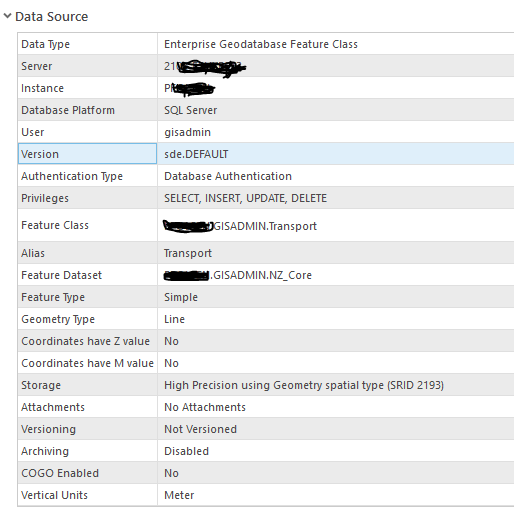
Before:
After:

surely this property is exposed in the connection_info dictionary? Right?
Ta
Fraser
Solved! Go to Solution.
Accepted Solutions
- Mark as New
- Bookmark
- Subscribe
- Mute
- Subscribe to RSS Feed
- Permalink
Starting in version 2.4, there is a work around using the arcpy cim module. Python CIM access is available which will provide finer-grained access to more settings/capabilities. We dont have data source examples in the help yet, but here is the overview help topic and a video.
Help topic: https://pro.arcgis.com/en/pro-app/arcpy/mapping/python-cim-access.htm
Video: https://www.youtube.com/watch?v=8wgt8bKD0Ww&feature=youtu.be
The following script will update layer data sources from Enterprise Geodatabase to File Geodatabase. It will also handle the differences in feature dataset names between the two data formats (line 38).
# new File Geodatabase
newFGDB = r"C:\backup\UC2019\arcpy.mp\DataSources\SDE2FGDB.gdb"
# Enterprise Geodatabase
entServer = "ss2014-104"
# folder to search
folder = r"C:\backup\UC2019\arcpy.mp\DataSources"
import arcpy, os
for file in os.listdir(folder):
if os.path.splitext(file)[1].lower() == '.aprx':
print("")
print(f"APRX : {file}")
aprx = arcpy.mp.ArcGISProject(os.path.join(folder, file))
for m in aprx.listMaps():
print(f" MAP : {m.name}")
for lyr in m.listLayers():
if lyr.supports("dataSource"):
if lyr.dataSource.find(f"Server={entServer}") != -1:
# FOUND A LAYER TO UPDATE!
print(f" LAYER : {lyr.name} -> UPDATING LAYER'S DATASOURCE!")
# Access layer CIM
lyrCIM = lyr.getDefinition("V2")
dc = lyrCIM.featureTable.dataConnection
# Update the connection properties - 4 steps:
# ===========================================
# 1.) Change the connection string to point to the new file gdb
dc.workspaceConnectionString = f'DATABASE={newFGDB}'
# 2.) If the data is in a Feature Dataset, then update it
# That is, remove the user name [all formats] and database [SQL Server]
# e.g. change mydb.myuser.MyFDSName to MyFDSName
if hasattr(dc, "featureDataset"):
dc.featureDataset = dc.featureDataset[dc.featureDataset.rfind('.')+1:]
# 3.) Change the workspace type from SDE (Enterprise) to FileGDB
dc.workspaceFactory = 'FileGDB'
# 4.) Change the dataset name
# That is, remove the user name [all formats] and database [SQL Server].
# e.g. change mydb.myuser.MyFCName to MyFCName
dc.dataset = dc.dataset[dc.dataset.rfind('.')+1:]
# Update layer CIM (commit the changes)
lyr.setDefinition(lyrCIM)
else:
print(f" LAYER : {lyr.name}")
else:
print(f" LAYER : {lyr.name}")
# save a copy of the updated APRX
aprx.saveACopy(os.path.join(folder, 'output', file))
print('')
print('+++++++++')
print('+ DONE! +')
print('+++++++++') - Mark as New
- Bookmark
- Subscribe
- Mute
- Subscribe to RSS Feed
- Permalink
Hi Fraser, someone will take a look (and BTW 'Ta' doesn't travel outside NZ) 
- Mark as New
- Bookmark
- Subscribe
- Mute
- Subscribe to RSS Feed
- Permalink
Hi Bruce and Fraser, I am also experiencing the same issue with updateConnectionProperties method on the Layer class (assuming same issue is present for the same method on different classes like Map, Project, etc...). Feature Dataset is not exposed in connectionProperties python dictionary property. Thanks!
- Mark as New
- Bookmark
- Subscribe
- Mute
- Subscribe to RSS Feed
- Permalink
Hi,
Esri are aware of it and it will be addressed in a future release. You'll need to work around in the meantime.
Thanks
Fraser
- Mark as New
- Bookmark
- Subscribe
- Mute
- Subscribe to RSS Feed
- Permalink
When!? It has been months and we (a very large million dollar ESRI client) are waiting. This is blocking a critical organisation wide enterprise project. I want to scream at ESRI right now for not fixing this. Please PM.
There is no workaround.
- Mark as New
- Bookmark
- Subscribe
- Mute
- Subscribe to RSS Feed
- Permalink
Hi Marko Polo,
If you have not already I would strongly suggest lodging a case with technical support. They'll be able to actively look into it.
Thanks,
Chris
- Mark as New
- Bookmark
- Subscribe
- Mute
- Subscribe to RSS Feed
- Permalink
Are there any updates on this issue? (11/15/2019)
- Mark as New
- Bookmark
- Subscribe
- Mute
- Subscribe to RSS Feed
- Permalink
Starting in version 2.4, there is a work around using the arcpy cim module. Python CIM access is available which will provide finer-grained access to more settings/capabilities. We dont have data source examples in the help yet, but here is the overview help topic and a video.
Help topic: https://pro.arcgis.com/en/pro-app/arcpy/mapping/python-cim-access.htm
Video: https://www.youtube.com/watch?v=8wgt8bKD0Ww&feature=youtu.be
The following script will update layer data sources from Enterprise Geodatabase to File Geodatabase. It will also handle the differences in feature dataset names between the two data formats (line 38).
# new File Geodatabase
newFGDB = r"C:\backup\UC2019\arcpy.mp\DataSources\SDE2FGDB.gdb"
# Enterprise Geodatabase
entServer = "ss2014-104"
# folder to search
folder = r"C:\backup\UC2019\arcpy.mp\DataSources"
import arcpy, os
for file in os.listdir(folder):
if os.path.splitext(file)[1].lower() == '.aprx':
print("")
print(f"APRX : {file}")
aprx = arcpy.mp.ArcGISProject(os.path.join(folder, file))
for m in aprx.listMaps():
print(f" MAP : {m.name}")
for lyr in m.listLayers():
if lyr.supports("dataSource"):
if lyr.dataSource.find(f"Server={entServer}") != -1:
# FOUND A LAYER TO UPDATE!
print(f" LAYER : {lyr.name} -> UPDATING LAYER'S DATASOURCE!")
# Access layer CIM
lyrCIM = lyr.getDefinition("V2")
dc = lyrCIM.featureTable.dataConnection
# Update the connection properties - 4 steps:
# ===========================================
# 1.) Change the connection string to point to the new file gdb
dc.workspaceConnectionString = f'DATABASE={newFGDB}'
# 2.) If the data is in a Feature Dataset, then update it
# That is, remove the user name [all formats] and database [SQL Server]
# e.g. change mydb.myuser.MyFDSName to MyFDSName
if hasattr(dc, "featureDataset"):
dc.featureDataset = dc.featureDataset[dc.featureDataset.rfind('.')+1:]
# 3.) Change the workspace type from SDE (Enterprise) to FileGDB
dc.workspaceFactory = 'FileGDB'
# 4.) Change the dataset name
# That is, remove the user name [all formats] and database [SQL Server].
# e.g. change mydb.myuser.MyFCName to MyFCName
dc.dataset = dc.dataset[dc.dataset.rfind('.')+1:]
# Update layer CIM (commit the changes)
lyr.setDefinition(lyrCIM)
else:
print(f" LAYER : {lyr.name}")
else:
print(f" LAYER : {lyr.name}")
# save a copy of the updated APRX
aprx.saveACopy(os.path.join(folder, 'output', file))
print('')
print('+++++++++')
print('+ DONE! +')
print('+++++++++') - Mark as New
- Bookmark
- Subscribe
- Mute
- Subscribe to RSS Feed
- Permalink
Greate script Jeff, you just saved me so so much pain. Slotted it in and bang, rolled it.
thanks mate!
- Mark as New
- Bookmark
- Subscribe
- Mute
- Subscribe to RSS Feed
- Permalink
Starting at ArcGIS version 2.6, we improved this workflow so that you can use Enterprise Geodatabase Connection Files in the first parameter of the UpdateConnectionProperties function. Instead of using the above arcpy CIM workaround, you can now do something like the following code sample. This will work if the feature dataset name in the Enterprise Geodatabase is the same as the File Geodatabase (not including the user and database prefix - meaning "mydb.myuser.MyFDSName" is equivalent to "MyFDSName")
import arcpy
aprx = arcpy.mp.ArcGISProject(r'C:\Projects\YosemiteNP\Yosemite.aprx')
aprx.updateConnectionProperties(r'C:\Projects\YosemiteNP\DBConnections\Server.sde',
r'C:\Projects\YosemiteNP\Local_Data\YosemiteLocal.gdb') More info and code samples can be found here: Updating and fixing data sources—ArcGIS Pro | Documentation