Turn on suggestions
Auto-suggest helps you quickly narrow down your search results by suggesting possible matches as you type.
Cancel
- Home
- :
- All Communities
- :
- Products
- :
- 3D
- :
- 3D Mapping Questions
- :
- DEM pixel values in content layers show disconsist...
Options
- Subscribe to RSS Feed
- Mark Topic as New
- Mark Topic as Read
- Float this Topic for Current User
- Bookmark
- Subscribe
- Mute
- Printer Friendly Page
DEM pixel values in content layers show disconsistency with values in map
Subscribe
1423
1
10-17-2018 10:01 AM
10-17-2018
10:01 AM
- Mark as New
- Bookmark
- Subscribe
- Mute
- Subscribe to RSS Feed
- Permalink
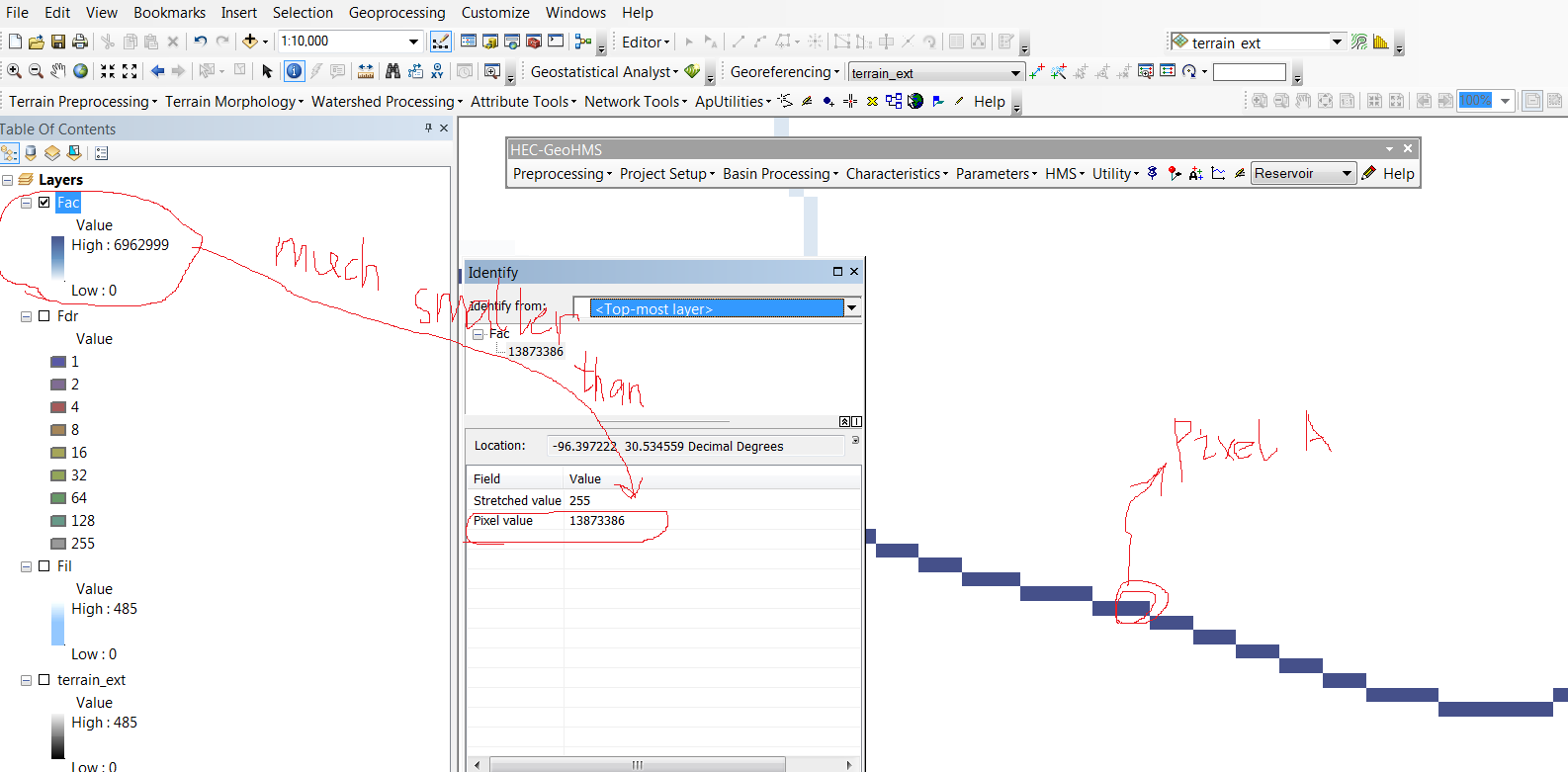
hi everyone, i am dealing with DEM data for a river basin area. The question is after some execution, each pixel (e.g. pixel A) will be assigned a value which represents the number of pixels above the location of pixel A. But i found the highest value in the content layers are much smaller than those in the map window. (showed in figure 1) Could anyone tell me whats going on? Thanks a lot! By the way, i dont know what is that streched value mean, but it all showed 255.
1 Reply
10-17-2018
12:12 PM
- Mark as New
- Bookmark
- Subscribe
- Mute
- Subscribe to RSS Feed
- Permalink
hi guys, i have solved the problem by processing the raster data in a folder file instead of a gdb file... It seems like where i store the raster data and shapefile matter when i use this extension. But still, i dont know why. Could anyone explain the reason? Thanks.