- Home
- :
- All Communities
- :
- Products
- :
- ArcGIS CityEngine
- :
- ArcGIS CityEngine Questions
- :
- GIS Diven Building.cga and building footprints
- Subscribe to RSS Feed
- Mark Topic as New
- Mark Topic as Read
- Float this Topic for Current User
- Bookmark
- Subscribe
- Mute
- Printer Friendly Page
GIS Diven Building.cga and building footprints
- Mark as New
- Bookmark
- Subscribe
- Mute
- Subscribe to RSS Feed
- Permalink
Hello, I am new to CityEngine. I was wondering if someone has GIS Driven Buildings cga? I am building up attributes table and it would ideal to apply a rule which will generate all the buildings within their respective heights and other atrr.
Also what is the easiest way to get building footprints. Lidar? Your help would be amazing.
Urban Planner from OZ!
- Mark as New
- Bookmark
- Subscribe
- Mute
- Subscribe to RSS Feed
- Permalink
I´m not the best to talk about CGA rules, but You can find a lot of CGA samples to learn how to create your rules or apply some rules to create buildings from Footprint.Here to samples for you.
Check here Tutorial 16: Urban planning—CityEngine Tutorials | ArcGIS Desktop
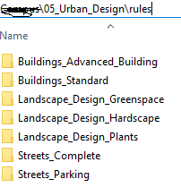
Or download the Project - 05 - Urban Design from CityEngine(see attached)
And about the best way to get Footprints: LIDAR is a good option but is expensive if you don´t have budget.
Openstreetmap it´s a free alternative
Or create your own Footprint using Satellite images on ArcMap.
- Mark as New
- Bookmark
- Subscribe
- Mute
- Subscribe to RSS Feed
- Permalink
Hi,
I have a simple code which extrudes footprints by the average height of the building (taken from LiDAR) and then colours the shape:
@Building_Height
attr BuildingHeight = 5
attr RoofType = RandomRoofType
35%: "Gable"
else: "Hip"
## Rules ##
@StartRule
BuildingShell -->
cleanupGeometry(all,0.5)
extrude(world.up, BuildingHeight)
comp (f) {top : Roof| all : ColourBuilding}
ColourBuilding
Roof -->
case RoofType == "Gable" : GableRoof
else : HipRoof
roofGable(25,0.2)
ColourRoof
HipRoof -->
roofHip(30, 0.5)
ColourRoof
color("#E1E1E1")
color("#9C9C9C")
- Mark as New
- Bookmark
- Subscribe
- Mute
- Subscribe to RSS Feed
- Permalink
An easy way to get OpenStreetMap data into CityEngine is to use File -> Get Map Data.
For some cities, sometimes the building footprints have height data. If this data is present, the ESRI.lib Building_From_OpenStreetMap.cga rule (which is automatically assigned to building footprints downloaded from Get Map Data) will create a building with the specified height. This rule also takes into account these attributes: height, building__levels, roof__height, roof__shape, building__colour, roof__colour.
Of course, you can make your own rule that takes into account the attributes that you want to consider.